 NERC Data Catalogue Service
Geochemical maps
Type of resources
Available actions
Topics
Keywords
Contact for the resource
Provided by
Years
Formats
Representation types
Update frequencies
Service types
Scale
-
A collection of regional geochemical data, mainly from stream sediment surveys, gathered from many BGS overseas projects since 1960s. Some areas are well covered and well documented with data available digitally on CD-ROM. Projects from 1960s and 1970s generally have no digital data and information exists only in paper form.
-
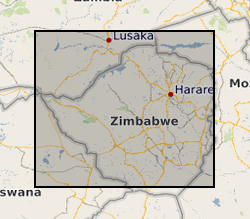
During the period 1982-86 a team of geologists from the British Geological Survey carried out a programme of regional geological mapping and geochemical exploration in collaboration with the Zimbabwe Geological Survey under a Technical Co-operation agreement supported by the UK Department for International Development (DFID) (formerly Overseas Development Agency). Three regions of Zimbabwe were mapped (Harare, Rushinga & Nyampanda, and Makaha) and the results of the stream sediment geochemical surveys were presented as three reports. Over 17,000 stream sediments were collected and analysed for Cu, Pb, Zn, Co, Ni, Mn, Li, As, Ba, Sn, Ta, and W. Raw data can be obtained from the Geological Survey of Zimbabwe, PO Box CY210,Causeway, Harare, Zimbabwe.
-
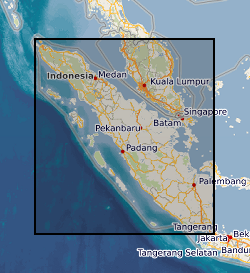
Regional Geochemical data from drainage basin reconnaissance survey carried out as part of a bilateral aid project between the UK Department for International development (DFID) (formerly ODA) and the Indonesian Government. Some 23,000 stream sediment samples collected and analysed (less than 80 mesh fraction) for Copper, Lead, Zinc, Cobalt, Nickel, Manganese, Silver, Arsenic, Molybdenum, Tin and Tungsten (partial extraction) and Lithium, Potassium, Chromium and Iron (total extraction). Samples collected and classified on the basis of 1:250 000 map quadrangle areas. Data gathering completed in two phases: First phase: North of the equator (North Sumatra Project, NSP). Second phase: South of the equator (Southern Sumatra Geological and mineral exploration Project). Sampling and analytical methodology has been consistent throughout. All data is available as on the Sumatra CD-database CD-ROM. North of the equator data published as 1:250 000 single element classified symbol plots and as a monochrome geochemical atlas. South of the equator data published as 1:250 000 single element proportional symbol plots and a geochemical atlas (hardcopy and CD-ROM). Projects also involved regional geological mapping and in Southern Sumatra regional geophysics (gravity). Raw data can be obtained from the Directorate of Mineral Resources, Bandung, Indonesia.
-
Two geochemical surveys were undertaken in the Solomon Islands between 1976 and 1983 as part of a combined geological mapping and mineral exploration project. The survey of Choiseul and the Shortland Islands was carried out between 1976 and 1979 by the Institute of Geological Sciences (now the British Geological Survey) with support from staff of the Geology Division of the Ministry of Land, Energy and Natural Resources, Solomon Islands. The project produced 12 geological maps at 1:50,000 scale as well as a series of unpublished reports. The survey of the New Georgia Group of islands was undertaken between 1979 and 1983. The project produced 7 geological maps at a scale of 1:100,000 and a regional map of the entire island group at a scale of 1:250,000. A series of multielement geochemical anomaly maps were produced at a scale of 1:100,000 to accompany each of the published geological maps. Master copies of these are held at the Geological Survey in Honiara. Full descriptions of the methods used are described in the margins of the anomaly maps. A total of 8848 stream sediment samples were collected from Choiseul and 7441 from the New Georgia Group, resulting in an average sampling density for the two areas of 2.68 samples per km2 and 1.47 samples per km2 respectively. Sampling in the Shortland Islands was confined to the larger islands, 187 were collected from the Fauro Island group, 148 from Alu and 69 from Mono. The samples were dry sieved and the fraction passing -80 mesh B.S. (177 microns) was analysed. A hot concentrated nitric acid digestion was used prior to analysis by atomic absorbtion spectrophotometry (AAS) for Co, Cu, Pb, Zn, Ni, Ag, and Mn. Samples from the vicinity of the Siruka Ultramafic Complex were determined for Cr by AAS after digestion by a bisulphate fusion technique. Raw data can be obtained from the Geology Division, Ministry of Mines and Energy, PO Box G37, Honiara, Solomon Islands.
-
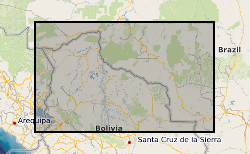
Between 1976 and 1982, the Overseas Directorate of the British Geological Survey, United Kingdom and the Geological Survey of Bolivia, Santa Cruz, carried out a major reconnaissance geological mapping, geochemical sampling and mineral exploration programme of that part of the Precambrian Brazilian Shield lying within eastern Bolivia. Previous geological work had been undertaken in the area, but this was the first time that a systematic and fully integrated survey had been attempted. The Project area is approximately 220,000 square kilometres and regional geochemical samples were collected from 8185 sites producing an overall sampling density of 1 sample per 27 square kilometres. Because of logistic problems it was impossible to sample certain inaccessible areas so the actual sampling density was 1 sample per 16 square kilometres for the 130,000 square kilometres effectively sampled. The geochemical samples were analysed in the Project laboratories in Santa Cruz and in the GEOBOL geochemical laboratories in La Paz. Uranium analyses were carried out by a commercial laboratory in the UK. The results of the Project are incorporated in 21 comprehensive reports in both English and Spanish. Twelve describe the geology, geochemistry and mineral potential of the individual 1:250,000 map areas and the remainder are devoted to the geology and mineral potential of areas of special geological or economic interest. The stream sediments were determined for: Ag, Co, Cu, Fe, Mn, Ni, Pb, Zn, As, U, B, Ba, Be, Cr, La, Li, Mo, Nb, Sn, Sr, Y, and Zr. These results are presented in an atlas as 22 single element 1:1 million scale, classed proportional symbol, point source data maps in which the symbols are overprinted on a simplified geological base map in order to facilitate rapid data interpretation. A 1:4 million scale moving average map based on a 4 x 4 km cell size and a 10 km search radius, printed alongside the symbol map, identifies the major regional variations. Raw data is available from the Geological Survey of Bolivia, Santa Cruz along with copies of the reports.
-

The BGS database of geological maps is an index into BGS holdings of modern and historical published geological maps, geological standards and field slips, and also contains a range of other map series, including geophysical maps, geochemical maps, hydrogeological maps, thematic maps and other small-scale miscellaneous non-series maps. Historical vertical and horizontal sections, as well as indices to colours, are also included. The database comprises map metadata, including the title, theme, survey and revision years, publication years, mapped geological theme, base material, map function, colouration, approval status and the spatial extent of each map sheet. An accompanying file store contains high-resolution JPEG2000 scans for delivery, as well as various digital master and delivery formats. For a small number of maps, no scan exists. In total, the database contains over 240,000 scans of over 130,000 maps and field slips. The majority of the maps in the database cover Great Britain, but other regions are also represented, including a historical series of 1-inch maps of Ireland, 6-inch maps of the Isle of Man, 1:25 000 scale maps of the Channel Islands, and various overseas maps. The database contains a record of all geological maps produced by the British Geological Survey and its predecessors since the commencement of systematic geological mapping in the 1830s. The BGS Maps Database is mostly an archive of previous BGS maps, and is not the same as the latest BGS digital mapping. The maps within the database may differ significantly from BGS digital vector mapping. Further information about BGS digital vector mapping is available on the BGS website, under 'BGS Datasets'. The database has evolved over time, originally being a series of discrete databases. These databases have now been aggregated into a single dataset. BGS published maps, as well as 1:10 560 and 1:10 000 large-scale geological maps of England and Wales, and Scotland, are available through the BGS Maps Portal. Field slips and some thematic maps are not included on the BGS Maps Portal. The information about a map is normally a transcription from the map itself. Sometimes key information such as the title may not be actually printed on the map. Where this is the case the information is supplied in square brackets, e.g. [Kirk Maiden]. Information in square brackets means the information is supplied by the cataloguer and is not transcribed from the item.
-
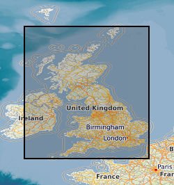
The BGS Geochemical Baseline Survey of the Environment (G-BASE) was the national strategic geochemical mapping programme in Great Britain. The project set out to establish the chemistry of the surface environment by the collection and analysis of stream sediment, stream water and soil samples. Beginning in the late 1960s in northern Scotland and moving southwards across the country, the primary focus was mineral exploration, however, the project quickly developed to address important environmental concerns. The final G-BASE samples were collected in southern England in 2014. The outputs from the G-BASE project provide an invaluable, systematic baseline of geochemical information for Great Britain, serving as a marker of the state of the environment against which to measure future change. At G-BASE drainage sampling sites (average density: one site per 1.5 km square), sediment was collected from the centre of the stream and sieved through two sieves (2 mm and 150 microns). The fine-grained fraction formed the stream sediment sample and underwent chemical analysis. Excess material from the <2 mm fraction was panned using a wooden dulang pan to collect a heavy mineral concentrate. During the G-BASE project, these samples were archived, but not routinely submitted for chemical analysis. For more information about accessing these samples and their analytical results, contact BGS Enquiries (enquries@bgs.ac.uk).
-

The BGS Geochemical Baseline Survey of the Environment (G-BASE) was the national strategic geochemical mapping programme in Great Britain. The project set out to establish the chemistry of the surface environment by the collection and analysis of stream sediment, stream water and soil samples. Beginning in the late 1960s in northern Scotland and moving southwards across the country, the primary focus was mineral exploration, however, the project quickly developed to address important environmental concerns. The final G-BASE samples were collected in southern England in 2014. The outputs from the G-BASE project provide an invaluable, systematic baseline of geochemical information for Great Britain, serving as a marker of the state of the environment against which to measure future change. Stream sediments were the primary sample medium for G-BASE, with an average density of one site per 1.5 km square. The drainage sampling sites cover most of Great Britain. Sediment was collected from the centre of the stream and sieved through two sieves (2 mm and 150 µm) to obtain a fine grain-size fraction of <150 microns. Analytical data (by a variety of analytical methods, including XRF and direct-reading optical emission spectrometry (DR-OES) for the <150 micron fraction of stream sediment samples are available for some or all of the following elements: Ag, As, Ba, Bi, Br, Ca, Cd, Ce, Co, Cr, Cs, Cu, Fe, Ga, Ge, Hf, I, K, La, Mg, Mn, Mo, Nb, Ni, P, Pb, Rb, Sb, Sc, Se, Se, Sn, Sr, Ta, Te, Th, Ti, Tl, U, V, W, Y, Zn and Zr. Some stream sediment samples were originally collected as part of the Mineral Reconnaissance Programme (MRP), and later re-analysed for G-BASE. These samples may have been assigned a new sample number, but will plot at the same site. For more information about accessing these samples and their analytical results, contact BGS Enquiries (enquries@bgs.ac.uk).
-

This Web service provides layers which show metadata relating to geochemical samples held by the British Geological Survey (BGS). The layers are point layers which indicate the spatial locations samples were taken from. Geochemical samples have been collected, analysed and stored in the BGS Geochemistry Database from different projects. The two most significant contributors to the database are the Geochemical Baseline Survey of the Environment (G-BASE) project and the Mineral Reconnaissance Programme (MRP). Each project took a variety of different sample types, including stream water, stream sediment, shallow soil and deep soil, and one layer is provided for each type of sample. The sample metadata provided include: sample name; sample type; the Regional Geochemical Atlas area (for G-BASE samples only) and a comma-separated list of available analytes. In many cases, samples are retained in the National Geoscience Data Centre (NGDC) at BGS Keyworth. For more information about obtaining samples or the results of their geochemical analyses, contact BGS Enquiries (enquiries@bgs.ac.uk).
-
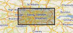
The London Earth data are part of the Geochemical Baseline Survey of the Environment (G-BASE) dataset, a nation-wide project to determine the distribution of chemical elements in the surface environment. London Earth focuses on the soil of the capital city, the limits of the survey being defined by the Greater London Authority (GLA) administrative boundary. Chemical elements have been determined by X-ray fluorescence spectrometry (XRFS) at the laboratories of the British Geological Survey (BGS) in Keyworth, Nottingham. These results are presented as a Microsoft Excel file.