250000
Type of resources
Available actions
Topics
Keywords
Contact for the resource
Provided by
Years
Formats
Representation types
Update frequencies
Scale
-
Data identifying landscape areas (shown as polygons) attributed with geological names. The scale of the data is 1:25 000 scale. Onshore coverage is partial and BGS has no intention to create a national coverage at this scale. Areas covered are essentially special areas of 'classic' geology and include Llandovery (central Wales), Coniston (Lake District) and Cuillan Hills (Isle of Skye). Mass movement describes areas where deposits have moved down slope under gravity to form landslips. These landslips can affect bedrock, superficial or artificial ground. Another batch of tiles was added to the data in 2012 to bring the total to 167 for this version 2 release. Mass movement deposits are described in the BGS Rock Classification Scheme Volume 4. However the data also includes foundered strata, where ground has collapsed due to subsidence (this is not described in the Rock Classification Scheme). Caution should be exercised with this data; whilst mass movement events are recorded in the data due to the dynamic nature of occurrence significant changes may have occurred since the data was released. The data should therefore be regarded as a snapshot in time (as at 2008). The data are available in vector format (containing the geometry of each feature linked to a database record describing their attributes) as ESRI shapefiles and are available under BGS data licence. Another batch of tiles was added to the data in 2012 to bring the total to 167 for this version 2 release.
-
[This metadata record has been superseded, see http://data.bgs.ac.uk/id/dataHolding/13480412]. The map shows the location of excess sample materials from the G-BASE (Geochemical Baseline Survey Of The Environment) geochemistry project:- stream sediments, panned heavy mineral concentrates and soils are stored long term in the National Geoscience Data Centre and are available for use in other projects. The Minerals Programme (incorporating the Mineral Reconnaissance Programme) sample collection contains reference samples of drill cores, rocks, tills, soils, stream sediments and panned concentrates. These samples were collected in the period 1974 - to date in mineralised and potentially mineralised areas of the United Kingdom, principally in the northern and western Britain.
-
This layer of the map based index (GeoIndex) is a map based index of the National Well Record Archive. This index shows the location of water wells along with basic information such as well name, depth and date of drilling. The index is based on the collection of over 105,000 paper records of water wells, springs and water boreholes. Geological information, construction details, water quality data and hydrogeological data may also be available for some water wells. The amount of detail held on individual sites varies widely and certain fields will have an 'unknown' value where the paper records have yet to be checked for their content. The zero values for the depth represent those for which the depth has yet to be entered into the database from the paper records.
-

The BGS database of geological maps is an index into BGS holdings of modern and historical published geological maps, geological standards and field slips, and also contains a range of other map series, including geophysical maps, geochemical maps, hydrogeological maps, thematic maps and other small-scale miscellaneous non-series maps. Historical vertical and horizontal sections, as well as indices to colours, are also included. The database comprises map metadata, including the title, theme, survey and revision years, publication years, mapped geological theme, base material, map function, colouration, approval status and the spatial extent of each map sheet. An accompanying file store contains high-resolution JPEG2000 scans for delivery, as well as various digital master and delivery formats. For a small number of maps, no scan exists. In total, the database contains over 240,000 scans of over 130,000 maps and field slips. The majority of the maps in the database cover Great Britain, but other regions are also represented, including a historical series of 1-inch maps of Ireland, 6-inch maps of the Isle of Man, 1:25 000 scale maps of the Channel Islands, and various overseas maps. The database contains a record of all geological maps produced by the British Geological Survey and its predecessors since the commencement of systematic geological mapping in the 1830s. The BGS Maps Database is mostly an archive of previous BGS maps, and is not the same as the latest BGS digital mapping. The maps within the database may differ significantly from BGS digital vector mapping. Further information about BGS digital vector mapping is available on the BGS website, under 'BGS Datasets'. The database has evolved over time, originally being a series of discrete databases. These databases have now been aggregated into a single dataset. BGS published maps, as well as 1:10 560 and 1:10 000 large-scale geological maps of England and Wales, and Scotland, are available through the BGS Maps Portal. Field slips and some thematic maps are not included on the BGS Maps Portal. The information about a map is normally a transcription from the map itself. Sometimes key information such as the title may not be actually printed on the map. Where this is the case the information is supplied in square brackets, e.g. [Kirk Maiden]. Information in square brackets means the information is supplied by the cataloguer and is not transcribed from the item.
-
The Bedrock summary lithologies dataset is digital geological map across the bulk of the UK Continental Shelf (UKCS), for areas up to a water depth of 200 m, which groups the bedrock lithologies (rock types) into classes based on similar engineering geology characteristics. The map is derived from the 1:250 000 scale digital bedrock map of the UKCS (BGS Offshore Bedrock 250k), which is available separately from BGS. The map was produced in 2014 in collaboration with, and co-funded by, The Crown Estate as part of a wider commissioned project to assess seabed geological constraints on engineering infrastructure across the UKCS. The divisions on the map combine the bedrock formations into 8 classes (with several subdivisions) of similar strength and lithological variability, each with a 'Category' title that summarises their main lithological character: Class1 – Igneous; Class 2 - Tertiary Sandstone and Limestone; Class 2.5 - Tertiary Sandstone and Limestone Interbedded; Class 3 - Tertiary Mudstone; Class 4 - Mesozoic Sandstone and Limestone; Class 4.5 - Mesozoic Sandstone and Limestone Interbedded; Class 5 - Mesozoic Mudstone; Class 6 – Chalk; Class 7 – Metamorphic; Class 8 - Palaeozoic Sedimentary. The data are held by the BGS as an ESRI Shapefile.
-
[This metadata record has been superseded, see http://data.bgs.ac.uk/id/dataHolding/13608329]. This layer of the map based index (GeoIndex) providex an index to 17,500 borehole rock samples (drillcore) from the Mineral Reconnaissance Programme (MRP) and related studies. The UK Government's Department of Trade and Industry (DTI) funded BGS to provide baseline information on areas prospective for the occurrence of metallic minerals in Great Britain. This programme, known as the MRP, ran continuously from 1973 to 1997 and covered particular locations across Great Britain. It was designed to stimulate private sector exploration and to encourage the development of Britain's indigenous mineral resources. Under the programme a number of boreholes were drilled to gather information.
-
Data identifying landscape areas (shown as polygons) attributed with geological names and rock type descriptions. The scale of the data is 1:10 000 scale. Onshore coverage is partial with approximately 30% of England, Scotland and Wales available in the version 2 data release. BGS intend to continue developing coverage at this scale; current focus is to include all large priority urban areas, along with road and rail transport corridors. Superficial deposits are the youngest geological deposits formed during the most recent period of geological time, the Quaternary, which extends back about 2.58 million years from the present. They lie on top of older deposits or rocks referred to as bedrock. Superficial deposits were laid down by various natural processes such as action by ice, water, wind and weathering. As such, the deposits are denoted by their BGS lexicon name, which classifies them on the basis of mode of origin (lithogenesis) with names such as, 'glacial deposits', 'river terrace deposits' or 'blown sand'; or on the basis of their composition such as 'peat'. Most of these superficial deposits are unconsolidated sediments such as gravel, sand, silt and clay. The digital data includes attribution to identify each deposit type (in varying levels of detail) as described in the BGS Rock Classification Scheme (volume 4). The data are available in vector format (containing the geometry of each feature linked to a database record describing their attributes) as ESRI shapefiles and are available under BGS data licence.
-

A collection of small-scale non-series maps which offer whole-country coverage of the United Kingdom 1856-2013. Included in the collection are geological, tectonic, structural, mineral resource and geophysical maps, together with a small number of historical facsimile maps. Key geological maps included in the collection which ran to many editions are Geology of the British Islands 1:584 000 and the Geological Map of Great Britain 1:625 000. These maps are hard-copy paper records stored in the National Geoscience Data Centre (NGDC) and are delivered as digital scans through the BGS website.
-

The UTM series of maps are based on 1:250 000 base maps published by the Ordnance Survey. Mapping is divided into squares which cover 1 degree by 1 degree of latitude / longitude in the Universal Transverse Mercator (UTM) projection, and coverage extends offshore and onto the continental shelf. The UTM series are available in three different themes: - Solid geology (complete coverage within the mapped area, including most of the UK continental shelf) - Sea bed sediments (coverage for most offshore areas) - Quaternary geology (coverage for the UK sector of the North Sea, Irish Sea and the Atlantic margin) Also included within this series are two small-scale (1:500 000) bedrock geology maps of the Central Rockall Basin and North Rockall Basin. These maps supersede the older quarter-inch series of maps which were published for England / Wales and Scotland. Geological maps represent a geologist's compiled interpretation of the geology of an area. A geologist will consider the data available at the time, including measurements and observations collected during field campaigns, as well as their knowledge of geological processes and the geological context to create a model of the geology of an area. This model is then fitted to a topographic basemap and drawn up at the appropriate scale, with generalization if necessary, to create a geological map, which is a representation of the geological model. Explanatory notes and vertical and horizontal cross sections may be published with the map. These maps are, for the most part, hard-copy paper records stored in the National Geoscience Data Centre (NGDC) and are delivered as digital scans through the BGS website.
-
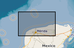
BIRPS (the British Institutions Reflection Profiling Syndicate) acquired almost 650 km of offshore seismic data and 300 km of onshore seismic data over the Chicxulub impact crater. The data were recorded to 18 s two-way time.
 NERC Data Catalogue Service