irregular
Type of resources
Available actions
Topics
Keywords
Contact for the resource
Provided by
Years
Formats
Representation types
Update frequencies
Service types
Scale
Resolution
-
A card index storing supplementary information regarding name, operator, dates and commodity worked for each planning permission boundary recorded (drawn) on the Ministry of Housing and Local Government (MHLG) Mineral Planning Permissions Maps (see associated metadata). Information on the cards has been used to attribute the Ministry of Housing and Local Government (MHLG) Mineral Planning Permission Polygons (see associated metadata for MHLG Planning Permission Polygons).
-

Structural geology data obtained by Land Survey staff during their mapping work. Originally designed for the Mid-Wales Mapping Programme but subsequently used by other teams. Holds details of planar structures, linear structures, folds, faults and veins.
-
The BGS Geoscience Thesaurus contains approximately 6000 descriptor terms for concepts in the geoscience and related subjects. Some entries have scope notes to further explain the term. The original source of the data was the Australian Mineral Foundation thesaurus of geoscience; some terms have been added or updated to suit BGS needs and the content will continue to be updated as required. The thesaurus includes synonyms to descriptor terms, hierarchical relationships, symmetric (see also) relationships and lapsed (deprecated) term replacements.
-
The Britrocks database provides an index to the BGS mineralogical & petrological collection. The computer database covers samples in the UK onshore mapping collection together with world wide reference minerals and the Museum Reserve collection. Currently circa 200k out of circa 300k samples are recorded in the computer database. A collection audit is ongoing, so availability of any particular sample is not guaranteed. The first England and Wales collection sample is from circa 1877, Threshthwaite Comb, Cumbria (collected by the Reverend Clifton Ward). The addition of new samples, transfer of records from registers and updates of existing records is ongoing on a regular basis. Internet access to the database is provided on the BGS web site.
-
Collections of miscellaneous items mainly of semi-current value, including some field observations supplementary to 1:10560/1:10K mapping, arranged on 1:10K or One-Inch sheet basis. Set up in 1950's filing miscellaneous records for Scotland and Northern England. Records of archival value for permanent retention being transferred to Land Survey Archives (LSA). Indexed in the Land Survey Record Index (LSRI).
-
The Seismic Line Index database stores summary administrative information about the collection of printed seismic sections, Original Seismic Sections dataset (ORIGSEISECS). This includes: details of data ownership or source, date of acquisition, purpose of survey, confidentiality, media, survey acquisition and processing parameters, and storage location in BGS. Almost all data are within the UK Onshore area; although there are some UK near-shore and offshore (North Sea, Irish Sea) and foreign data. Most data were acquired for commercial hydrocarbon exploration and subsequently provided to BGS for use on specific projects. Some data were acquired by BGS and other public-sector bodies, e.g. BIRPS (British Institutes Reflection Profiling Syndicate), for academic research. There is also scope to add relevant information about the data held in Copy Seismic Sections (COPYSEISECS) and Original Seismic Shotpoint Location Maps (ORIGSPMAPS) datasets.
-
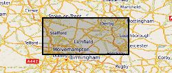
The full title of this project is" Studies into metal speciation and bioavailability to assist risk assessment and remediation of brownfield sites in urban areas" and is funded by NERC under the URGENT thematic programme form 1998-2001. The project is being undertaken by a consortium of workers from the Imperial College, University of Nottingham, and the British Geological Survey. Innovative collaborative and multi-disciplinary research will be applied to the interpretation of urban geochemical maps and associated meta-datasets to assist decision making by local authorities in the redevelopment of brownfield sites. Source apportionment, speciation and bioavailability of potentially toxic heavy metals will be studied at representative conurbations in the UK Midlands region. Scanning electron microscopy, chemical extractions and soil solution and vegetable analysis, will be integrated with high precision isotopic analyses of Pb and other potential toxic metals in this study. The results will be available as maps in GIS format to provide a generic decision support system for quantitative health risk assessment.
-
Primary Geological Data resulting from Open Cast Coal exploration in British coalfield areas. Maps showing the site outlines of opencast coal prospecting sites annotated with site reference number. Sites date back to the 1940s. Outlines drawn on 1:25000 scale topographic bases. The majority of the collection was deposited with the National Geological Records Centre by the Coal Authority in July 2001.
-

Available metadata for oil and gas industry site surveys, including their geographic locations. As the Data Archive Centre (DAC) for geology and geophysics for MEDIN (the Marine Environment Data and Information Network), the British Geological Survey (BGS) has been indexing metadata relating to oil and gas industry site surveys since 2009. The metadata describe site survey data acquired under exploration and production licences by oil companies from 1997 onwards. The metadata have been collected in collaboration with the Oil and Gas Authority (OGA) (now the North Sea Transition Authority, NSTA). The metadata collected include: survey name; survey reference number(s); originator (or operating licencee); survey area boundary; contractor; start date; end date; survey description; additional information (including the equipment used); and the data custodian at the time of metadata submission. BGS hold only the metadata, not the data. To access the data, first check whether the data are provided by the NSTA through the National Data Repository (NDR) at https://ndr.nstauthority.co.uk/. If the data are not available, the NDR may be able to contact the data custodian to obtain the data.
-
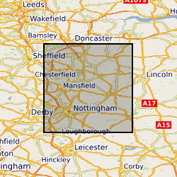
Paper records and photos used to create the Nottingham Caves digital register and maps. Includes archival material of the caves known to BGS, around northern and central Nottingham. Data mainly captured in 1989, infrequent since then approximately 1 per year.
 NERC Data Catalogue Service