 NERC Data Catalogue Service
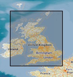
G-BASE panned stream sediment samples
The BGS Geochemical Baseline Survey of the Environment (G-BASE) was the national strategic geochemical mapping programme in Great Britain. The project set out to establish the chemistry of the surface environment by the collection and analysis of stream sediment, stream water and soil samples. Beginning in the late 1960s in northern Scotland and moving southwards across the country, the primary focus was mineral exploration, however, the project quickly developed to address important environmental concerns. The final G-BASE samples were collected in southern England in 2014. The outputs from the G-BASE project provide an invaluable, systematic baseline of geochemical information for Great Britain, serving as a marker of the state of the environment against which to measure future change. At G-BASE drainage sampling sites (average density: one site per 1.5 km square), sediment was collected from the centre of the stream and sieved through two sieves (2 mm and 150 microns). The fine-grained fraction formed the stream sediment sample and underwent chemical analysis. Excess material from the <2 mm fraction was panned using a wooden dulang pan to collect a heavy mineral concentrate. During the G-BASE project, these samples were archived, but not routinely submitted for chemical analysis. For more information about accessing these samples and their analytical results, contact BGS Enquiries
(enquries@bgs.ac.uk
).
Simple
- Date (Creation)
- 2000
Distributor
British Geological Survey
-
Enquiries
0115 936 3276
The Lyell Centre, Research Avenue South
,
EDINBURGH
,
LOTHIAN
,
EH14 4AP
,
United Kingdom
0115 936 3142
0115 936 3276
Point of contact
British Geological Survey
-
Enquiries
0115 936 3276
The Lyell Centre, Research Avenue South
,
EDINBURGH
,
LOTHIAN
,
EH14 4AP
,
United Kingdom
0115 936 3142
0115 936 3276
Distributor
British Geological Survey
-
Enquiries
0115 936 3276
Environmental Science Centre, Nicker Hill, Keyworth
,
NOTTINGHAM
,
NOTTINGHAMSHIRE
,
NG12 5GG
,
United Kingdom
0115 936 3143
0115 936 3276
Point of contact
British Geological Survey
-
Enquiries
0115 936 3276
Environmental Science Centre, Nicker Hill, Keyworth
,
NOTTINGHAM
,
NOTTINGHAMSHIRE
,
NG12 5GG
,
United Kingdom
0115 936 3143
0115 936 3276
- Maintenance and update frequency
- notPlanned Not planned
- GEMET - INSPIRE themes, version 1.0
- BGS Thesaurus of Geosciences
-
- UK Location (INSPIRE)
- Geochemistry
- Sample analysis
- EGDI
- Geochemical sampling
- Scottish SDI
- Geochemical data
- Stream sediment sampling
- Geochemical maps
- Geology
- Sampling
- Geochemical background
- dataCentre
- Keywords
-
- NERC_DDC
- Access constraints
- otherRestrictions Other restrictions
- Other constraints
- no limitations
- Other constraints
- The dataset is made freely available for access, e.g. via the Internet. Either no third party data / information is contained in the dataset or BGS has secured written permission from the owner(s) of any third party data / information contained in the dataset to make the dataset freely accessible.
- Use constraints
- otherRestrictions Other restrictions
- Other constraints
- The copyright of materials derived from the British Geological Survey's work is vested in the Natural Environment Research Council [NERC]. No part of this work may be reproduced or transmitted in any form or by any means, or stored in a retrieval system of any nature, without the prior permission of the copyright holder, via the BGS Intellectual Property Rights Manager. Use by customers of information provided by the BGS, is at the customer's own risk. In view of the disparate sources of information at BGS's disposal, including such material donated to BGS, that BGS accepts in good faith as being accurate, the Natural Environment Research Council (NERC) gives no warranty, expressed or implied, as to the quality or accuracy of the information supplied, or to the information's suitability for any use. NERC/BGS accepts no liability whatever in respect of loss, damage, injury or other occurence however caused.
- Other constraints
- Available under the Open Government Licence subject to the following acknowledgement accompanying the reproduced NERC materials "Contains NERC materials ©NERC [year]"
- Other constraints
- The dataset is made available to external clients under BGS Digital Data Licence terms and conditions. Revert to the IPR Section (iprdigital@bgs.ac.uk ) if further advice is required with regard to permitted usage.
- Spatial representation type
- vector Vector
- Metadata language
- EnglishEnglish
- Topic category
-
- Geoscientific information
- Geographic identifier
-
GBN
- Date (Revision)
- 2009
- Geographic identifier
-
GREAT BRITAIN [id=139600]
- Date (Creation)
- 1979
N
S
E
W
))
- Begin date
- 1968
- End date
- 2014
- Unique resource identifier
- OSGB 1936 / British National Grid (EPSG::27700)
- Unique resource identifier
- WGS 84 (EPSG::4326)
- Distribution format
-
Distributor
British Geological Survey
-
Enquiries
0115 936 3276
The Lyell Centre, Research Avenue South
,
EDINBURGH
,
LOTHIAN
,
EH14 4AP
,
United Kingdom
0115 936 3142
0115 936 3276
Distributor
British Geological Survey
-
Enquiries
0115 936 3276
Environmental Science Centre, Nicker Hill, Keyworth
,
NOTTINGHAM
,
NOTTINGHAMSHIRE
,
NG12 5GG
,
United Kingdom
0115 936 3143
0115 936 3276
- OnLine resource
-
Geochemical baseline survey of the environment (G-BASE)
(
WWW:LINK-1.0-http--link
)
The BGS Geochemical Baseline Survey of the Environment (G-BASE) is the national strategic geochemical mapping programme in Great Britain. The project set out to establish the chemistry of the surface environment by the collection and analysis of stream sediment, stream water and soil samples.
- Hierarchy level
- dataset Dataset
- Other
- dataset
Conformance result
- Date (Publication)
- 2011
- Explanation
- See the referenced specification
- Pass
- No
Conformance result
- Date (Publication)
- 2010-12-08
- Explanation
- See http://eur-lex.europa.eu/LexUriServ/LexUriServ.do?uri=OJ:L:2010:323:0011:0102:EN:PDF
- Pass
- No
- Statement
- Sampling and data collection procedures evolved over the course of the G-BASE project. More information may be found in the G-BASE field procedures manual (2005): https://nora.nerc.ac.uk/id/eprint/5190/. The G-BASE project was initially called the 'Regional Geochemical Reconnaissance Programme' (RGRP) and subsequently the 'Geochemical Survey Project' (GSP). All G-BASE data have been loaded into the BGS Geochemistry Database.
- File identifier
- 9df8df53-2a87-37a8-e044-0003ba9b0d98 XML
- Metadata language
- EnglishEnglish
- Hierarchy level
- dataset Dataset
- Date stamp
- 2025-11-13
- Metadata standard name
- UK GEMINI
- Metadata standard version
- 2.3
Point of contact
British Geological Survey
The Lyell Centre, Research Avenue South
,
EDINBURGH
,
LOTHIAN
,
EH14 4AP
,
United Kingdom
+44 131 667 1000
- Dataset URI
- http://data.bgs.ac.uk/id/dataHolding/13605453
Overviews
Spatial extent
N
S
E
W
Provided by

Associated resources
Not available