2000
Type of resources
Available actions
Topics
Keywords
Contact for the resource
Provided by
Years
Formats
Representation types
Update frequencies
Scale
Resolution
-
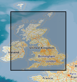
[This metadata record has been superseded, see http://data.bgs.ac.uk/id/dataHolding/13480412]. The map shows the location of excess sample materials from the G-BASE (Geochemical Baseline Survey Of The Environment) geochemistry project:- stream sediments, panned heavy mineral concentrates and soils are stored long term in the National Geoscience Data Centre and are available for use in other projects. The Minerals Programme (incorporating the Mineral Reconnaissance Programme) sample collection contains reference samples of drill cores, rocks, tills, soils, stream sediments and panned concentrates. These samples were collected in the period 1974 - to date in mineralised and potentially mineralised areas of the United Kingdom, principally in the northern and western Britain.
-
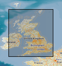
This layer of the map based index (GeoIndex) is a map based index of the National Well Record Archive. This index shows the location of water wells along with basic information such as well name, depth and date of drilling. The index is based on the collection of over 105,000 paper records of water wells, springs and water boreholes. Geological information, construction details, water quality data and hydrogeological data may also be available for some water wells. The amount of detail held on individual sites varies widely and certain fields will have an 'unknown' value where the paper records have yet to be checked for their content. The zero values for the depth represent those for which the depth has yet to be entered into the database from the paper records.
-
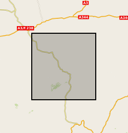
Oju/Obi is a remote part of Eastern Nigeria. There are severe water shortages during the 4-5 month dry season. The hydrogeology of the area is complex, and groundwater is difficult to find. In an attempt to understand and quantify the available groundwater resources within the area, DFID commissioned BGS from 1997 – 2000 to carry out a hydrogeological review of the area and devise appropriate and effective methods for siting wells and boreholes assessing groundwater resources and how best these resources could be developed. The field study involved the collection of time series data including groundwater chemistry and rainfall Cl along with mineralogical information. These results are being used by WaterAid, Local and regional Government to help local communities develop sustainable water supplies.
-
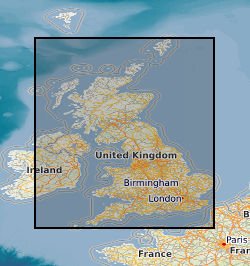
The BGS Geochemical Baseline Survey of the Environment (G-BASE) was the national strategic geochemical mapping programme in Great Britain. The project set out to establish the chemistry of the surface environment by the collection and analysis of stream sediment, stream water and soil samples. Beginning in the late 1960s in northern Scotland and moving southwards across the country, the primary focus was mineral exploration, however, the project quickly developed to address important environmental concerns. The final G-BASE samples were collected in southern England in 2014. The outputs from the G-BASE project provide an invaluable, systematic baseline of geochemical information for Great Britain, serving as a marker of the state of the environment against which to measure future change. At G-BASE drainage sampling sites (average density: one site per 1.5 km square), sediment was collected from the centre of the stream and sieved through two sieves (2 mm and 150 microns). The fine-grained fraction formed the stream sediment sample and underwent chemical analysis. Excess material from the <2 mm fraction was panned using a wooden dulang pan to collect a heavy mineral concentrate. During the G-BASE project, these samples were archived, but not routinely submitted for chemical analysis. For more information about accessing these samples and their analytical results, contact BGS Enquiries (enquries@bgs.ac.uk).
-
[This metadata record has been superseded, see http://data.bgs.ac.uk/id/dataHolding/13608329]. This layer of the map based index (GeoIndex) providex an index to 17,500 borehole rock samples (drillcore) from the Mineral Reconnaissance Programme (MRP) and related studies. The UK Government's Department of Trade and Industry (DTI) funded BGS to provide baseline information on areas prospective for the occurrence of metallic minerals in Great Britain. This programme, known as the MRP, ran continuously from 1973 to 1997 and covered particular locations across Great Britain. It was designed to stimulate private sector exploration and to encourage the development of Britain's indigenous mineral resources. Under the programme a number of boreholes were drilled to gather information.
-
The Regional Geochemical Atlases are the principal hard copy product of the British Geological Survey G-BASE (Geochemical Baseline Survey of the Environment) project. The majority of atlases are for stream sediment, with data on stream water and soil included where available. Separate stream sediment, soil and stream water atlases have been published for Wales. This dataset relates to the hard-copy atlases, which are available for Shetland, Orkney, South Orkney and Caithness, Sutherland, Hebrides, Great Glen, East Grampians, Argyll, Southern Scotland, Lake District, NE England, NW England and N Wales and Wales. The atlases were issued between 1978 and 2000. Each atlas comprises a set of separate interpolated heat-maps for each analyte, as well as descriptive and interperative information. The atlases provide an invaluable, systematic baseline of geochemical information for Great Britain, serving as a marker of the state of the environment against which to measure future change. Digital atlases and map products are also available for the Clyde Basin, central England, the London region and south-west England. National-scale digital atlas products are also available.
-
The BGS Geochemical Baseline Survey of the Environment (G-BASE) was the national strategic geochemical mapping programme in Great Britain. The project set out to establish the chemistry of the surface environment by the collection and analysis of stream sediment, stream water and soil samples. Beginning in the late 1960s in northern Scotland and moving southwards across the country, the primary focus was mineral exploration, however, the project quickly developed to address important environmental concerns. The final G-BASE samples were collected in southern England in 2014. The outputs from the G-BASE project provide an invaluable, systematic baseline of geochemical information for Great Britain, serving as a marker of the state of the environment against which to measure future change. The routine collection of regional soil samples was introduced in 1986 in areas of poor drainage density, with an average sample density of one site per 2 square kilometres. Urban soil sampling commenced in 1991, with an average density of four samples per square kilometres, for the urban areas of Belfast, Cardiff, Corby, Coventry, Derby, Doncaster, Glasgow, Hull, Ipswich, Leicester, Lincoln, Manchester, Mansfield, Northampton, Nottingham, Peterborough, Scunthorpe, Sheffield, Swansea, Stoke, Telford, Wolverhampton and York. Topsoil samples were collected between depths of 5 cm and 20 cm, and were sieved through a 2 mm mesh and milled to less than 150 microns. The data include XRF and direct-reading optical emission spectrometry (DR-OES) analyses for some or all of the following elements: Ag, As, Ba, Bi, Br, Ca, Cd, Ce, Co, Cr, Cs, Cu, Fe, Ga, Ge, Hf, I, K, La, Mg, Mn, Mo, Nb, Ni, P, Pb, Rb, Sb, Sc, Se, Se, Sn, Sr, Ta, Te, Th, Ti, Tl, U, V, W, Y, Zn and Zr. Loss on Ignition (LOI) and pH (in a slurry of 0.01 M CaCl2) were also routinely determined on 50% of regional and all urban samples. For more information about accessing these samples and their analytical results, contact BGS Enquiries (enquries@bgs.ac.uk).
-
This layer of the GeoIndex shows the localities for which details of identified fossil specimens in the BGS Biostratigraphy Museum are databased. Only Ordovician and Silurian specimens listed currently. Samples and taxonomic identifications will be listed and will in future be able to be queried using the query-by-attribute tool to the right of the map. See also Fossil Localities. Material is available for inspection on application by e-mail; it is free for academic research but is charged for commercial work. Specimens are sometimes available for loan to bona fide academics.
-
The BGS Geochemical Baseline Survey of the Environment (G-BASE) was the national strategic geochemical mapping programme in Great Britain. The project set out to establish the chemistry of the surface environment by the collection and analysis of stream sediment, stream water and soil samples. Beginning in the late 1960s in northern Scotland and moving southwards across the country, the primary focus was mineral exploration, however, the project quickly developed to address important environmental concerns. The final G-BASE samples were collected in southern England in 2014. The outputs from the G-BASE project provide an invaluable, systematic baseline of geochemical information for Great Britain, serving as a marker of the state of the environment against which to measure future change. Deep soil samples (also known as profile soil samples) were taken from depths of between 35 cm and 50 cm at densities of 1 sample per two square kilometres (rural / regional areas) and 4 samples per square kilometre (urban areas). The G-BASE profile soils were generally sieved to 150 microns before analysis and determined by XRF for some or all of: Ag, As, Ba, Bi, Br, Ca, Cd, Ce, Co, Cr, Cs, Cu, Fe, Ga, Ge, Hf, I, K, La, Mg, Mn, Mo, Nb, Ni, P, Pb, Rb, Sb, Sc, Se, Se, Sn, Sr, Ta, Te, Th, Ti, Tl, U, V, W, Y, Zn and Zr. Since 2003, for both regional and urban sampling, deep soil samples and shallow soil samples were routinely collected from the same sites, but only the shallow soil samples were submitted for chemical analysis. The deep soil samples were archived in the National Geoscience Data Centre. For more information about accessing these samples and their analytical results, contact BGS Enquiries (enquries@bgs.ac.uk).
-
The BGS Geochemical Baseline Survey of the Environment (G-BASE) was the national strategic geochemical mapping programme in Great Britain. The project set out to establish the chemistry of the surface environment by the collection and analysis of stream sediment, stream water and soil samples. Beginning in the late 1960s in northern Scotland and moving southwards across the country, the primary focus was mineral exploration, however, the project quickly developed to address important environmental concerns. The final G-BASE samples were collected in southern England in 2014. The outputs from the G-BASE project provide an invaluable, systematic baseline of geochemical information for Great Britain, serving as a marker of the state of the environment against which to measure future change. Stream sediments were the primary sample medium for G-BASE, with an average density of one site per 1.5 km square. The drainage sampling sites cover most of Great Britain. Sediment was collected from the centre of the stream and sieved through two sieves (2 mm and 150 µm) to obtain a fine grain-size fraction of <150 microns. Analytical data (by a variety of analytical methods, including XRF and direct-reading optical emission spectrometry (DR-OES) for the <150 micron fraction of stream sediment samples are available for some or all of the following elements: Ag, As, Ba, Bi, Br, Ca, Cd, Ce, Co, Cr, Cs, Cu, Fe, Ga, Ge, Hf, I, K, La, Mg, Mn, Mo, Nb, Ni, P, Pb, Rb, Sb, Sc, Se, Se, Sn, Sr, Ta, Te, Th, Ti, Tl, U, V, W, Y, Zn and Zr. Some stream sediment samples were originally collected as part of the Mineral Reconnaissance Programme (MRP), and later re-analysed for G-BASE. These samples may have been assigned a new sample number, but will plot at the same site. For more information about accessing these samples and their analytical results, contact BGS Enquiries (enquries@bgs.ac.uk).
 NERC Data Catalogue Service