 NERC Data Catalogue Service
1982
Type of resources
Topics
Keywords
Contact for the resource
Provided by
Years
Formats
Representation types
Update frequencies
Scale
-

The database contains images of the UK, recorded from various airborne multispectral sensors operated by or on behalf of the NERC airborne remote sensing facility. It includes data from the ATM, CASI, PMI, and thermal line scanner instruments. The data are stored in proprietary formats on various types of magnetic media. Full datasets belong to the NERC but BGS has access, the NERC earth observation data centre, NEODC, hold the data. For all enquiries contact NEODC at http://www.neodc.rl.ac.uk.
-
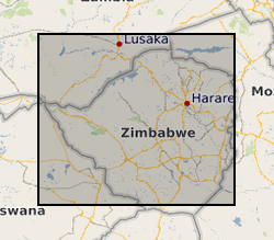
During the period 1982-86 a team of geologists from the British Geological Survey carried out a programme of regional geological mapping and geochemical exploration in collaboration with the Zimbabwe Geological Survey under a Technical Co-operation agreement supported by the UK Department for International Development (DFID) (formerly Overseas Development Agency). Three regions of Zimbabwe were mapped (Harare, Rushinga & Nyampanda, and Makaha) and the results of the stream sediment geochemical surveys were presented as three reports. Over 17,000 stream sediments were collected and analysed for Cu, Pb, Zn, Co, Ni, Mn, Li, As, Ba, Sn, Ta, and W. Raw data can be obtained from the Geological Survey of Zimbabwe, PO Box CY210,Causeway, Harare, Zimbabwe.