 NERC Data Catalogue Service
Format
ASCII (.csv)
Type of resources
Topics
Keywords
Contact for the resource
Provided by
Years
Formats
Representation types
Update frequencies
From
1
-
1
/
1
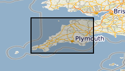
-
Airborne geophysical data acquired as part of the BGS-NERC TellusSW project (http://www.tellusgb.ac.uk/) during the second half of 2013. The survey comprised a high resolution magnetic/magnetic gradient survey combined with a multichannel (256 channel) radiometric survey. The survey was carried out using 200m (N-S) line separations at a mean elevation of 91m. Encompassing the counties of Cornwall and parts of Devon and Somerset, the survey provided 60,323 line-km of data. Digital data and derived (e.g. spatial derivatives) maps of the geophysical information are provided to facilitate spatial modelling of the soil, geological and environmental aspects of the data.