 NERC Data Catalogue Service
Sedimentary geology
Type of resources
Available actions
Topics
Keywords
Contact for the resource
Provided by
Years
Formats
Representation types
Update frequencies
Scale
-

PROJECT DETAILS ONLY - NO DATA. Mountain belts disrupt atmospheric circulation patterns and profoundly influence climate. Understanding long-term climate change thus requires good definition of timing and growth rate of major mountain belts, but is complicated by high erosion rates which remove much of the early record of mountain formation. Sophisticated geodynamic and climate-atmosphere models describe the evolution and influences of the Himalayan-Tibet orogen. Many geodynamic models predict palaeogene crustal thickening with little or no early exhumation and erosion. Such models need testing. Decades of geological, geophysical and geochemical investigations centred on the continental rock record have failed to produce data sets suitable for testing fully such models because information about the early orogen evolution is missing. Our alternative strategy looks at marine sediments formed from material eroded in the early history of the mountain belt and preserved in the Andaman Islands, Sylhet Trough, Bangladesh and Iranian Makran. These sediments contain a record of their origin and early history in the Himalayas-Tibet which can be recovered using a combination of geochemical and thermochronological methods. Results from this project will provide the groundwork for major international collaborative projects to drill sediments eroded off the Himalayas and deposited offshore in the Indus and Bengal submarine fans.
-
The data were produced by Joe Emmings, NERC-funded PhD student at the University of Leicester and British Geological Survey, between 2014 and 2017. Authors of these data: Joe Emmings a, b; Sarah Davies a; Christopher Vane b; Melanie Leng b, c; Vicky Moss-Hayes b; Michael Stephenson b a School of Geography, Geology and the Environment, University of Leicester, University Road, Leicester, LE1 7RH, UK. b British Geological Survey, Keyworth, Nottingham, NG12 5GG, UK. c School of Biosciences, Centre for Environmental Geochemistry, University of Nottingham, Sutton Bonington Campus, Leicestershire LE12 5RD, UK. Data include: 1) A range of photographs from the outcrop Hind Clough and boreholes MHD4 and Cominco S9, sample photographs, thin section scans, microphotographs (transmitted light and scanning electron microscopy) and hand specimen descriptions; 2) The results of 100 analyses from the outcrop Hind Clough and boreholes MHD4 and Cominco S9; x-ray fluorescence major and trace element concentrations, RockEval pyrolysis measurements, x-ray diffraction traces and LECO elemental C and S data. These data were interpreted together with 20 drill-core samples previously acquired from Hind Clough ('HC01' prefix). See http://dx.doi.org/10.5285/c39a32b2-1a30-4426-8389-2fae21ec60ad for further information regarding this drill-core dataset. Acknowledgements: This study was funded by NERC grant NE/L002493/1, a part of the Central England Training Alliance (CENTA). This study also received CASE funding from the BGS. Nick Riley (Carboniferous Ltd) is thanked for sharing his expertise, particularly regarding the field identification of marine faunas. Charlotte Watts is thanked for providing field assistance. Nick Marsh, Tom Knott and Cheryl Haidon are thanked for providing expertise and assistance during inorganic geochemical and mineralogical analyses.
-

This dataset contains numerical model output of a morphodynamic and sedimentological simulation of a large river confluence based loosely on the Jamuna-Ganges junction in Bangladesh. The work was carried out as part of a joint project between the Universities of Birmingham, Southampton and Exeter. "The sedimentology of fluvial megascours" was a scientific research project funded by NERC. One aspect of the project was to undertake numerical simulations (the data described here) with which to compare with river bed bathymetry data (collected using a multibeam echosounder) and sub bottom seismic profiling data (collected using a surface tow boomer and chirp system). The data has been accepted for a publication in the journal 'Sedimentology' which will be published in 2018 with the title 'The Sedimentology of channel confluences'.
-
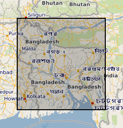
This dataset contains data from a river multibeam and seismic survey which took place in 2013 and 2014 at scour sites within the Brahmaputra river basin in Bangladesh. The survey was carried out as part of a joint project between the Universities of Birmingham, Southampton and Exeter. "The sedimentology of fluvial megascours" was a scientific research project funded by NERC. The purpose was to collect the data necessary to validate the first generic numerical model of scour zone stratigraphy that will be widely applicable to a broad range of large rivers. River bed bathymetry data were collected using a multibeam echosounder. Sub bottom seismic profiling data were collected using a surface tow boomer and chirp system. Technical details of the survey are contained in the cruise report of the survey which comprises part of the metadata. Some of the data has been accepted for a publication in the journal 'Sedimentology' which will be published in 2018 with the title 'The Sedimentology of channel confluences'.
-
A series of technical palaeontological and biostratigraphical reports produced in the London, Leeds, Edinburgh and Keyworth offices of BGS between 1953 and March 2000. The reports provide information on fossils collected during Geological Survey mapping or supplied by clients. Fossils are collected in order to date (relative age) the rocks in which they occur and/or to provide evidence for the conditions of deposition, so the information contained in each report usually includes determinations of the fossils present in a collection and an interpretation of their stratigraphical and/or their palaeoenvironmental/palaeogeographical significance.Individual reports vary enormously in scope, depending on the reasons for the investigation. Some reports may be site specific, documenting the fossil fauna/flora from a particular locality or borehole, whereas others may deal with material from a number of localities on a 1:10 000, 1:25 000 or 1:50 000 sheet, or from several boreholes. Other reports may be in the form of reviews. Geographical coverage is wide, covering the UK and Northern Ireland onshore, UK offshore and overseas localities.All reports are held as hardcopy only. Each report bears a unique identifying number in the form SS/YY/NN, where 'SS' identifies the series, 'YY' identifies the year in which it was written and 'NN' is a serial number. Reports were numbered sequentially, regardless of whether they dealt with material from the UK and Northern Ireland onshore, UK offshore, or overseas, and a sequential set is held by BGS. Reports are also filed by 1:50 000 sheet, (UK onshore), offshore quadrant and foreign country, as appropriate.
-
The data set consists of rock samples collected from Coquetdale, Coldstream and Whitrope Burn from 2013-2014; milled material is included. There is an Excel spreadsheet of sample numbers with location, sample height on log, d13C data and %C. There are scans of field logs from Coquetdale, Coldstream and Whitrope Burn, and Illustrator drawn logs from Coldstream which include samples collected at a later date. Scans of thin sections are also included. (thin sections to be kept at Leicester for the time being – still being worked on for papers.) Each locality folder has an Excel spreadsheet detailing samples, sample height, %C and bulk and specific d13C values. These data were used to interpret the environment in which early tetrapods have been found in the early Carboniferous. These data supported the MPhil thesis 'In an alternating marine and non-marine depositional setting, where and how are early Carboniferous tetrapods preserved?' by Sherwin, 2018, and one publication including data from Whitrope Burn - Richards et al., 2018, (https://doi.org/10.1017/S1755691018000166).
-
This is a geochemical dataset accompanying Emmings, J., Poulton, S., Vane, C., Davies, S., Jenkin, G., Stephenson, M., Leng, M., Lamb, A., Moss-Hayes, V. A Mississippian Black Shale Record of Redox Oscillation. Palaeogeography, Palaeoclimatology, Palaeoecology [submitted July 2019]. This dataset includes RockEval pyrolysis, major and trace element (XRF), Fe speciation, C, N and S isotopes and S species analyses through the Upper Bowland Shale in the Craven Basin (Lancashire, UK). This research was conducted by Joe Emmings, PhD researcher at the University of Leicester and British Geological Survey (BGS) between 2014-2018, and as a post-doctoral research associate (PDRA) at the British Geological Survey (2018-2021). The PhD research was funded by the Natural Environment Research Council (NERC), as part of the Central England Training Alliance (CENTA) [grant no. NE/L002493/1] and received CASE funding from the BGS. PDRA research was funded by the British Geological Survey. Reproduction or manipulation of these data in future analyses should cite one or more of the following related publications (as necessary): Emmings, J., 2018. Controls on UK Lower Namurian Shale Gas Prospectivity: Understanding the Spatial and Temporal Distribution of Organic Matter in Siliciclastic Mudstones. PhD Thesis, University of Leicester. Emmings J. et al. 2017. Stream and slope weathering effects on organic-rich mudstone geochemistry and implications for hydrocarbon source rock assessment: a Bowland Shale case study. Chemical Geology. 471. 74-91. Emmings, J. et al., 2019a. From Marine Bands to Hybrid Flows: Sedimentology of a Mississippian Black Shale. Sedimentology, [Accepted ms.]. Emmings, J.F. et al., 2019b. Controls on amorphous organic matter type and sulphurization in a Mississippian black shale. Review of Palaeobotany and Palynology, 268: 1-18. Emmings, J.F. et al. A Mississippian black shale record of redox oscillation. Palaeogeography, Palaeoclimatology, Palaeoecology [submitted July 2019] Co-workers: Sarah Davies (University of Leicester) - Primary PhD supervisor, sedimentology Chris Vane (BGS) - PhD supervisor, RockEval pyrolysis Mel Leng (BGS & University of Nottingham) - PhD supervisor, C & S isotopes Mike Stephenson (BGS) - PhD supervisor Simon Poulton (University of Leeds) - Fe speciation Gawen Jenkin (University of Leicester) - PhD supervisor Vicky Moss-Hayes (BGS) - RockEval pyrolysis Angela Lamb (BGS) - S isotopes
-

PROJECT DETAILS ONLY - NO DATA. A pilot study in the Taf estuary, South Wales (Carman et al., in press) has demonstrated the potential of Testate amoebae analyses in reconstructing high-resolution Holocene sea-level changes. Testate amobae faunas in surface samples from the saltmarsh were found to be not vey abundant and diverse, but also distinctly zoned with respect to elevation. This new finding is based on analyses of the sub-63 um size sediment fraction; previous saltmarsh studies only recorded larger testate amoebae in very low numbers and low diversity. We propose to test the replicability and applicability of Testate amoebae in sea-level studies by (i) sampling and analysing a new transect in the Brancaster marshes in the North Norfolk; and analysing fossil samples from the University of Durham core archive representing a wide range of coastal palaeo-environments.
-

PROJECT DETAILS ONLY - NO DATA. Vegetation plays an important role in landscapes that are shaped by wind-driven (aeolian) sand transport, such as coastal dunes and semi-arid regions. We have a good knowledge of how and why different types of desert dunes and dune fields form without the presence of vegetation, but our understanding of the effects of vegetation in the formation of coastal foredunes, parabolic dunes, blowouts, and nebkha's (shrub hummocks) is limited to descriptive observations and reasoning. This is especially true for vegetated dune fields on a landscape scale, and the effects of various plant species on the evolution and dynamics of such environments are not quantified. This research project aims to develop a computer simulation model based on moving around slabs of sand across a grid of cells that represents a landscape surface including varying amounts of vegetation in each cell. These movements are controlled by a set of simple rules that dictate interactions between the existing surface, the vegetation in each cell, and the propagation of the sand slabs. This allows simulating the evolution of aeolian landscapes through self-organisation into different types of dune fields without actually modelling the complex airflow dynamics and sand transport patterns. Simulations will be compared with our current descriptive understanding of vegetated aeolian landscape development to ensure that the model generates realistic results. The model is then used to systematically investigate exactly how and why various kinds of plant species and vegetation patterns influence the dynamics of dune development in aeolian environments.
-

PROJECT DETAILS ONLY - NO DATA. The 'snowball Earth' theory has been the subject of widespread media attention, particularly its lively defence by key proponent, Prof. Paul Hoffman. This period of earth history from 750 to 540 million years ago contained perhaps as many as 5 extreme events of climatic fluctuation. During the coldest of these the globe may have been entirely covered in ice. Until recent years research into the rocks of this age had focussed mainly on cold or hot desert areas of the world with very good outcrop and undeformed piles of sediments, but some of the most complete, but poorly exposed rock sections of this age are in more accessible areas such as Scotland and Ireland. Sediments are extremely difficult to date and ages of these rock sequences rely on the rare occurences of volcanic rocks. There is now the makings of a global framework of these glacial periods based on the isotopes of carbon in limestones, but without other dating evidence this can only say that the rocks are related to a glacial event, not which one. The isotopes of sulphur are constrained during this period by the rapid increase in the oxygen content of earth's oceans and atmosphere which resulted in the rapid evolution of many species and the development of vertebrate animals. This sulphur signal changed rapidly after the largest 'snowball Earth' event and recent studies suggest that this distinct signal might be globally recognisable. In Scotland and Ireland 3 glacial periods have been recognised in a seqence of rocks aged approximately 800 million years old at the base, 600 million about 75% of the way up from the base and containing 540-520 million year old vertebrate fossils close to the top. Linking the glacial periods to a particular global event in this 260 million year period has proved difficult. Combining new sulphur isotope data for the mineral pyrite from limestone and black shale rocks, with carbon isotope data and organic carbon content will allow these glacial events in Scotland and Ireland to be correlated and put into global context. This new data will place better age constraints on these rocks in Scotland and Ireland and improve the global understanding of this period of Earth history. Man's influence on the planet might have destabilised the climate system, so it is important that we understand the causes and effects of extreme climate variation in the past.