2017
Type of resources
Available actions
Topics
Keywords
Contact for the resource
Provided by
Years
Formats
Representation types
Update frequencies
Service types
Scale
Resolution
-
In this project we developed a new geobarometer for mafic and ultramafic igneous rocks, which can be used by the scientific community for a wide range of mineralogical and petrological studies. The material here include the description of the geobarometer, guidelines for its use, software and chemical data acquired for some case studies.
-
Electron backscatter diffraction data for cumulates from the Skaergaard Intrusion of East Greenland. 12 samples from the Skaergaard Intrusion: 9 from the Layered Series, and 3 from the trough layering. Layered Series samples have a prefix LS; Trough layer samples have a prefix TB.
-
Computed tomography (CT) scans of extant and fossil chondrichthyans, of teeth organized into functional dentitions. These scans were taken on a Nikon Metrology HMX ST 225, in the Image and Analysis Centre, Natural History Museum, London.
-
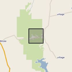
Data from Tanzania Drilling Project Core Site 14 B. Data spans the Paleocene Eocene Thermal Maximum ~56 million years ago. Data includes: bulk sediment geochemistry, BIT index and GDGT data, n-alkane d13C data, single specimen planktonic foraminifera stable isotope data and planktonic foraminifera count data. Geographic location 9°16'59.89"S, 39°30'45.04"E
-
FeS polymorphs are of significant relevance to condensed matter physics and planetary science. In particular, they are thought to form the cores of Earth and Mars, which is suggested by their presence in many meteorites. Data are plain text files containing the relative volume expansion, molar heat capacity and molar entropy of the FeS phases at different pressures as a function of temperature. Research results based upon these data are published at https://doi.org/10.1016/j.jpcs.2017.07.033
-
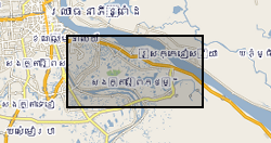
The dataset comprise hydrogeochemical, isotopic and environmental geophysics data from surface waters and groundwater and sediments from scientific boreholes drilled into arsenic-prone aquifers in the Mekong River Basin. The data is divided into 5 categories: Geophysical data Hydrogeochemical data Isotopic data Sedimentary data Outreach and Dissemination Publications to date - open access linkages The data pertain to samples obtained from northern Kandal province just south of Phnom Penh in Cambodia. The data were collected over the period 2013-2016. The hydrogeochemical data were obtained by one of more of (i) in situ analytical techniques; or (ii) instrumental geochemical techniques, notably IC, ICP-AES, ICP-MS and GC-MS in the Manchester Analytical Geochemistry Unit, University of Manchester following methods as described in Richards et al. (2015, 2017). The geophysical data were obtained as described in Uhlemann et al. (2017). The data were obtained as part of a project funded by NERC Standard Research Grant NE/J023833/1 the major purpose of which was to determine the extent to which surface derived organics may be driving arsenic mobilisation in shallow circum-Himalayan aquifers, an exemplar of which is norther Kandal Province's largely Holocene aquifers to which these data refer. The data were obtained and interpreted by the University of Manchester except as follows: environmental geophysics data were obtained and interpreted by Oliver Kuras and Sebastian Uhlemann of the British Geological Survey GTOM team; tritium data were generated by Jurgen Sultenfuss of the University of Bremen; oxygen and hydrogen isotope data by SUERC, East Kilbride and carbon-14 data by the NERC Radiocarbon Laboratory at East Kilbride.
-
Microstructural data for rocks in the Shiant Isles Main Sill, presented as a function of stratigraphic height in the sill. The data were published: Holness et al. (2017) Contributions to Mineralogy and Petrology, 172:7. OI 10.1007/s00410-016-1325-x
-

This dataset encompasses thin section photographs, mineral composition data and Ar/Ar data. Grant abstract: Many of the Earth's great mountain ranges, such as the Alps and the Himalaya, result from the collision between two continents. As mountains get pushed up by tectonic forces, they also get worn away by surface erosion. The uplift of topography causes long-term regional and global climate change, and conversely, changes in climate have also been linked to changes in the rate of tectonic processes. This project will define and quantify the competition between growth and erosion during the early stages of mountain uplift by exploiting a combination of state-of the art advances in numerical modelling and analytical techniques. During the early stages of continental collision, unusual (and diagnostic) rock types form under very high pressure conditions. Certain minerals in these rocks preserve details of the pressures and temperatures experienced during the journey from initial formation deep in the mantle, through their subsequent transport to the Earth's surface, their erosion, and their final deposition as sand grains in a sedimentary rock. The minerals retain distinctive chemical signatures which allows them to be distinguished from those formed in other rock types, even when eroded and turned into sand. Sand grains retain information about not only the original rock type, but also about details of the formation and transport history of the original rock. Unlocking this information will therefore yield insight into earlier stages of mountain belt growth history than is currently preserved in the bedrock record. However the methods needed to decipher these details are currently insufficiently precise to provide useful insight into changes in rates of tectonic or erosive processes, or constraints for the models. This project will therefore also develop and exploit innovative techniques for obtaining high-precision data from these high pressure rocks and their eroded remains. These data will enable the competing forces which act to shape a mountain belt during the early stages of formation to be quantified and allow the numerical models to be robustly tested. The unique contribution of this proposal lies in the combination of geodynamic numerical modelling with studies based on observational data and hence exploiting the synergy between these two, normally disparate, fields.
-

The Collapsible Ground dataset provides an assessment of the potential for a geological deposit to collapse (to subside rapidly) as a consequence of a metastable microfabric in loessic material. Such metastable material is prone to collapse when it is loaded (as by construction of a building, for example) and then saturated by water (as by rising groundwater, for example). Collapse may cause damage to overlying property. The methodology is based on 'BGS Geology' (Digital Map) and expert knowledge of the origin and behaviour of the formations so defined. It provides complete coverage of Great Britain, subject to revision in line with changes in DiGMapGB lithology codes and methodological improvements. The storage formats of the data are ESRI Shapefiles and MapInfo but other formats can be supplied. The GeoSure datasets and related reports from the British Geological Survey provide information about potential ground movement due to six types of natural geological hazard, in a helpful and user-friendly format. The reports can help inform planning decisions and indicate causes of subsidence.
-
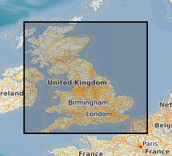
The data are the gridded recharge values obtained from the BGS distributed recharge model (ZOODRM) driven by 11 Ensembles of the HaDCM3 Regional Climate Model (RCM) taken from the Future Flow and Groundwater Level data set (http://www.ceh.ac.uk/our-science/projects/future-flows-and-groundwater-levels). The model covers the mainland areas of England, Scotland and Wales. The 11 ensembles are run from January 1950 to December 2099. The dataset themselves are the gridded (2 km by 2 km) outputs from the recharge model averaged over four time horizons: historical, 20s, 50s, and 80s, for each of the 11 ensembles. The results can be used to assess the impact of climate change on potential recharge (soil drainage) for catchments in mainland England, Scotland and Wales.
 NERC Data Catalogue Service