 NERC Data Catalogue Service
Ground control
Type of resources
Topics
Keywords
Contact for the resource
Provided by
Years
Update frequencies
-
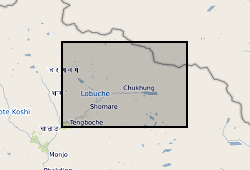
These data consist of a spreadsheet containing 557 ground control points (GCPs) collected in the Everest region of Nepal between October 2015 and October 2016. GCPs were collected using a Leica GS10 differential Global Positioning System (dGPS), post-processed against base station data at Syangboche. These final data have sub-centimetre accuracy (in x, y and z) in all cases. Point positions are heavily concentrated around meltwater ponds on the glacier surface, and prominent features around the glacier margin. These data will be used by PhD students and staff in the School of Geography, University of Leeds, to provide ground control for fine-resolution satellite imagery and Structure-from-Motion surveys to assess mass loss processes on Khumbu Glacier.