
Glaciers
Type of resources
Available actions
Topics
Keywords
Contact for the resource
Provided by
Years
Formats
Representation types
Update frequencies
status
-

2014 and 2016 time series of automatic weather station (AWS) data (Dataset 1) and (ii) GPS data (Dataset 2) at the location of the SAFIRE research project, Store Glacier, Greenland.
-
The ESA Glaciers Climate Change Initiative (CCI) dataset consists of data produced by the ESA CCI Glaciers Project. The main objective of the Glaciers_cci project is to contribute to the efforts of creating a globally complete and detailed glacier inventory as requested in action T2.1 by GCOS (2006). This activity has two major parts: One is data creation (glacier outlines) in selected and currently still missing key regions, and the other one is in establishing a more consistent framework for glacier entity identification to enhance the integrity and error characterization of the available data sets. As meltwater from glaciers and ice caps provide a substantial contribution to global sea-level rise, the project will also create two additional products in selected key regions, elevation changes and velocity fields
-
These files contain ground penetrating radar (GPR) data collected from the glacier margins and forelands of Falljökull and of Kvíárjökull, south-east Iceland, between 2012 and 2014. The data were collected using a Sensors and Software PulseEKKO Pro GPR system. For each glacier the data are stored in folders that indicate the month and year in which the surveys were conducted. Each GPR profile has a Sensors and Software GPR (.DT1) file, and associated header (.HD) and GPS (.GPS) files. The .HD files (which can be opened as text files) give the parameters and equipment used for each profile. GPS files are not available for some of the profiles collected on Falljökull in April 2013 (due to damage that occurred to the GPS linked with the PulseEKKO Pro system). For these profiles start, finish, and mid profile positions were recorded using differential GPS, and locations of these profiles are instead given by GIS shapefiles in the relevant folders. These datasets have been used in the publications listed below. Further information relating to the data collection methodology can be found therein. Phillips, Emrys; Everest, Jez; Evans, David J.A.; Finlayson, Andrew; Ewertowski, Marek; Guild, Ailsa; Jones, Lee. 2017 Concentrated, ‘pulsed’ axial glacier flow: structural glaciological evidence from Kvíárjökull in SE Iceland. Earth Surface Processes and Landforms, 42 (13). 1901-1922. https://doi.org/10.1002/esp.4145 Phillips, Emrys; Finlayson, Andrew; Bradwell, Tom; Everest, Jez; Jones, Lee. 2014 Structural evolution triggers a dynamic reduction in active glacier length during rapid retreat: evidence from Falljökull, SE Iceland. Journal of Geophysical Research: Earth Surface, 119 (10). 2194-2208. https://doi.org/10.1002/2014JF003165 Phillips, Emrys; Finlayson, Andrew; Jones, Lee. 2013 Fracturing, block-faulting and moulin development associated with progressive collapse and retreat of a polar maritime glacier: Virkisjokul-Falljokull, SE Iceland. Journal of Geophysical Research: Earth Surface, 118 (3). 1545-1561. https://doi.org/10.1002/jgrf.20116 Flett, Verity; Maurice, Louise; Finlayson, Andrew; Black, Andrew; MacDonald, Alan; Everest, Jez; Kirkbride, Martin. 2017. Meltwater flow through a rapidly deglaciating glacier and foreland catchment system: Virkisjökull, SE Iceland. Hydrology Research, 48 (6). 1666-1681. https://doi.org/10.2166/nh.2017.205
-
Data generated using freely-available satellite remote sensing observations from the USGS Earth Resources Observation Science Centre, together with a freely-available ice margin chronology from Dyke et al. (2003) Geological Survey of Canada Open File Report No. 1574. The map is published in the Journal of Maps: http://www.tandfonline.com/doi/full/10.1080/17445647.2014.912036 Published article in 'Nature' Volume 530 Feb 2016 with associated source data. https://dx.doi.org/10.1038/nature16947 Published paper in the Taylor Francis Online Journal with associated data. https://dx.doi.org/10.1080/17445647.2014.912036
-
These high resolution high-oblique time-lapse images were collected in hourly intervals from 5 locations around Helheim glacier in SE Greenland in the summer of 2013. Three cameras (Cameras 1, 2 and 3) were aimed at the calving front ~3.5 km down glacier from the calving front and two cameras (Cameras 4 and 5) were aimed cross-glacier ~3 km up glacier from the calving front. The images are in two stereo groups allowing the extraction of 3D data with significant processing though there are some optical issues that will degrade quality. Links to Published Papers: 1, Extensive Retreat of Greenland Tidewater Glaciers 2000-2010. http://dx.doi.org/10.1657/AAAR0014-049 2, Dynamics of glacier calving at the ungrounded margin of Helheim Glacier South East Greenland. http://dx.doi.org/10.1002/2015JF003531 3, Reverse Glacier motion during Iceberg calving and the cause of Glacial Earthquakes. http://dx.doi.org/10.1126/science.aab0460. 5, A High-resolution Sensor Network for Monitoring Glacier Dynamics. http://dx.doi.org/10.1109/JSEN.2014.2348534. , On the Role of Buoyant Flexure in Glacier Calving. 6, Buoyant Flexure controls summer dynamic mass loss at Helheim Glacier Greenland
-
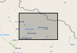
These data consist of a spreadsheet containing 557 ground control points (GCPs) collected in the Everest region of Nepal between October 2015 and October 2016. GCPs were collected using a Leica GS10 differential Global Positioning System (dGPS), post-processed against base station data at Syangboche. These final data have sub-centimetre accuracy (in x, y and z) in all cases. Point positions are heavily concentrated around meltwater ponds on the glacier surface, and prominent features around the glacier margin. These data will be used by PhD students and staff in the School of Geography, University of Leeds, to provide ground control for fine-resolution satellite imagery and Structure-from-Motion surveys to assess mass loss processes on Khumbu Glacier.
-

2014 and 2016 time series of basal multiprobe data (Dataset 1), englacial temperature data (Dataset 2), and englacial tilt data (Dataset 3) measured in boreholes drilled at the location of the SAFIRE research project, Store Glacier, Greenland.
-
There is a report highlighting the approach for model construction and recommendations for any future work. There is an excel file pf processed data including time, centrifuge speed, water pressure, and temperature data. There is a zip folder containing photographs of the models, the instrumentaiton and granular ice used for model construction There is a zip folder containing the raw data.
-

This image dataset was captured as part of the operation of a river gauging station on the Virkisá River, SE Iceland. The station formed part of the BGS Iceland Glacier Observatory network of sensors, deployed between 2009 and 2020 in order to characterise and identify glacial, geomorphological and hydrological drivers and processes and their timescales across the deglaciating Virkisjökull-Falljökull catchment in SE Iceland. The records presented here begin in September 2011 with the installation of the river gauging station, and continue to August 2020. Responsibility for the station passed to the Icelandic Meteorological Office in January 2018. The gauge is understood to remain operational as at August 2024. The data complements the published meteorological and river gauging datasets published here, and will be of use to researchers and students interested in the hydrology of a rapidly deglaciating landscape, including anyone interested to follow up on the various research studies published from this site in the international literature.
-

A continuous four-year record of physicochemical properties of soils deglaciated in the last century due to the retreat of Midtre Lovénbreen (ML) glacier in the vicinity of Ny-Ålesund, Svalbard. Below ground data are accompanied by an over ground three-year (2022-2024) photographic record aimed at capturing snow depth levels during the transition seasons between Arctic summer and winter (NET0105681_SUNSPEARS_Photographic data). This dataset aids our understanding of deglaciated soil evolution in the current rapidly changing Arctic landscape. At four locations (reported in NET0105681_SUNSPEARS_GPS data) along the ML glacier forefield, in October 2020, soil in four different stages of development, depending on time elapsed since deglaciation, was sampled. Samples were processed in the laboratory in order to determine their texture (results reported in NET0105681_SUNSPEARS_Particle Size Analysis data) and X-ray CT scanned in order to determine their internal structure (CT reconstructed images reported in NET0105681_SUNSPEARS_Computed Tomography data). At two of the four sampling locations (SUN1 and SUN2), geophysical monitoring stations were installed, which use an array of sensors to continuously measure soil electrical resistivity in 3D (NET0105681_SUNSPEARS_PRIME 3D ERT data). Raw electrical resistivity data, instrument health data and corresponding reconstructed 3D electrical resistivity profile images (and timelapse videos) of the subsurface are included. Topographic surveys of all the sensors operated by the monitoring stations are included. In the vicinity of the two geophysical monitoring stations, longer and deeper electrical resistivity profiles were acquired. These allow one to image the boundary between the active layer (that freezes and thaws depending on ambient temperature) and underlying permanently frozen ground. Raw electrical resistivity data and corresponding reconstructed 2D electrical resistivity profile images of the subsurface are included (NET0105681_SUNSPEARS_PRIME 2D ERT data).