 NERC Data Catalogue Service
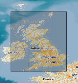
Field maps
Type of resources
Topics
Keywords
Contact for the resource
Provided by
Years
Formats
Representation types
Update frequencies
Scale
-
Manuscript geological maps produced by the Survey geologists or other recognised geologists on County Series (1:10560) and National Grid (1:10560 & 1:10000) Ordnance Survey base maps of Great Britain. A small number are produced at larger scale. Similar maps compiled from other sources. Maps produced since the 1850's, current holdings over 35,000 maps, all now scanned and available internally as image files.
-
The dataset comprises scanned images of maps and aerial photographs of the Falkland Islands. The original maps are printers films and final paper printed originals of Falkland Islands OS maps, compiled for the Falkland Islands Government and the Foreign and Commonwealth Office by the Overseas Directorate of the Ordnance Survey. The Falkland Islands Government retains copyright interest in the maps. There are no access or usage constraints for BGS staff for BGS purposes. The field slips of geological maps were compiled by BGS under contract to the Falkland Islands Government. Copyright remains with the Falkland Islands Government , but there are no access or usage constraints for BGS staff for BGS purposes. Access to both datasets are restricted to BGS staff.
-

The dataset comprises maps and aerial photographs of the Falkland Islands. The maps are printers films and final paper printed originals of Falkland Islands OS maps, compiled for the Falkland Islands Government and the Foreign and Commonwealth Office by the Overseas Directorate of the Ordnance Survey. They were discarded by the Ordnance Survey around 2004, and offered to BGS for storage on behalf of the Falkland Islands Government. The Falkland Islands Government retains copyright interest in the maps. There are no access or usage constraints for BGS staff for BGS purposes. The aerial photographs and associated paper overlays represent copies of field slips of geological maps that were compiled by BGS under contract to the Falkland Islands Government. Copyright remains with the Falkland Islands Government , but there are no access or usage constraints for BGS staff for BGS purposes. Access to both datasets are restricted to BGS staff.
-

This dataset comprises scanned images of the manuscript geological maps produced by the Survey geologists or other recognised geologists on County Series (1:10560) and National Grid (1:10560 and 1:10000) Ordnance Survey base maps. The collection also includes similar maps compiled from other sources. Currently the dataset contains over 35,000 scanned images. Original maps date from the 1860s, and cover surveys in Great Britain, scanning started in 2003.
-

The BGS database of geological maps is an index into BGS holdings of modern and historical published geological maps, geological standards and field slips, and also contains a range of other map series, including geophysical maps, geochemical maps, hydrogeological maps, thematic maps and other small-scale miscellaneous non-series maps. Historical vertical and horizontal sections, as well as indices to colours, are also included. The database comprises map metadata, including the title, theme, survey and revision years, publication years, mapped geological theme, base material, map function, colouration, approval status and the spatial extent of each map sheet. An accompanying file store contains high-resolution JPEG2000 scans for delivery, as well as various digital master and delivery formats. For a small number of maps, no scan exists. In total, the database contains over 240,000 scans of over 130,000 maps and field slips. The majority of the maps in the database cover Great Britain, but other regions are also represented, including a historical series of 1-inch maps of Ireland, 6-inch maps of the Isle of Man, 1:25 000 scale maps of the Channel Islands, and various overseas maps. The database contains a record of all geological maps produced by the British Geological Survey and its predecessors since the commencement of systematic geological mapping in the 1830s. The BGS Maps Database is mostly an archive of previous BGS maps, and is not the same as the latest BGS digital mapping. The maps within the database may differ significantly from BGS digital vector mapping. Further information about BGS digital vector mapping is available on the BGS website, under 'BGS Datasets'. The database has evolved over time, originally being a series of discrete databases. These databases have now been aggregated into a single dataset. BGS published maps, as well as 1:10 560 and 1:10 000 large-scale geological maps of England and Wales, and Scotland, are available through the BGS Maps Portal. Field slips and some thematic maps are not included on the BGS Maps Portal. The information about a map is normally a transcription from the map itself. Sometimes key information such as the title may not be actually printed on the map. Where this is the case the information is supplied in square brackets, e.g. [Kirk Maiden]. Information in square brackets means the information is supplied by the cataloguer and is not transcribed from the item.
-

A spatial database of over 30 000 point localities which have been noted on geological field slips and their associated field note record cards or notebooks during the course of survey activity. The data cover areas surveyed from the early 1980s onwards, and contain a reference to the field slip, the version number of the field slip, the number of the locality point and a spatial location. The index contains only the locations of locality points. The textual descriptions of field localities are held on hard-copy field note record cards, which are held within the National Geoscience Data Centre (NGDC) and are accessible on request to BGS Enquiries. A high-level index of available field note record cards in Scotland is available via the NGDC Deposited Data Search: https://webapps.bgs.ac.uk/services/ngdc/accessions/index.html?simpleText=field%20note%20card#. Data were entered into the database by BGS staff from 1997 onwards. For more information, refer to: Kilpatrick, K., 1999. Users' Guide: Data Entry and Editing for the BGS Field Notebook Database. British Geological Survey technical report WO/99/6R. Kilpatrick, K., 1999. Users' Guide: Data Retrieval for the BGS Field Notebook Database. British Geological Survey technical report WO/99/7R.