 NERC Data Catalogue Service
1997
Type of resources
Topics
Keywords
Contact for the resource
Provided by
Years
Formats
Representation types
Update frequencies
Scale
-

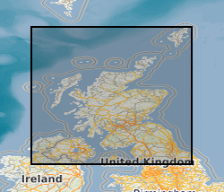
Digitally held Seabed Sediment, Facies, Bathymetry, Solid and Quaternary offshore geology for certain areas in the UK inshore waters. The storage formats of the data are ESRI and MapInfo but other formats can be supplied.
-
This dataset is an index of the Survey Collection of fossils for Scotland and Northern England. It is the digital equivalent of the analogue (card) index. The latter contains some 31k records, c.70% of which has been transcribed. The continually growing Survey Collection comprises about 450k samples (including nearly 30k specimens from the John Smith Collection) which are individually registered in c.150 leather bound volumes. The Oracle relational database BGS_FOSSLOC is a first step in ascertaining what registered fossil materials exist for certain areas, who collected them and when, their geographical and stratigraphical details, the type of collection (whether from boreholes or exposures), and any covering technical reports. It is also a pathway to an extensive and unique collection of paper graphic logs, some 18k of which record annotated information on fossil occurrences and assemblages at certain stratigraphical levels (particularly in the Carboniferous) in Scotland and Northern England.
-
In Autumn 1995, the Goddard Distributed Active Archive Center (GDAAC) compiled the Climatology Interdisciplinary Data Collection (CIDC) to facilitate interdisciplinary studies related to climate and global change. This data collection has been produced in collaboration with the Center for Earth Observing and Space Research (CEOSR), Institute for Computational Sciences and Informatics (CSI), and George Mason University. It was designed for the study of global change, seasonal to interannual climate change, and other phenomena that require from one to dozens of interacting parameters. A few of the possible study areas are the depletion of stratospheric ozone, the weather changes associated with the periodic El Niño Southern Oscillation (ENSO) events, periodic droughts, and global warming. Short background information scenarios are given on the CD for the Monsoon, El Niño, and global warming phenomena. The CD set also contains read software and the Gridded Analysis and Display System (GrADS). Data from the scientific disciplines dealing with meteorology and atmospheric sciences, land surface, ocean, cryosphere, biosphere, the Sun, and remote sensing science have been gathered into one place and, where feasible, presented in a common format (monthly means with a 1° x 1° world grid, or commensurable resolution and IEEE 32-bit floating point numbers). Over 70 physical parameters from some 25 separate datasets are represented. The Data Collection Overview document on the CDs lists alphabetically all the physical parameters along with the dataset(s) in which they can be found. It also contains a separate listing of each dataset, its origin, and the parameters included. Each dataset is also accompanied by a detailed user's guide. The Climatology Interdisciplinary Data Collection (CIDC) has been subdivided into seven categories. The grouping is influenced by the types of physical parameters involved and partially by the way that they are processed. Because of this the same physical parameter may appear in several datasets and in more than one category. When this occurs different algorithms have normally been used to produce the parameter. The included datasets included below. Atmospheric dynamics & atmospheric sounding products Radiation and clouds Biosphere data Measured variable atmospheric constituents Measured surface temperature and pressure Hydrological data Remote sensing science The data on the CD set was collected in a variety of ways, using remote sensing, direct measurements, and model output. The individual datasets were provided in a variety of forms. In some cases this required the data publication team to regrid and reformat datasets and in others to produce monthly averages from finer resolution data. The specific handling for each dataset is detailed in the documentation. The regridded, reformatted, integrated, and peer reviewed datasets are published on this four-volume CD collection. The data are held online at the BADC are public and are made available for browsing purposes. Volume 1: Biosphere, Hydrology, Surface Temperature, Ozone, Greenhouse Gases Volume 2: Atmospheric Dynamics Volume 3: Radiation and Clouds Volume 4: Atmospheric Surroundings
-
Programme of research funded by the Natural Environment Research Council. URGENT aims to stimulate the regeneration of the urban environment through understanding and managing the interaction of natural and man-made processes. Projects throughout the UK first set up in 1997 and completed in 2005. It was supported by partners from British industry, local authorities and Government agencies. A total of 40 URGENT projects in four key areas - air, water, soil and ecology. The projects aim was to determine the magnitude of urban environmental problems and risks, to understand the underlying patterns and processes that affect them, and to produce effective strategies for control and managment which will be accessible to users both in the UK and abroad.
-
The Global Ocean Surface Temperature Atlas Plus (GOSTAplus) contains maps of Sea Surface Temperature (SST) climatologies and anomalies, Night Marine Air temperature climatologies and anomalies and Sea Ice coverage spanning the period 1851-1995. Dataset includes gridded, global SSTs from 1951-1990 and Sea Ice coverage from 1903 to 1994. The data are provided by the Met Office. Updated version of some data also available on request.
-
This dataset comprises 87 hydrographic data profiles, collected by a conductivity-temperature-depth (CTD) sensor package, in July 1996 from stations along the Hebridean Shelf and shelf edge west of Scotland, centred around 56 30 N, 9W in the North East Atlantic. A complete list of all data parameters are described by the SeaDataNet Parameter Discovery Vocabulary (PDV) keywords assigned in this metadata record. The data were collected by the University of Wales, Bangor School of Ocean Sciences as part of the Land Ocean Interaction Study (LOIS) Shelf Edge Study (SES).
-
The dataset comprises 143 hydrographic data profiles, collected by a conductivity-temperature-depth (CTD) sensor package, during August - September 1997. The cruise worked the World Ocean Circulation Experiment (WOCE) one time section A25 with stations in the North Atlantic - from Portugal to Greenland and the Ellet Line. A complete list of all data parameters are described by the SeaDataNet Parameter Discovery Vocabulary (PDV) keywords assigned in this metadata record. The data were collected by the Southampton Oceanography Centre as part of the World Ocean Circulation Experiment (WOCE).
-
This dataset comprises 39 hydrographic data profiles, collected by a conductivity-temperature-depth (CTD) sensor package, during December 1997 - January 1998 from stations on the continental shelf and slope off NW Portugal and Spain. A complete list of all data parameters are described by the SeaDataNet Parameter Discovery Vocabulary (PDV) keywords assigned in this metadata record. The data were collected by the Proudman Oceanographic Laboratory as part of the Ocean Margin Exchange (OMEX) II project.
-
This dataset comprises hydrographic data profiles, collected by a conductivity-temperature-depth (CTD) sensor package, during January - February 1997. It incorporates a CTD survey in the Moray Firth. The data were collected by the Scottish Office Agriculture Environment and Fisheries Department Aberdeen Marine Laboratory to complement a pelagic fish survey to detemine biomass and distribution. The latter included surveys of clupeids and sandeels, top predators, and plankton and these data are not held a the British Oceanographic Data Centre.
-
This dataset comprises hydrographic data profiles, collected by a conductivity-temperature-depth (CTD) sensor package, during April 1997. It incorporates a CTD survey of the Minches between the Scottish mainland and the Outer Hebrides. The data were collected by the Fisheries Research Services Aberdeen Marine Laboratory as part of large-scale hydrographic, chemical, biological and sediments survey.