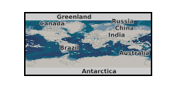
raster
Type of resources
Available actions
Topics
Keywords
Contact for the resource
Provided by
Years
Formats
Update frequencies
-

The raster provide the output of a machine-learning random forest algorithm modelling the occurrence of ferromanganese (Fe-Mn) crust deposits in the world ocean. This raster constitutes a data-driven approach for mineral prospectivity mapping of Fe-Mn crusts that should be used in conjunction with other expert-driven prospectivity analysis to guide the assessment of Fe-Mn crust coverage in the world ocean and potential mineral exploration. The raster contains values between 0.07 and 0.92. Any values outside of that range (e.g., 0) are outside of the model prediction and should not be displayed. To reproduce data as displayed in the forthcoming associated publication, it is recommended to apply a 'Percent Clip' stretched 'Viridis' colour scheme.
 NERC Data Catalogue Service