 NERC Data Catalogue Service
ACCESS REPORT - Access report.
Type of resources
Topics
Keywords
Contact for the resource
Provided by
Years
Formats
Representation types
Update frequencies
Scale
-
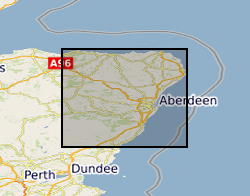
The database contains basic tabulated field data resulting from the work of the BGS East Grampians Project in the early 1980s to mid 1990s. Records include the locations of stations at which field observations were made, structural measurements and sample locations. To this end, the database provides an index to locations and structural data. However, it needs to be stated clearly that labels given to structural elements are largely subjective beyond the identification of bedding. This means that the structural data are largely unusable without a clear understanding of their context and with regard to the primary paper record on which descriptions of the observed structures are recorded. The data are held in MS ACCESS tables which are related via the Station number as the primary key. The coverage is mainly confined to the North East Grampian Highlands of Scotland. The database is currently unused and has not been added to since the end of the East Grampians Project. The station location and structural data are effectively complete. However, fields in the sample database, such as the sample stratigraphy, are largely incomplete because, at the time the data were acquired, the stratigraphy at each station was formally undefined. The most effective way of presenting and investigating the data is via GIS.