 NERC Data Catalogue Service
Waste disposal
Type of resources
Available actions
Topics
Keywords
Contact for the resource
Provided by
Years
Formats
Representation types
Update frequencies
Scale
-

PADAMOT (Palaeohydrogeological Data Analysis and Model Testing) is a database being built and populated as part of the PADAMOT project which is part of the 5th Framework R&D Programme of the European Union. The research being carried out is contributing to our understanding of the long-term safety of placing radioactive wastes in underground repositories. It is funded by the European Commission, Nirex (UK), SKB (Sweden), ENRESA (Spain) RAWRA (Czech Republic) and BGS (UK). The project is coordinated by Nirex (UK) and the research is being carried out by Terralogica (Sweden), CIEMAT, Spain, Universidad Politecnica de Madrid (Spain), Universidad de la Coruna (Spain), Charles University, Prague (Czech Republic), University of Edinburgh (UK), Intellisci (UK) and British Geological Survey (UK). Safety considerations for storing radioactive wastes must take into account the various scenarios for environmental change over the long period of time during which they will pose a hazard. One of the factors potentially affecting safety is therefore changing climate. Putting high level radioactive wastes and spent nuclear fuel deep underground in a 'geological repository' is the generally preferred option for their long-term management. A major reason for preferring this option is that the impacts of changing climate and the consequent increased uncertainty about long-term safety are removed or at least reduced by putting the waste deep underground.
-
Data deposited are connected to paper "Investigating the use of 3-D full-waveform inversion to characterize the host rock at a geological disposal site" by H.L.M. Bentham, J.V. Morgan and D.A. Angus, in Geophysical Journal International, https://doi.org/10.1093/gji/ggy386. The geological model consists of fractured granite host rock (depth: 800 - 1200 m) with an Excavated disturbed Zone (EdZ) that could be formed through constructing the tunnels. In addition to the host rock, the model contains sedimentary overburden (depth: 0 - 800 m) and a fractured granite bed rock (depth: 1200 - 2000 m). Seismic velocities and rock properties were assigned through analogues e.g. Olkiluoto, Finland. Full data description and method found in Bentham et al. (2018). Data deposited are for Case 1 (no tunnels) and Case 3 (with multiple tunnels). For each case, the following 3D volumes are available: * Seismic data * True velocity model (used to generate seismic data) * Starting velocity model for full-waveform inversion Additionally, the following ASCII files are available to aid the use of the seismic and velocity models: * Locations of sources at surface (Case 1, 2 and 3 except where survey area is reduced [see GJI article]) * Locations of receivers at surface and below tunnels (Case 1, 2 and 3) * Locations of receiver at surface and above and below tunnels (Case 3 only)
-

Surface and borehole information for a nuclear waste site investigation programme at Altnabreac, Northern Scotland. Dataset includes geological mapping, surface geophysics, borehole information, borehole geophysics and spring survey geochemistry.
-

Records of some 3500 waste sites in England and Wales identified by BGS as part of a survey carried out on behalf of the Department of the Environment in 1973. Information is included on the extent of the site, geology, wastes and risks to aquifers It should be noted that the assessments were carried out when the data was collected and may not reflect current interpretation. There are not records for all of the sites listed.
-
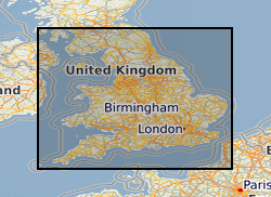
Oracle index to records of some 3500 waste sites in England and Wales identified by BGS as part of a survey carried out on behalf of the Departement of the Environment in 1973. The index has been corrected and updated to a limited extent, but the data itself has not been changed. The data was collected in 1972 and the information reflects the knowledge at that time. It does not reflect current interpretation. Not all authorities made returns and there are not records for all of the sites listed. However, the data is an invaluable source of information about pre-1974 sites. Information includes site name, location and risks to aquifers. It should be noted that the assessments were carried out when the data was collected and may not reflect current interpretation.