 NERC Data Catalogue Service
Stream sediment sampling
Type of resources
Available actions
Topics
Keywords
Contact for the resource
Provided by
Years
Formats
Representation types
Update frequencies
Service types
Scale
-

The map shows the location of excess sample materials from the G-BASE (Geochemical Baseline Survey Of The Environment) geochemistry project:- stream sediments, panned heavy mineral concentrates and soils are stored long term in the National Geoscience Data Centre and are available for use in other projects. The Minerals Programme (incorporating the Mineral Reconnaissance Programme) sample collection contains reference samples of drill cores, rocks, tills, soils, stream sediments and panned concentrates. These samples were collected in the period 1974 - to date in mineralised and potentially mineralised areas of the United Kingdom, principally in the northern and western Britain.
-

Tellus Sediments Stream sediments The G-Base samples (1994-1996) were analysed by XRF for Ag, As, Ba, Bi, CaO, Cd, Ce, Co, Cr, Cs, Cu, Fe, Ga, K2O, La, MnO, Mo, Nb, Ni, P2O5, Pb, Rb, Sb, Se, Sn, Sr, Th, TiO2, U, V, W, Y, Zn, Zr. Au, Pt and Pd were analysed by 10g Fire Assay. B was also analysed. The Tellus samples (2005-2006) were analysed by XRF for Al2O3, Ag, As, Ba, Bi, Br, CaO, Cd, Ce, Cl, Co, Cr, Cs, Cu, Fe2O3, Ga, Ge, Hf, I, In, K2O, La, MgO, MnO, Mo, Na2O, Nb, Nd, Ni, P2O5, Pb, Rb, S, Sb, Sc, Se, SiO2, Sm, Sn, SO3, Sr, Ta, Te, Th, TiO2, Tl, U, V, W, Y, Yb, Zn, Zr. Au, Pt and Pd were analysed by 10g Fire Assay. B was also analysed. The surveys followed the British Geological Survey's Geochemical Baseline Survey of the Environment (G-BASE) standard developed over many years that defines the specifications for mapping the regional geochemistry of the United Kingdom. For further information visit the Tellus webpages: http://www.bgs.ac.uk/gsni/tellus/
-

Tellus Survey 2005-2006 The Tellus geochemical survey began in the summer of 2004 and was completed in 2006. This was a multi-media survey of soil, stream-sediment and stream-water samples in rural and urban areas. The results will establish the natural geochemical baseline signature and any man-made overprint. Tellus Soils For rural soils, samples were collected at an interval of approximately one site per 2 km2 (about one site every 500 acres). Samples were collected from two depths (20 cm and 50 cm) at each site to provide an insight into vertical geochemical variations. The samples were analysed by XRF for Ag, Al2O3, As, Ba, Bi, Br, CaO, Cd, Ce, Cl, Co, Cr, Cs, Cu, Fe2O3, Ga, Ge, Hf, I, In, K2O, La, MgO, MnO, Mo, Na2O, Nb, Nd, Ni, P2O5, Pb, Rb, SO3, Sb, Sc, Se, SiO2, Sm, Sn, Sr, Ta, Te, Th, Tl, TiO2, U, V, W, Y, Yb, Zn, Zr. Au, Pt and Pd were analysed by 10g Fire Assay SO4 by Aqua Regia ICP-MS pH and Loss on Ignition were also recorded. Tellus Drainage The drainage dataset contains stream waters and stream sediment analysis and are a combination of two surveys. The first, the G-Base survey, was carried out between 1994 and 1996 in the west of Northern Ireland. In 2005 and 2006 a second survey was carried out as part of the Tellus project in the areas not covered by the original survey. Stream waters The G-Base samples (1994-1996) were analysed for the following anions and fluid parameters: Bicarbonate, Chloride, Fluoride, Nitrate, Sulphate, Dissolved Organic Carbon, Conductivity, pH. Samples were analysed for the tracer elements Ag, Al, Al, As, B, Ba, Be, Ca, Cd, Ce, Co, Cr, Cu, Fe, K, La, Li, Mg, Mn, Mo, Na, Ni, P, Pb, Rb, Sb, Se, Si, Sr, Tl, U V, Y, Zn, Zn, Zr. The Tellus samples (2005-2006) were analysed for the following anions and fluid parameters: Bicarbonate, Bromide, Chloride, Fluoride, Nitrate, Nitrite, Orthophosphate, Sulphate, Dissolved Organic Carbon, Alkalinity, Conductivity, pH. Samples were analysed for the trace elements Ag, Al, As, Au, B, Ba, Be, Bi, Ca, Cd, Co, Cr, Cs, Cu, Fe, Hg, Ho, K, La, Li, Mg, Mo, Mn, Na, Ni, P, Pb, Pd, Pt, Rb, Rh, Sb, Se, Si, Sn, Sr, Th, Tl, U, V, Y, Zn, Zr. Stream sediments The G-Base samples (1994-1996) were analysed by XRF for Ag, As, Ba, Bi, CaO, Cd, Ce, Co, Cr, Cs, Cu, Fe, Ga, K2O, La, MnO, Mo, Nb, Ni, P2O5, Pb, Rb, Sb, Se, Sn, Sr, Th, TiO2, U, V, W, Y, Zn, Zr. Au, Pt and Pd were analysed by 10g Fire Assay. B was also analysed. The Tellus samples (2005-2006) were analysed by XRF for Al2O3, Ag, As, Ba, Bi, Br, CaO, Cd, Ce, Cl, Co, Cr, Cs, Cu, Fe2O3, Ga, Ge, Hf, I, In, K2O, La, MgO, MnO, Mo, Na2O, Nb, Nd, Ni, P2O5, Pb, Rb, S, Sb, Sc, Se, SiO2, Sm, Sn, SO3, Sr, Ta, Te, Th, TiO2, Tl, U, V, W, Y, Yb, Zn, Zr. Au, Pt and Pd were analysed by 10g Fire Assay. B was also analysed. The surveys followed the British Geological Survey's Geochemical Baseline Survey of the Environment (G-BASE) standard developed over many years that defines the specifications for mapping the regional geochemistry of the United Kingdom. For further information visit the Tellus webpages: http://www.bgs.ac.uk/gsni/tellus/
-
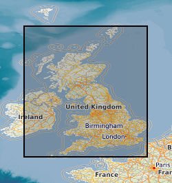
The BGS Geochemical Baseline Survey of the Environment (G-BASE) was the national strategic geochemical mapping programme in Great Britain. The project set out to establish the chemistry of the surface environment by the collection and analysis of stream sediment, stream water and soil samples. Beginning in the late 1960s in northern Scotland and moving southwards across the country, the primary focus was mineral exploration, however, the project quickly developed to address important environmental concerns. The final G-BASE samples were collected in southern England in 2014. The outputs from the G-BASE project provide an invaluable, systematic baseline of geochemical information for Great Britain, serving as a marker of the state of the environment against which to measure future change. At G-BASE drainage sampling sites (average density: one site per 1.5 km square), sediment was collected from the centre of the stream and sieved through two sieves (2 mm and 150 microns). The fine-grained fraction formed the stream sediment sample and underwent chemical analysis. Excess material from the <2 mm fraction was panned using a wooden dulang pan to collect a heavy mineral concentrate. During the G-BASE project, these samples were archived, but not routinely submitted for chemical analysis. For more information about accessing these samples and their analytical results, contact BGS Enquiries (enquries@bgs.ac.uk).
-

The BGS Geochemical Baseline Survey of the Environment (G-BASE) was the national strategic geochemical mapping programme in Great Britain. The project set out to establish the chemistry of the surface environment by the collection and analysis of stream sediment, stream water and soil samples. Beginning in the late 1960s in northern Scotland and moving southwards across the country, the primary focus was mineral exploration, however, the project quickly developed to address important environmental concerns. The final G-BASE samples were collected in southern England in 2014. The outputs from the G-BASE project provide an invaluable, systematic baseline of geochemical information for Great Britain, serving as a marker of the state of the environment against which to measure future change. Stream sediments were the primary sample medium for G-BASE, with an average density of one site per 1.5 km square. The drainage sampling sites cover most of Great Britain. Sediment was collected from the centre of the stream and sieved through two sieves (2 mm and 150 µm) to obtain a fine grain-size fraction of <150 microns. Analytical data (by a variety of analytical methods, including XRF and direct-reading optical emission spectrometry (DR-OES) for the <150 micron fraction of stream sediment samples are available for some or all of the following elements: Ag, As, Ba, Bi, Br, Ca, Cd, Ce, Co, Cr, Cs, Cu, Fe, Ga, Ge, Hf, I, K, La, Mg, Mn, Mo, Nb, Ni, P, Pb, Rb, Sb, Sc, Se, Se, Sn, Sr, Ta, Te, Th, Ti, Tl, U, V, W, Y, Zn and Zr. Some stream sediment samples were originally collected as part of the Mineral Reconnaissance Programme (MRP), and later re-analysed for G-BASE. These samples may have been assigned a new sample number, but will plot at the same site. For more information about accessing these samples and their analytical results, contact BGS Enquiries (enquries@bgs.ac.uk).
-

This Web service provides layers which show metadata relating to geochemical samples held by the British Geological Survey (BGS). The layers are point layers which indicate the spatial locations samples were taken from. Geochemical samples have been collected, analysed and stored in the BGS Geochemistry Database from different projects. The two most significant contributors to the database are the Geochemical Baseline Survey of the Environment (G-BASE) project and the Mineral Reconnaissance Programme (MRP). Each project took a variety of different sample types, including stream water, stream sediment, shallow soil and deep soil, and one layer is provided for each type of sample. The sample metadata provided include: sample name; sample type; the Regional Geochemical Atlas area (for G-BASE samples only) and a comma-separated list of available analytes. In many cases, samples are retained in the National Geoscience Data Centre (NGDC) at BGS Keyworth. For more information about obtaining samples or the results of their geochemical analyses, contact BGS Enquiries (enquiries@bgs.ac.uk).