 NERC Data Catalogue Service
Clay minerals
Type of resources
Topics
Keywords
Contact for the resource
Provided by
Years
Formats
Representation types
Update frequencies
status
Scale
-
This addition to the GeoSure ground stability data consists of a single data layer in Geographical Information System (GIS) format that identifies areas of potential shrink-swell hazard at subcrop level (up to 10 metres depth) in Great Britain. It is essentially a national hazard susceptibility map. This data has been produced by geologists, geotechnical specialists and information developers at the British Geological Survey and is presented as a GIS data layer. Swelling clays can change volume due to variation in moisture, this can cause ground movement, particularly in the upper two metres of the ground that may affect many foundations. Ground moisture variations may be related to a number of factors, including weather variations, vegetation effects (particularly growth or removal of trees) and the activities of people. Such changes can affect building foundations, pipes or services.
-

The database contains spectra of rock and soil that have predominantly been captured using a Portable Infrared Mineral Analyser although other instruments may also have been used.
-

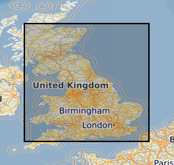
This dataset provides an assessment of the potential for a geological deposit to shrink and swell. Many soils contain clay minerals that absorb water when wet (making them swell), and lose water as they dry (making them shrink). This shrink-swell behaviour is controlled by the type and amount of clay in the soil, and by seasonal changes in the soil moisture content (related to rainfall and local drainage). The rock formations most susceptible to shrink-swell behaviour are found mainly in the south-east of Britain. Clay rocks elsewhere in the country are older and have been hardened by burial deep in the earth and are less able to absorb water. The BGS has carried out detailed geotechnical and mineralogical investigations into rock types known to shrink, and are modelling their properties across the near surface. This research underpins guidance contained in the national GeoSure dataset, and is the basis for our responses to local authorities, companies and members of the public who require specific information on the hazard in their areas. The BGS is undertaking a wide-ranging research programme to investigate this phenomenon by identifying those areas most at risk and developing sustainable management solutions. Complete Great Britain national coverage is available. The storage formats of the data are ESRI Shapefiles and MapInfo but other formats can be supplied. The GeoSure data sets and reports from the British Geological Survey provide information about potential ground movement or subsidence in a helpful and user-friendly format. The reports can help inform planning decisions and indicate causes of subsidence. The methodology is based on BGS DiGMap (Digital Map) and expert knowledge of the behaviour of the formations so defined.
-
This data set presents contents of the clay minerals smectite, illite, chlorite and kaolinite analysed on the clay fraction (<2 micrometer) of seafloor surface sediments. The sediments were recovered with a mega-corer (MC), box corer (BC), kasten corer (KC) or jumbo gravity corer (JGC) on the Amundsen Sea continental shelf in the vicinity of Thwaites Glacier and Pine Island Glacier. Sediment cores were collected during cruises NBP1902 (Jan-Mar 2019) and NBP2002 (Jan-Mar 2020) with RV/IB Nathaniel B. Palmer as part of the Thwaites Offshore Research (THOR) project on behalf of the International Thwaites Glacier Collaboration (ITGC) programme. The clay mineral contents are given in percentages and subbottom depth in centimetres (cm). NERC grant NE/S006664/1 and NSFPLR grant no. 1738942. This data was collected as part of the NERC-NSF funded International Thwaites Glacier Collaboration (ITGC) program.
-
This data set presents contents of the clay minerals smectite, illite, chlorite and kaolinite analysed on the clay fraction (less than 2 micrometers) of Pleistocene-Holocene drift sediments recovered at Hole U1532C on the Amundsen Sea continental rise during IODP Exp379 with RV JOIDES Resolution in Jan-Mar 2019. The clay mineral contents are given in percentages (%) both versus expedition number, site number, hole ID, core number, drill core type (H: advanced piston corer system, X: extended core barrel system; R: rotary core barrel system), section number (sect), section half (W: work; A: archive) and depth of the top and bottom of the sample within a section or core catcher (CC) in centimetres (cm) and versus depth below seafloor (CSF-A) in metres (m). The d-values (in Angstrom) and integral breadths (IB, delta 2theta) of the clay minerals smectite and illite as well as the ratios between the areas of the 5 Angstrom and 10 Angstrom peaks of illite are also given. The clay mineral data were generated and analysed by Dr Claus-Dieter Hillenbrand (British Antarctic Survey, Cambridge, United Kingdom) and Prof Werner Ehrmann (Institute of Geophysics and Geology, University of Leipzig, Germany). Users of this dataset should cite the dataset DOI and acknowledge both the data generators (C.-D. Hillenbrand and W. Ehrmann) and the International Ocean Discovery Program (IODP). The work was funded by NERC UK-IODP Moratorium Award NE/T010975/1.
-
This data set presents contents of the clay minerals smectite, illite, chlorite and kaolinite analysed on the clay fraction (less than 2 micrometers) of Pleistocene-Holocene drift sediments recovered at Hole U1533D on the Amundsen Sea continental rise during IODP Exp379 with RV JOIDES Resolution in Jan-Mar 2019. The clay mineral contents are given in percentages (%) both versus expedition number, site number, hole ID, core number, drill core type (H: advanced piston corer system, X: extended core barrel system; R: rotary core barrel system), section number (sect), section half (W: work; A: archive) and depth of the top and bottom of the sample within a section or core catcher (CC) in centimetres (cm) and versus depth below seafloor (CSF-A) in metres (m). The d-values (in Angstrom) and integral breadths (IB, delta 2theta) of the clay minerals smectite and illite as well as the ratios between the areas of the 5 Angstrom and 10 Angstrom peaks of illite are also given. The clay mineral data were generated and analysed by Dr Claus-Dieter Hillenbrand (British Antarctic Survey, Cambridge, United Kingdom) and Prof Werner Ehrmann (Institute of Geophysics and Geology, University of Leipzig, Germany). Users of this dataset should cite the dataset DOI and acknowledge both the data generators (C.-D. Hillenbrand and W. Ehrmann) and the International Ocean Discovery Program (IODP). The work was funded by NERC UK-IODP Moratorium Award NE/T010975/1.
-
This data set presents contents of the clay minerals smectite, illite, chlorite and kaolinite analysed on the clay fraction (less than 2 micrometers) of Pleistocene-Holocene drift sediments recovered at Hole U1532B on the Amundsen Sea continental rise during IODP Exp379 with RV JOIDES Resolution in Jan-Mar 2019. The clay mineral contents are given in percentages (%) both versus expedition number, site number, hole ID, core number, drill core type (H: advanced piston corer system, X: extended core barrel system; R: rotary core barrel system), section number (sect), section half (W: work; A: archive) and depth of the top and bottom of the sample within a section or core catcher (CC) in centimetres (cm) and versus depth below seafloor (CSF-A) in metres (m). The d-values (in Angstrom) and integral breadths (IB, delta 2theta) of the clay minerals smectite and illite as well as the ratios between the areas of the 5 Angstrom and 10 Angstrom peaks of illite are also given. The clay mineral data were generated and analysed by Dr Claus-Dieter Hillenbrand (British Antarctic Survey, Cambridge, United Kingdom) and Prof Werner Ehrmann (Institute of Geophysics and Geology, University of Leipzig, Germany). Users of this dataset should cite the dataset DOI and acknowledge both the data generators (C.-D. Hillenbrand and W. Ehrmann) and the International Ocean Discovery Program (IODP). The work was funded by NERC UK-IODP Moratorium Award NE/T010975/1.
-
This data set presents contents of the clay minerals smectite, illite, chlorite and kaolinite analysed on the clay fraction (less than 2 micrometers) of Pleistocene-Holocene drift sediments recovered at Hole U1533B on the Amundsen Sea continental rise during IODP Exp379 with RV JOIDES Resolution in Jan-Mar 2019. The clay mineral contents are given in percentages (%) both versus expedition number, site number, hole ID, core number, drill core type (H: advanced piston corer system, X: extended core barrel system; R: rotary core barrel system), section number (sect), section half (W: work; A: archive) and depth of the top and bottom of the sample within a section or core catcher (CC) in centimetres (cm) and versus depth below seafloor (CSF-A) in metres (m). The d-values (in Angstrom) and integral breadths (IB, delta 2theta) of the clay minerals smectite and illite as well as the ratios between the areas of the 5 Angstrom and 10 Angstrom peaks of illite are also given. The clay mineral data were generated and analysed by Dr Claus-Dieter Hillenbrand (British Antarctic Survey, Cambridge, United Kingdom) and Prof Werner Ehrmann (Institute of Geophysics and Geology, University of Leipzig, Germany). Users of this dataset should cite the dataset DOI and acknowledge both the data generators (C.-D. Hillenbrand and W. Ehrmann) and the International Ocean Discovery Program (IODP). The work was funded by NERC UK-IODP Moratorium Award NE/T010975/1.
-
This data set presents contents of the clay minerals smectite, illite, chlorite and kaolinite analysed on the clay fraction (less than 2 micrometers) of Pleistocene-Holocene drift sediments recovered at Hole U1533A on the Amundsen Sea continental rise during IODP Exp379 with RV JOIDES Resolution in Jan-Mar 2019. The clay mineral contents are given in percentages (%) both versus expedition number, site number, hole ID, core number, drill core type (H: advanced piston corer system, X: extended core barrel system; R: rotary core barrel system), section number (sect), section half (W: work; A: archive) and depth of the top and bottom of the sample within a section or core catcher (CC) in centimetres (cm) and versus depth below seafloor (CSF-A) in metres (m). The d-values (in Angstrom) and integral breadths (IB, delta 2theta) of the clay minerals smectite and illite as well as the ratios between the areas of the 5 Angstrom and 10 Angstrom peaks of illite are also given. The clay mineral data were generated and analysed by Dr Claus-Dieter Hillenbrand (British Antarctic Survey, Cambridge, United Kingdom) and Prof Werner Ehrmann (Institute of Geophysics and Geology, University of Leipzig, Germany). Users of this dataset should cite the dataset DOI and acknowledge both the data generators (C.-D. Hillenbrand and W. Ehrmann) and the International Ocean Discovery Program (IODP). The work was funded by NERC UK-IODP Moratorium Award NE/T010975/1.
-
This data set presents contents of the clay minerals smectite, illite, chlorite and kaolinite analysed on the clay fraction (less than 2 micrometers) of Pleistocene-Holocene drift sediments recovered at Hole U1532A on the Amundsen Sea continental rise during IODP Exp379 with RV JOIDES Resolution in Jan-Mar 2019. The clay mineral contents are given in percentages (%) both versus expedition number, site number, hole ID, core number, drill core type (H: advanced piston corer system, X: extended core barrel system; R: rotary core barrel system), section number (sect), section half (W: work; A: archive) and depth of the top and bottom of the sample within a section or core catcher (CC) in centimetres (cm) and versus depth below seafloor (CSF-A) in metres (m). The d-values (in Angstrom) and integral breadths (IB, delta 2theta) of the clay minerals smectite and illite as well as the ratios between the areas of the 5 Angstrom and 10 Angstrom peaks of illite are also given. The clay mineral data were generated and analysed by Dr Claus-Dieter Hillenbrand (British Antarctic Survey, Cambridge, United Kingdom) and Prof Werner Ehrmann (Institute of Geophysics and Geology, University of Leipzig, Germany). Users of this dataset should cite the dataset DOI and acknowledge both the data generators (C.-D. Hillenbrand and W. Ehrmann) and the International Ocean Discovery Program (IODP). The work was funded by NERC UK-IODP Moratorium Award NE/T010975/1.