 NERC Data Catalogue Service
Aerial surveys
Type of resources
Available actions
Topics
Keywords
Contact for the resource
Provided by
Years
Formats
Representation types
Update frequencies
Scale
Resolution
-
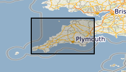
Airborne geophysical data acquired as part of the BGS-NERC TellusSW project (http://www.tellusgb.ac.uk/) during the second half of 2013. The survey comprised a high resolution magnetic/magnetic gradient survey combined with a multichannel (256 channel) radiometric survey. The survey was carried out using 200m (N-S) line separations at a mean elevation of 91m. Encompassing the counties of Cornwall and parts of Devon and Somerset, the survey provided 60,323 line-km of data. Digital data and derived (e.g. spatial derivatives) maps of the geophysical information are provided to facilitate spatial modelling of the soil, geological and environmental aspects of the data.
-

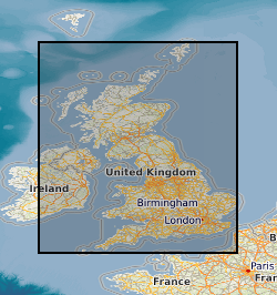
The HiRES-1 project acquired airborne geophysical data during 1998. Coverage included the Central Midlands of England and into the associated Welsh Borderland. Survey flying for the collaborative BGS and World Geoscience Corporation Ltd (WGC) high resolution geophysical and environmental survey was completed in early September 1998. The data comprise multi-channel gamma ray spectrometer, magnetometer and dual frequency VLF-EM. Flight line spacing was 400 m with tie lines at 1200 m and the total area surveyed is some 14 000 km2. Flight-line orientations are W–E over the western survey area, SW–NE over the eastern area. Ground clearance was maintained at 90 m in rural areas, increasing to about 240 m in built-up zones. The project and data descriptions are provided in an internal BGS report: R J Peart, R J Cuss, D Beamish and D G Jones, 2003. The High Resolution Airborne Resource and Environmental Survey- Phase 1 (HiRES-1): background, data processing and dissemination and future prospects. British Geological Survey Internal Report, IR/03/112. 28pp.
-
BGS has carried out geophysical surveys in many countries for different agencies. The surveys range from regional gravity and airborne magnetic mapping to targetted surveys for mineral and water. Individual surveys do not yet have metadata entries: this entry describes a notional database that represents all overseas geophysical surveys.
-
The surveys shown on the map based index (GeoIndex) include; Analogue airborne magnetic surveys of Great Britain for the Geological Survey (GSGB), commercial analogue survey of North Sea by Aeroservices Inc, subsequently digitised by BGS, commercial digital (+ one analogue) surveys off NW/N/NE of Britain by Huntings Geology and Geophysics, purchased outright by BGS and Local surveys, digital and analogue aeromagnetic (+ other methods) surveys for BGS and commercial companies.
-
The high-resolution airborne surveys shown on the map based index (GeoIndex) are classed as those flown with low terrain clearance (typically below 200m) and flight line spacing of less than 300m. The surveys were flown with various combinations of magnetic, radiometric and EM techniques, and include; Surveys flown for the DTI mineral reconnaissance programme, Commercial surveys flown for mineral exploration and subsequently donated to the BGS and Surveys flown for the BGS for research and other purposes.