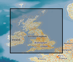
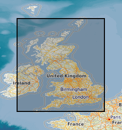
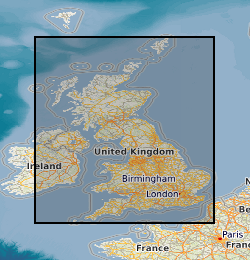
 NERC Data Catalogue Service
Geophysics
Type of resources
Available actions
Topics
Keywords
Contact for the resource
Provided by
Years
Formats
Representation types
Update frequencies
Service types
Scale
Resolution
-

This dataset includes numerical simulation data of bottom heated convection in a rotating spherical shell. These numerical models are used to investigate the dynamics of convection in planetary cores. The simulations are performed over a range of thermal forcing and rotation rate [1-3] to study the various dynamical regimes of rotating convection. The dataset includes the simulation states to reproduce the simulations, time-series output of relevant variables from the simulations apart from post-processed diagnostic quantities. Due to large volume of the simulation state files only the initial, final and time averaged files are stored in the dataset in NETCDF format. The simulation diagnostics are provided in text, which includes time series, spatial and temporal averages of various diagnostic quantities (e.g. kinetic energy of convection) and forces to assess the underlying dynamics and heat transfer behaviour. The simulations have been performed using the Leeds Spherical Dynamo code [4], using ARC2, ARC3 and ARC4 HPC system in University of Leeds and the ARCHER and ARCHER2 HPC system. Refs: [1] https://doi.org/10.1017/jfm.2017.539 [2] https://doi.org/10.1017/jfm.2020.67 [3] https://doi.org/10.48550/arXiv.2410.03369 [4] https://github.com/Leeds-Spherical-Dynamo/leeds-spherical-dynamo
-

A list of the laboratory reports produced from testing in the engineering geology laboratory. It includes report number, title and author's name(s). The reports themselves contain data on a wide range of geotechnical and geophysical laboratory tests, from standard and index tests to complex research. Test materials are highly varied, soils and rock, from the UK or overseas.
-
This digital data set contains original files of seismic reflection survey sections. Most data are within the UK Onshore area; although there are some UK near-shore and offshore (North Sea, Irish Sea) and foreign data. Most data were acquired for commercial hydrocarbon exploration and subsequently provided to BGS for use on specific projects. Some data were acquired by BGS and other public-sector bodies, e.g. BIRPS (British Institutions Reflection Profiling Syndicate), for academic research. These data are used for workstation-based interpretation. Some are kept as archive copies. There are approximately 50 tapes and 15 Exabyte cartridges. The data are mostly concentrated in areas prospective for coal, oil and gas.
-
A collection of reference drawings relating to investigations carried out by Nirex, during the period from 1989 to 1997. The drawings summarise the status of the geological investigation at Sellafield and include borehole locations, geology (surface, structure, sections etc) and geophysics (seismic, airborne, etc). Sites near Sellafield, in Cumbria, and Dounreay, in Caithness. The Nirex (Nuclear Industry Radioactive Waste Executive) geological archive was transferred to the British Geological Survey during 2000/2001. The BGS has undertaken to retain the records for a minimum of 50 years as part of its national geological archive. The ownership of Nirex was transferred from the nuclear industry to the UK Government departments DEFRA and DTI in April 2005, and then to the UK's Nuclear Decommissioning Authority (NDA) in November 2006.
-
The UK Onshore Geophysical Library was established in 1994 in conjunction with the Department of Trade and Industry (DTI) and the UK Onshore Operators Group (UKOOG). The Library manages the archive and official release of seismic data recorded over landward areas of the UK. By agreement with the DTI and HMSO, the Library operates as a registered charity, funded by revenues raised from data sales and donations, with the long term objective of bringing all available UK onshore digital seismic data into secure archival storage, whilst providing efficient access to all interested parties. BGS has access to the data at cost of copying only for science budget work. Data index on the BGS Geoscience Data Index.
-
The Geophysical Properties dataset consists of density, velocity, magnetic susceptibility and thermal conductivity values, with related source, location and geology data. The data have been collected on a project basis, therefore the quality and completeness of the database coding is variable. The data is currently from the UK and Ireland although this may be extended. The data consists of samples with related data values - (1,000s), Density Values - Laboratory Measurements - (1,000s); Velocity Values - Laboratory Measurements - (1,000's), Magnetic Susceptibility Values - Laboratory Measurements - (1,000s); Magnetic Susceptibility Values - Field Measurements - (10,000s measurements on 1,000s samples). Borehole information for data obtained as Downhole profiles with related data values; British Rock Densities Project - Insitu density values obtained from the analysis of formation density logs - (10s boreholes with 100s values). Downhole Magnetic Susceptibility - Obtained for a confidential project with some offshore - (10s boreholes with 10,000s samples) . Thermal Conductivity - (100s boreholes with 1,000s samples), Mean Data Values derived from a data source such as published literature for a site or rock formation; Density - (100s), Magnetic Susceptibility - (100s). Information about the source from which data is obtained, Engineering Geology Laboratory Reports - (100s), Literature which may be published or unpublished - (100s). The database is not maintained and no new data has been added since 2004.
-

Three datasets, ground-penetrating radar, side-scan sonar and sub-bottom profile data (CHIRP), were collected in April and June 2022 from the proximal Skeiðarársandur area (~63.9 N, 17.2 E) and Skeiðarársandur coastline (63.7 N, 17.5 E) that lie at the mouth of Gígjukvísl. Ground-penetrating radar (GPR) data acquired for this project on 15th and 18th April 2022 provide new insights into the sediment architecture of differing depositional environments at Skeiðarársandur, southeast Iceland, including: (i) a recently emplaced jökulhlaup deposit in a large ice-proximal depression, and (ii) the coastal environment of a vast glaciofluvial braidplain. Radar data collected in the ice-proximal depression utilised a 250 MHz Utsi GroundVue (GV) 3, a shielded single-channel bistatic radar system suited to near surface (0-10 m depth). Approximately 30 km of 250 MHz GPR data were collected parallel and perpendicular to the jökulhlaup flow direction. The GPR data from the coastal regions of Skeiðarársandur were collected using a 100 MHz Utsi GV7. The 100 MHz Utsi GV7 is a ruggedised and unshielded radar system with a centre-frequency of 100 MHz and an emitted bandwidth of ~1-160 MHz. The radar system has a maximum time-window of 800 ns and each stacked radar trace is comprised of 256 samples (i.e. one sample every 3.125 ns). Approximately 12 km of 100 MHz radar data were collected at the Skeiðarársandur coastline. File format for the raw data includes .dat, .gps, .gpt and .hdr. Positional (Lat, Lon) data were acquired using a handheld GPS connected via USB to the ruggedised laptop (100 MHz Utsi GV7) or connected directly to GPR control unit (250 MHz Utsi GV3). All GPS data were recorded directly in the Utsi GroundVue software by logging an NMEA string concurrent with radar trace samples (i.e. an XY position for each individual sampled radar trace). Side scan sonar, CHIRP and single-beam echosounding data were collected within a large proglacial lake fronting Skeiðarárjökull (63.5 N, 16.3 W) between 11th to 24th June. Side scan data was acquired using an AquaScan Precision Side Scan Sonar System. During surveys the tow fish was lowered to a constant relative position and depth below the boat hull. This data provides an imaging of the lakebed which is used for qualitative description of lakebed features (filed are .xtf). A hull mounted Sonarmite BTX single-beam echosounder was used to provide depth control which was linked via Bluetooth a hull mounted Leica GS14 (.txt files). Sub bottom data was acquired using Bathy 2010PC CHIRP Sub Bottom Profiler operating at dual frequency (3.5KHz and 10.0KHz). This was towed alongside the boat and used to constrain lakebed depth as well as buried sediment architecture. Ping rate varied based on depth of returns. Raw data was collected at .seg files. All lake survey data is georeferenced using GNSS data from boat mounted Leica GS14 receiving real-time corrections from a base station over a known location.
-
High Resolution, Airborne Magnetic, Radiometric, VLF Survey over north Midlands of GB. Survey flying for the collaborative BGS and World Geoscience Corporation Ltd (WGC) high resolution geophysical and environmental survey was completed in early September 1998. The data comprise multi-channel gamma ray spectrometer, magnetometer and dual frequency VLF-EM. Flight line spacing was 400 m with tie lines at 1200 m and the total area surveyed is some 14 000 km2. Flight-line orientations are W–E over the western survey area, SW–NE over the eastern area. Ground clearance was maintained at 90 m in rural areas, increasing to about 240 m in built-up zones.
-

The Seismic Line Index database stores summary administrative information about the collection of printed seismic sections, Original Seismic Sections dataset (ORIGSEISECS). This includes: details of data ownership or source, date of acquisition, purpose of survey, confidentiality, media, survey acquisition and processing parameters, and storage location in BGS. Almost all data are within the UK Onshore area; although there are some UK near-shore and offshore (North Sea, Irish Sea) and foreign data. Most data were acquired for commercial hydrocarbon exploration and subsequently provided to BGS for use on specific projects. Some data were acquired by BGS and other public-sector bodies, e.g. BIRPS (British Institutes Reflection Profiling Syndicate), for academic research. There is also scope to add relevant information about the data held in Copy Seismic Sections (COPYSEISECS) and Original Seismic Shotpoint Location Maps (ORIGSPMAPS) datasets.
-
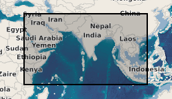
Data from geophysical surveys carried out by the British Geological Survey in many countries in the Middle East, the Indian sub-continent and Indo-China for different agencies. The surveys range from regional gravity and airborne magnetic mapping to targetted surveys for mineral and water. Individual surveys do not yet have metadata entries: this entry describes a notional database that represents all geophysical surveys carried out within the region.