 NERC Data Catalogue Service
Slope stability
Type of resources
Topics
Keywords
Contact for the resource
Provided by
Years
Representation types
Update frequencies
-
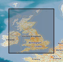
The 5km Hex GS Landslides dataset shows a generalised view of the GeoSure Landslides v7 dataset to a hexagonal grid resolution of 64.95km coverage area (side length of 5km). This dataset indicates areas of potential ground movement in a helpful and user-friendly format. The rating is based on a highest level of susceptibility identified within that Hex area: Low (1), Moderate (2), Significant (3). Areas of localised significant rating are also indicated. The summarising process via spatial statistics at this scale may lead to under or over estimation of the extent of a hazard. The supporting GeoSure reports can help inform planning decisions and indicate causes of subsidence. The methodology is based on the BGS Digital Map (DiGMapGB-50) and expert knowledge of the behaviour of the formations so defined. This dataset provides an assessment of slope instability. Landslide hazard occurs due to particular slope characteristics (such as geology, gradient, sources of water, drainage, man-made constructions) combining to cause the slope to become unstable. Downslope movement of materials, such as a landslide or rockfall may lead to a loss of support and damage to buildings. Complete Great Britain national coverage is available.
-

**No longer exists - now part of GeoSure**An assessment of the potential for landslides to be present or occur in an area. The methodology is based on BGS a digital terrain model, digital stratigraphic linework and expert knowledge of the behaviour of the formations so defined.
-

This dataset provides an assessment of slope instability. Landslide hazard occurs due to particular slope characteristics (such as geology, gradient, sources of water, drainage, man-made constructions) combining to cause the slope to become unstable. Downslope movement of materials, such as a landslide or rockfall may lead to a loss of support and damage to buildings. Complete Great Britain national coverage is available. The storage formats of the data are ESRI Shapefiles and MapInfo but other formats can be supplied. The GeoSure data sets and reports from the British Geological Survey provide information about potential ground movement or subsidence in a helpful and user-friendly format. The reports can help inform planning decisions and indicate causes of subsidence. The methodology is based on 'BGS Geology' (Digital Map) and expert knowledge of the behaviour of the formations so defined.
-

Through manufacturing, and geophysically characterising the properties and distribution of a range of synthetic gas hydrate morphologies in a range of sediments in the laboratory, protocols will be established for geophysically logging natural sediment-hydrate core preserved in pressure chambers on board ship. Based on pressure cycling, geophysical behaviour responses will be determined during the start of dissociation and formation. On this basis we then propose to develop protocols to characterise and classify hydrates sampled during ODP Leg 204, significantly improving our understanding of the nature and behaviour of these sediments. This new knowledge will enhance geophysical survey data, better constrain estimates of in-situ hydrates and improve the evaluation of hydrate destabilisation on methane release and slope stability.
-

Through manufacturing and geophysically characterising the properties and distribution of a range of synthetic gas hydrate morphologies in a range of sediments in the laboratory, protocols will be established for geophysically logging natural sediment-hydrate core preserved in pressure chambers on board ship. Based on pressure cycling, geophysical behaviour responses will be determined during the start of dissociation and formation. On this basis the investigators then propose to develop protocols to characterise and classify hydrates sampled during ODP Leg 204, significantly improving our understanding of the nature and behaviour of these sediments. This new knowledge will enhance geophysical survey data, better constrain estimates of in-situ hydrates and improve the evaluation of hydrate destabilisation on methan release and slope stability.
-

There is a great deal of uncertainty as to the levels of stability of slope components of the European margin, other than localised detailed surveys completed using a combination of side-scan sonar and swathe bathymetry in recent years. These surveys have revealed that the factors which control the locations of areas of potential slope failure are complex and manifold. Clearly slope gradients, sediment supply, physical oceanographic conditions and sediment type all have major roles to play, but their interaction is far from well understood. One of the problems to be addressed is the lack of a comprehensive and focussed data synthesis with which to derive and test models of slope behaviour. A promising way in which this shortfall could be rectified would be to combine selected parts of the extensive survey database acquired by the telecommunications industry in its search for suitable pathways in which to lay earlier copper-core and now, more recently, fibre-optic cable systems. These data would be interpreted in conjunction with a rigorous analysis of the industry's historical cable-fault database which provides parameters of naturally occuring cable failures (through sediment failure, for example). Together these data will provide an understanding of the geological characteristics of key parts of the European shelf, underpinned with the statistics of active slope processes over the most recent decades. The benefits of such a synthesis to both the telecommunications and hydrocarbon industries cannot be overstated.