 NERC Data Catalogue Service
Geohazards
Type of resources
Available actions
Topics
Keywords
Contact for the resource
Provided by
Years
Formats
Representation types
Update frequencies
Service types
Scale
Resolution
-
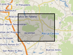
The data is provided as a single spreadsheet containing geochemical information from three volcanoes (Antuco, Chile; Jocotitlan, Mexico; Montserrat), all of which have been affected by major debris avalanches. The data was collected in order to investigate the long-term evolution of these volcanic systems. In addition, a single worksheet is provided of a summary database of published examples of volcanic debris avalanches. The geochemical data include bulk-rock XRF and ICP-MS data, Sr and Pb isotope measurements, and glass analyses for the Montserrat samples, along with site information for Antuco and Jocotitlan. Additional published analyses for Montserrat is availabile in published papers, as detailed in the spreadsheet.
-

The 5km Hex GS Compressible Ground dataset shows a generalised view of the GeoSure Compressible Ground v8 dataset to a hexagonal grid resolution of 64.95km coverage area (side length of 5km). This dataset indicates areas of potential ground movement in a helpful and user-friendly format. The rating is based on a highest level of susceptibility identified within that Hex area: Low (1), Moderate (2), Significant (3). Areas of localised significant rating are also indicated. The summarising process via spatial statistics at this scale may lead to under or over estimation of the extent of a hazard. The supporting GeoSure reports can help inform planning decisions and indicate causes of subsidence. The methodology is based on the BGS Digital Map (DiGMapGB-50) and expert knowledge of the behaviour of the formations so defined. This dataset provides an assessment of the potential for a geological deposit to compress under an applied load, a characteristic usually of superficial deposits such as peat or alluvium. Some types of ground may contain layers of very soft materials like clay or peat. These may compress if loaded by overlying structures, or if the groundwater level changes, potentially resulting in depression of the ground and disturbance of foundations. Complete Great Britain national coverage is available.
-

The 5km Hex GS Running Sand dataset shows a generalised view of the GeoSure Running Sand v7 dataset to a hexagonal grid resolution of 64.95km coverage area (side length of 5km). This dataset indicates areas of potential ground movement in a helpful and user-friendly format. The rating is based on a highest level of susceptibility identified within that Hex area: Low (1), Moderate (2), Significant (3). Areas of localised significant rating are also indicated. The summarising process via spatial statistics at this scale may lead to under or over estimation of the extent of a hazard. The supporting GeoSure reports can help inform planning decisions and indicate causes of subsidence. The Running Sand methodology is based on the BGS Digital Map (DiGMapGB-50) and expert knowledge of the behaviour of the formations so defined. This dataset provides an assessment of the potential for a geological deposit to show running sand behaviour under the action of flowing water, a characteristic usually of saturated sand and silt grade material. Complete Great Britain national coverage is available.
-
The 5km Hex GS Running Sand dataset shows a generalised view of the GeoSure Running Sand v8 dataset to a hexagonal grid resolution of 64.95km coverage area (side length of 5km). This dataset indicates areas of potential ground movement in a helpful and user-friendly format. The rating is based on a highest level of susceptibility identified within that Hex area: Low (1), Moderate (2), Significant (3). Areas of localised significant rating are also indicated. The summarising process via spatial statistics at this scale may lead to under or over estimation of the extent of a hazard. The supporting GeoSure reports can help inform planning decisions and indicate causes of subsidence. The Running Sand methodology is based on the BGS Digital Map (DiGMapGB-50) and expert knowledge of the behaviour of the formations so defined. This dataset provides an assessment of the potential for a geological deposit to show running sand behaviour under the action of flowing water, a characteristic usually of saturated sand and silt grade material. Complete Great Britain national coverage is available.
-

**This dataset has been superseded**The newGeoSure Insurance Product (newGIP) provides the potential insurance risk due to natural ground movement. It incorporates the combined effects of the 6 GeoSure hazards on (low-rise) buildings: landslides, shrink-swell clays, soluble rocks, running sands, compressible ground, and collapsible deposits. These hazards are evaluated using a series of processes including statistical analyses and expert elicitation techniques to create a derived product that can be used for insurance purposes such as identifying and estimating risk and susceptibility. The evaluated hazards are then linked to a postcode database - the Derived Postcode Database (DPD), which is updated biannually with new releases of Ordnance Survey Code-Point® data (current version used: 2024.1). The newGIP is provided for national coverage across Great Britain (not including the Isle of Man). This product is available in a range of GIS formats including Access (*.dbf), ArcGIS (*.shp) or MapInfo (*.tab) on request. The newGIP is produced for use at 1:50 000 scale providing 50 m ground resolution.
-
**This dataset has been superseded** The newGeoSure Insurance Product (newGIP) provides the potential insurance risk due to natural ground movement at a postcode level. It incorporates the combined effects of the 6 GeoSure hazards on (low-rise) buildings: landslides, shrink-swell clays, soluble rocks, running sands, compressible ground, and collapsible deposits. The newGeoSure Insurance Product evaluates these hazards using a series of processes including statistical analyses and expert elicitation techniques to create a derived product that can be used for insurance purposes such as identifying and estimating risk and susceptibility. The newGeoSure Insurance Product is updated biannually with new releases of Ordnance Survey Code-Point® data (current version used: 2017.1) and is provided for national coverage across Great Britain (not including the Isle of Man). This product is available in a range of GIS formats including Access (*.dbf), ArcGIS (*.shp), or MapInfo (*.tab). The newGeoSure Insurance Product is produced for use at 1:50 000 scale, providing 50 m ground resolution.
-
**This dataset has been superseded** The newGeoSure Insurance Product (newGIP) provides the potential insurance risk due to natural ground movement. It incorporates the combined effects of the 6 GeoSure hazards on (low-rise) buildings: landslides, shrink-swell clays, soluble rocks, running sands, compressible ground, and collapsible deposits. These hazards are evaluated using a series of processes including statistical analyses and expert elicitation techniques to create a derived product that can be used for insurance purposes such as identifying and estimating risk and susceptibility. The evaluated hazards are then linked to a postcode database - the Derived Postcode Database (DPD), which is updated biannually with new releases of Ordnance Survey Code-Point® data (current version used: 2023.1). The newGIP is provided for national coverage across Great Britain (not including the Isle of Man). This product is available in a range of GIS formats including Access (*.dbf), ArcGIS (*.shp) or MapInfo (*.tab) on request. The newGIP is produced for use at 1:50 000 scale providing 50 m ground resolution.
-
The 5km Hex GS Collapsible Deposits dataset shows a generalised view of the GeoSure Collapsible Deposits v7 dataset to a hexagonal grid resolution of 64.95km coverage area (side length of 5km). This dataset indicates areas of potential ground movement in a helpful and user-friendly format. The rating is based on a highest level of susceptibility identified within that Hex area: Low (1), Moderate (2), Significant (3). Areas of localised significant rating are also indicated. The summarising process via spatial statistics at this scale may lead to under or over estimation of the extent of a hazard. The supporting GeoSure reports can help inform planning decisions and indicate causes of subsidence. The reports can help inform planning decisions and indicate causes of subsidence. The Collapsible Ground dataset provides an assessment of the potential for a geological deposit to collapse (to subside rapidly) as a consequence of a metastable microfabric in loessic material. Such metastable material is prone to collapse when it is loaded (as by construction of a building, for example) and then saturated by water (as by rising groundwater, for example). Collapse may cause damage to overlying property. The methodology is based on the BGS Digital Map (DiGMapGB-50) and expert knowledge of the origin and behaviour of the formations so defined. It provides complete coverage of Great Britain, subject to revision in line with changes in DiGMapGB lithology codes and methodological improvements.
-

**This dataset has been superseded** The newGeoSure Insurance Product (newGIP) provides the potential insurance risk due to natural ground movement. It incorporates the combined effects of the 6 GeoSure hazards on (low-rise) buildings: landslides, shrink-swell clays, soluble rocks, running sands, compressible ground and collapsible deposits. These hazards are evaluated using a series of processes including statistical analyses and expert elicitation techniques to create a derived product that can be used for insurance purposes such as identifying and estimating risk and susceptibility. The evaluated hazards are then linked to a postcode database - the Derived Postcode Database (DPD), which is updated biannually with new releases of Ordnance Survey Code-Point® data (current version used: 2018.1). The newGIP is provided for national coverage across Great Britain (not including the Isle of Man). This product is available in a range of GIS formats including Access (*.dbf), ArcGIS (*.shp) or MapInfo (*.tab). The newGIP is produced for use at 1:50 000 scale providing 50 m ground resolution.
-

**This dataset has been superseded** The newGeoSure Insurance Product (newGIP) provides the potential insurance risk due to natural ground movement. It incorporates the combined effects of the 6 GeoSure hazards on (low-rise) buildings: landslides, shrink-swell clays, soluble rocks, running sands, compressible ground and collapsible deposits. These hazards are evaluated using a series of processes including statistical analyses and expert elicitation techniques to create a derived product that can be used for insurance purposes such as identifying and estimating risk and susceptibility. The evaluated hazards are then linked to a postcode database - the Derived Postcode Database (DPD), which is updated biannually with new releases of Ordnance Survey Code-Point® data (current version used: 2018.3). The newGIP is provided for national coverage across Great Britain (not including the Isle of Man). This product is available in a range of GIS formats including Access (*.dbf), ArcGIS (*.shp) or MapInfo (*.tab). The newGIP is produced for use at 1:50 000 scale providing 50 m ground resolution.