 NERC Data Catalogue Service
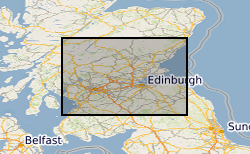
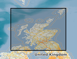
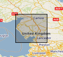
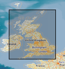
Mine planning
Type of resources
Topics
Keywords
Contact for the resource
Provided by
Years
Formats
Representation types
Update frequencies
Scale
Resolution
-
Contains digitised mine plan contours, spot heights and worked ground outlines on key coal seams from the Midland Valley in ASCII or ArcView format. Incomplete, only some seams and some areas digitised. All contours digitised on key seams, worked ground outlines simplified, spot heights digitised where no contours exist.
-
The collection includes colour microfilm aperture card copies of 7,170 plans of mine workings for coal and oil shale dating from 1872 onwards deposited on abandonment of a mine in compliance with the Coal Mines Regulation Act. An additional c.5,000 coal 'working' plans, mostly pre-dating 1872, formerly belonging to British Coal, have been added to the abandonment plan collection. The latter are held as black & white microfilm aperture cards. The collection includes plans of workings for other minerals, notably ironstone, where worked with coal. The microfilms are held on behalf of the Coal Authority who hold the original plans on behalf of the Health & Safety Executive (HSE). Original plans are held by the Coal Authority, Mansfield. No complete digital index held by BGS. An up to date finding aid is provided by the Coal Authority's paper 'Catalogue of Plans of Abandoned Mines'. The collection is believed to be fairly complete for mines abandoned since the 1872 Act. Plans were added from the British Coal plan collections to fill gaps in holdings, particularly for mines abandoned prior to 1872. Relates to coalfield areas of Central Scotland.
-
The collection comprises photographic half plate black & white negative and 35mm colour transparency copies of plans of mine workings for haematite, gypsum, limestone, baryte and metalliferous minerals for Cumbria dating from 1872 onwards. The plans were originally deposited in compliance with the Coal and Metalliferous Mines Regulation acts. The original plans are currently held by Cumbria County Record Office on behalf of the Health & Safety Executive (HSE) and total about 1240 plans. No digital index is available but a paper catalogue is provided by the Health & Safety Executive. As the collection relates to plans of mines abandoned after the 1872 Act, the holdings are fairly complete after this date. Note however, that the Metalliferous Mines Act originally applied only to mines employing more than 12 men, (eg. some limestone mines). Coal Authority may hold non-coal mine plans not covered by Mine Abandonment Plan collection.
-

Scanned images of large scale or large format plans of all types including those relating to mining activity, including abandonment plans and site investigations. The images include plans held in the BGS Collection but also plans held elsewhere. The majority of scans produced from 2002. All the plans are indexed on BGS.ALL_PLANS and non-coal plans are also available by the Mining Portal. Not all the plans have been scanned. The collection covers the whole of Great Britain.
-

The dataset comprises plans of various types relating to mining activity, including abandonment plans, gathered since the 1800s. Most were collected as part of the BGS mapping programme and the type and amount of data available will vary considerably by area. The coverage for Northern England and Scotland is more comprehensive than for the rest of the country. The plans include working copies, compilations and interpretations which may be copyright or confidential. The BGS mine plans are indexed in the BGS mine plan database along with metadata and scans of mine plans held on behalf of the Mining Remediation Authority (MRA) and the Health and Safety Executive (HSE) for online delivery. The general nature of some of the plans means that they may not be applicable to a specific site. Current holdings over 80,000.
-
Index to the BGS collection of large scale or large format plans of all types including those relating to mining activity, including abandonment plans and site investigations. The Plans Database Index was set up c.1983 as a digital index to the collections of Land Survey Plans and Plans of Abandoned Mines. There are entries for all registered plans but not all the index fields are complete, as this depends on the nature of the original plan. The index covers the whole of Great Britain.
-

A detailed index into information relating to mining activity and hazards contained within select field notebooks held by the British Geological Survey (BGS). Two former National Coal Board (NCB) surveyors created the index in the 1970s by examining the historical archive of geological field notebooks held by BGS (at the time IGS; Institute of Geological Sciences) at their London and Leeds offices, and extracting detailed information relating to mining activity. The data cover England and Wales only, and notebooks deposited or produced after 1975 would not have been included in the index. Only notebooks containing information relating to mining activity (and associated hazards) are included in the index, so the data are mostly constrained to traditional coalfield areas, though all mining information included in the notebooks considered is included. Later data (after 1960) recorded on field record cards or directly onto field slips are not included. The indices are paper records, with one document per notebook. The documents are tables containing page numbers, an extract of detailed information from the notebook, and a reference to a geological map sheet, where applicable. The indices have been scanned and are held as multi-page TIF files. The spatial data (British National Grid 5 km or 10 km grid squares) and geologist name, notebook number and page number have been digitised and are held in the BGS corporate database system. This information can be used to identify the original notebook by reference to the BGS field notebook index. The index is an important dataset to be considered under the Mines (Precautions Against Inrushes) Regulations 1979 (PAIR).
-
The dataset comprises of the plans of abandoned coal mines in Great Britain deposited with the Mining Remediation Authority (MRA) and held on behalf of the Health and Safety Executive in line with the 1872 Coal Mines Regulation Act and Metalliferous Mines Regulation Act. The physical plans are held by the MRA and a digital copy of the index to and scans of these plans was deposited to the British Geological Survey (BGS) for delivery through the BGS mine plans viewer. BGS also holds an incomplete disaster recovery copy of the microfiche of the statutory mine abandonment plans for the MRA.
-

A set of 11 1:25 000 scale OS sheets annotated with the outcrops of the principal veins of the North Pennine Orefield, prepared as aids to the revision of the BGS Geology of the Northern Pennine Orefield memoir, vol. 1: Tyne to Stainmore, published in 1990. Some mining data are also included on the maps. The original data provided by Sir Kingsley Dunham were transcribed onto the 1:25 000 scale sheets to aid in adding grid references to the revised memoir. The data were mostly originally compiled from Dunham's detailed Second World War investigations of the orefield, together with some of Dunham's original 1930s PhD work. These records came from Geological Survey 'mining slips', which were on County Series sheets. For the 1990 revision of the memoir, new data were incorporated, derived from more recent mapping and a large volume of post-1940s mining and exploration data, together with the results of major advances in stratigraphical, structural, mineralogical and geochemical interpretations. The maps depict all of the major mineralised veins as black solid lines. The extent of replacement 'flat' orebodies are generally not shown, though the comparatively modest 'flats' associated with the Windshaw Bridge and Browngill veins at Tynebottom (sheet NY74) and the famous Boltsburn flats at Rookhope (sheet NY84/94) are indicated: the extent of the substantial area of 'flat' mineralisation around Nenthead is not depicted, almost certainly due to the difficulty of so doing due to the closely-spaced network of parent veins. Major, mostly un-mineralised, faults relevant to the descriptions and interpretations of the mineralisation are depicted as broken black lines. Other faults, depicted on BGS mapping, are not generally included. Only those details of mining, such as shaft and adit positions – shown in red by the use of standard BGS symbols – included on Dunham’s Mining Slips are recorded here. There are countless other shafts and adits across the orefield, some of which are mentioned in the memoir text but not depicted on these maps. Broken red lines depict significant underground cross-cut levels and drives which are described in detail in the memoir text. Countless others were not depicted by Dunham and are not shown here. Notes in red, copied from Dunham, are mostly self-explanatory and indicate the names of individual mines, shafts and adits. On his ‘Mining Slips’ Dunham made brief notes on some of the most obvious primary minerals he observed on some mine dumps. These are not included on these 1:25 000 scale maps. Many of these dumps have since become overgrown, and some have been removed. Reference to the ‘Mining slips’ may therefore be useful, though subsequent detailed mineralogical studies have revealed a much greater diversity of mineral species than was then recognised and which gives important clues to the nature and origins of the deposits. There is a rather extensive more recent literature on these.