Minerals
Type of resources
Available actions
Topics
Keywords
Contact for the resource
Provided by
Years
Formats
Representation types
Update frequencies
Service types
Scale
-
Zeta potential measurements of the fluorcarbonate mineral parisite-(Ce), under water, supernatant and collector conditions. Zeta potential measurements can be used to indicate the surface behaviour of a mineral under different reagent conditions. Mineral surface behaviour is important in processing and extracting minerals from their host ore, which can be energy intensive. Parisite-(Ce) is a fluorcarbonate mineral which contains rare earth elements. Rare earth elements are important in a wide range of products from iPhones to wind turbines.
-
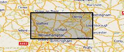
The full title of this project is" Studies into metal speciation and bioavailability to assist risk assessment and remediation of brownfield sites in urban areas" and is funded by NERC under the URGENT thematic programme form 1998-2001. The project is being undertaken by a consortium of workers from the Imperial College, University of Nottingham, and the British Geological Survey. Innovative collaborative and multi-disciplinary research will be applied to the interpretation of urban geochemical maps and associated meta-datasets to assist decision making by local authorities in the redevelopment of brownfield sites. Source apportionment, speciation and bioavailability of potentially toxic heavy metals will be studied at representative conurbations in the UK Midlands region. Scanning electron microscopy, chemical extractions and soil solution and vegetable analysis, will be integrated with high precision isotopic analyses of Pb and other potential toxic metals in this study. The results will be available as maps in GIS format to provide a generic decision support system for quantitative health risk assessment.
-
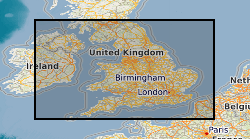
Derived from data collated from the 2005 Aggregate Minerals Survey, carried out by BGS for the Department for Communities and Local Government (CLG) which provide an in-depth and up-to-date understanding of regional and national sales, inter-regional flows, transportation, consumption and permitted reserves of primary aggregates for England and Wales. The information is used to monitor and develop policies for the supply of aggregates. This data set depicts the flow of crushed rock aggregate between the regions of England and Wales. The data originator also has similar data for sand and gravel and also the same data derived from the 1997 and 2001 Aggregate Minerals Surveys.
-

Compiled by the Minerals Intelligence section of the Survey from 1918 to 1985. Comprises around 250,000 card entrys that refer to published articles on mineral topics world-wide.
-
A compilation of mineral and glass compositions erupted at Villarrica volcano, Chile, measured by electron microprobe. Data are sourced from published articles, theses and unpublished works. Minerals and glasses are from deposits erupted over the last 100ka. This is supporting data for the manuscript entitled 'Insights into Magma Storage Beneath a Frequently Erupting Arc Volcano (Villarrica, Chile) from Unsupervised Machine Learning Analysis of Mineral Compositions' by F. O. Boschetty, D. J. Ferguson, J. A Cortés, E. Morgado, S. K. Ebmeier, D. J. Morgan, J. E. Romero and C. Silva Parejas.
-
Series of water/rock and water/mineral interaction experiments at a range of temperatures and pressures. Most experimental runs now held in Excel spreadsheets. All runs held as paper records in the laboratory. Analytical results also held in Excel format. Kinetic information held in Access database for a range of minerals. Also have several reference datasets in Hypercard and End Note.
-
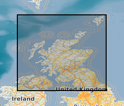
The collection, amounting to c.6,000 records, consists of reports and data relating to geochemical sampling, geophysics, drilling and field mapping deposited by mineral exploration companies dating from c.1960 onwards. Major accessions include records of Mineral Exploration Incentive Grant Act (MEIGA) and reports and plans of Exploration Ventures Ltd (EVL) relating to NE Scotland. Indexed in Land Survey Record Index Database (LSRI).
-
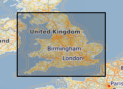
This dataset provides digital spatial information on the location of mineral resources in England at a scale of 1:50 000. The term ‘mineral resources’ has a definition under international standards that includes both an economic and geological dimension. These data are based primarily on mapped geology with limited assessment of economics. Therefore, the term ‘mineral resources’ is used here in a broad sense. The dataset allows users to visualise the extent and distribution of mineral resources and to relate them to other forms of land-use (such as urban areas or designated environmentally sensitive areas) or to other factors (such as transport infrastructure and conservation information). The dataset is derived from a set of commissioned projects to prepare a series of mineral resource maps based on counties or amalgamations of counties. Maps for England were commissioned by the central government department with responsibility for mineral planning at the time (Department of the Environment (DoE), Department of the Environment, Transport and the Regions (DETR), Department for Transport, Local Government and the Regions (DTLR), Office of the Deputy Prime Minister (ODPM), and the Department for Communities and Local Government (DCLG) between 1994 and 2006. Each map produced (with an accompanying report describing the mineral resources depicted on the map) is available to download, as a PDF file from the BGS-hosted website: www.MineralsUK.com. During 2011-2012 revisions were made to areas of the resource linework. These changes were made as a result of new research and release of a new version of DiGMap (v5). This work was on an ad hoc basis but affects all resource layers. In 2020 minor revisions to geometry and attributes were made in in response to minor corrections that were required. The paper maps were not re-released with these data updates. The BGS Mineral Resource data does not determine mineral reserves and therefore does not denote potential areas of extraction. Only onshore, mainland mineral resources are included in the dataset. This dataset has been produced by the collation and interpretation of mineral resource data principally held by the British Geological Survey. The mineral resource data presented are based on the best available information, but are not comprehensive and their quality is variable. The dataset should only be used to show a broad distribution of those mineral resources which may be of current or potential economic interest.
-
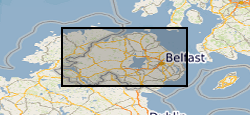
This mineral resource data was produced as part of the Mineral Resource Map of Northern Ireland via a commission from the Northern Ireland Department of the Environment. The work resulted in a series of 21 data layers which were used to generate a series of six digitally generated maps. This work was completed in 2012 with one map for each of the six counties (including county boroughs) of Northern Ireland at a scale of 1:100 000. This data and the accompanying maps are intended to assist strategic decision making in respect of mineral extraction and the protection of important mineral resources against sterilisation. They bring together a wide range of information, much of which is scattered and not always available in a convenient form. The data has been produced by the collation and interpretation of mineral resource data principally held by the Geological Survey of Northern Ireland and was funded via a commission from the Northern Ireland Department of the Environment. These layers display the spatial data of the mineral resources of Northern Ireland. There are a series of layers which consist of: Bedrock: Clay, Bauxitic clay, Coal & Lignite, Coal – lignite proven, Conglomerate, Dolomite, Igneous and meta-igneous rock, Limestone, a 100m buffer layer on the Ulster White Limestone, Meta-sedimentary rocks, Perlite, Salt, Sandstone and Silica Sand. Superficial (unconsolidated recent sediments) : Sand & gravel and Peat. The data except for the salt and proven lignite resource layers was derived from the 1:50 00 and 1:250 000 scale DigMap NI dataset. This version of the data retains the internal geological boundaries which are dissolved out in the accompanying dissolved version. A user guide 'The Mineral Resources of Northern Ireland digital dataset (version 1)' OR/12/039 describing the creation and use of the data is available.
-
The dataset indicates the potential for hazard in Great Britain as a result of mineral extraction. It excludes areas of Coal mining as these are covered by the Coal Authority. It is based on a simple A-E rating scale indicating the increasing likelihood of an underground mining hazard. The data was created using expert knowledge, detailed literature searches, local knowledge and a series of rule based geological constraints applied to the DigMapGB50k (Digital Geological Map of Great Britain) data.
 NERC Data Catalogue Service