 NERC Data Catalogue Service
Land use planning
Type of resources
Topics
Keywords
Contact for the resource
Provided by
Years
Formats
Representation types
Update frequencies
Scale
-
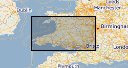
The dataset is based on a 1 hectare(ha) vector grid which covers the whole of Wales. It has been populated with a series of environmental and cultural assets, reflecting the presence or absence of an asset in an individual cell. The dataset has been designed to enable a single asset to be displayed in a generalised fomat; total numbers of assets within a given cell; or the opportunity to create in unique combination of the assets based on the generalised 1 ha data. The data is also available at 1km.
-

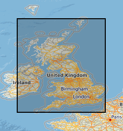
The dataset is based on a 1 hectare(ha) vector grid which covers the whole of Scotland. It has been populated with a series of environmental and cultural assets, reflecting the presence or absence of an asset in an individual cell. The dataset has been designed to enable a single asset to be displayed in a generalised fomat; total numbers of assets within a given cell; or the opportunity to create in unique combination of the assets based on the generalised 1 ha data. The data is also available at 1km.
-

Many mineral resource maps for areas of Great Britain at scales of 1:25 000 and 1:50 000 have been produced by the British Geological Survey and its predecessors. Many of these maps were produced by the Industrial Minerals Assessment Unit (IMAU) from 1971 to 1986. Most maps cover a single 10 km x 10 km grid square, but some cover larger areas. The majority of maps are sand and gravel resource maps, but conglomerate, limestone, dolomite and celestite are also covered in certain regions. The maps show the locations of IMAU mineral resource blocks, the locations and categories of resource deposits and the locations of boreholes with indicative logs. A series of technical reports (Mineral Assessment Reports, MARs) was also created alongside the maps. Refer to the metadata entry for the Mineral Assessment Reports for more information. The maps are intended to be used for resource development, strategic planning, land-use planning, the indication of hazard in mined areas, environment assessment and as a teaching aid. The data was originally published in printed map form. The printed maps have been scanned and added to the BGS Maps Database.
-
Between 2001 and 2003 BGS received approximately 1400 1:25 000 paper maps and associated card index from the Office of the Deputy Prime Minister (now Department for Communities and Local Government (CLG)). The maps, originally compiled by the Minerals Division of the Ministry of Housing and Local Government (CLGs historic predecessor), contain hand drawn boundaries for permitted, withdrawn and refused mineral planning permissions, and worked ground. They also contain hand drawn boundaries for land use at each site. These 'MHLG' maps show information collated from the 1940s (retrospectively to 1930) to the mid 1980s. The index cards provide supplementary information regarding name, operator, dates and relevant local authority. Data depicted on the maps are for England only and include; [a] all planning appeals, departures and called in cases whether permitted or refused; [b] all planning permission and refusal data for various local authority areas which were obtained by Departmental officials through visits to authorities in a staged programme spread over many years. Priority was placed on areas that were giving rise to then current casework issues thus at the time when the maintenance of the maps ended (mid 1985), some authority information had been updated recently but other areas had not been visited for many years. [c] land use present at each site. Categories include: derelict areas, restored quarries (filled and unfilled), tip heaps and spoil heaps, and wet areas. The variable completeness of the data sets should be kept in mind when this material is being used. Land use polygons have been digitised from the MHLG maps and attribute information has been provided from the map legend and the appropriate card in the card index. The principal aim of the data is to show land use present in areas of land that have been affected by the extraction of minerals.
-
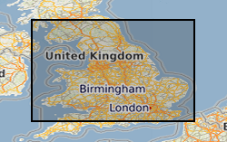
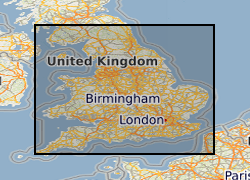
The dataset is based on a 1 hectare(ha) vector grid which covers the whole of England. It has been populated with a series of environmental and cultural assets, reflecting the presence or absence of an asset in an individual cell. The dataset has been designed to enable a single asset to be displayed in a generalised fomat; total numbers of assets within a given cell; or the opportunity to create in unique combination of the assets based on the generalised 1 ha data. The data is also available at 1km.
-
This dataset contains scans of Applied Geology Maps (AGMs) and sections, which are also known as thematic maps, Environmental Geology Maps (EGMs) or Planning for Development Maps (PfD). They were produced as part of 'Geological Background for Planning and Development' and preliminary sand and gravel projects carried out by the British Geological Survey for the Department of the Environment, Transport and the Regions (DETR), the Scottish Development Department and Scottish Office from 1975 to 1996. The maps and sections cover a number of themes (up to 22) for specific areas relating to the project area within the United Kingdom (which are mostly urban areas). Themes include simplified bedrock and superficial maps, drift thickness, drift lithology, rockhead contours and a range of mining-related themes. Each area had its own custom set of maps and were issued with an accompanying BGS Technical Report. The maps and report were sometimes issued as a pack, but for some areas they were made available separately. The geological linework and the methods used to produce the maps are those current at the time of production. Map scales are predominantly 1:10 000 or 1:25 000, with a few 1:50 000 maps. The maps have Ordnance Survey map bases and are bounded by the project area. The maps could be used for geological, engineering geological, environmental and resources research, as an information and reference resource and for inclusion in reports and papers. These maps are hard-copy paper records and digital scans, stored in the National Geoscience Data Centre (NGDC).