 NERC Data Catalogue Service
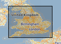
Historic Land Use associated with Mineral Planning Permissions for England
Between 2001 and 2003 BGS received approximately 1400 1:25 000 paper maps and associated card index from the Office of the Deputy Prime Minister (now Department for Communities and Local Government (CLG)). The maps, originally compiled by the Minerals Division of the Ministry of Housing and Local Government (CLGs historic predecessor), contain hand drawn boundaries for permitted, withdrawn and refused mineral planning permissions, and worked ground. They also contain hand drawn boundaries for land use at each site. These 'MHLG' maps show information collated from the 1940s (retrospectively to 1930) to the mid 1980s. The index cards provide supplementary information regarding name, operator, dates and relevant local authority. Data depicted on the maps are for England only and include; [a] all planning appeals, departures and called in cases whether permitted or refused; [b] all planning permission and refusal data for various local authority areas which were obtained by Departmental officials through visits to authorities in a staged programme spread over many years. Priority was placed on areas that were giving rise to then current casework issues thus at the time when the maintenance of the maps ended (mid 1985), some authority information had been updated recently but other areas had not been visited for many years. [c] land use present at each site. Categories include: derelict areas, restored quarries (filled and unfilled), tip heaps and spoil heaps, and wet areas. The variable completeness of the data sets should be kept in mind when this material is being used. Land use polygons have been digitised from the MHLG maps and attribute information has been provided from the map legend and the appropriate card in the card index. The principal aim of the data is to show land use present in areas of land that have been affected by the extraction of minerals.
Simple
- Date (Creation)
- 2008-07-01
Distributor
British Geological Survey
-
Enquiries
0115 936 3276
Environmental Science Centre, Nicker Hill, Keyworth
,
NOTTINGHAM
,
NOTTINGHAMSHIRE
,
NG12 5GG
,
United Kingdom
0115 936 3143
0115 936 3276
Point of contact
British Geological Survey
-
Enquiries
0115 936 3276
Environmental Science Centre, Nicker Hill, Keyworth
,
NOTTINGHAM
,
NOTTINGHAMSHIRE
,
NG12 5GG
,
United Kingdom
0115 936 3143
0115 936 3276
Custodian
British Geological Survey
-
Enquiries
0115 936 3276
Environmental Science Centre, Nicker Hill, Keyworth
,
NOTTINGHAM
,
NOTTINGHAMSHIRE
,
NG12 5GG
,
United Kingdom
0115 936 3143
0115 936 3276
- Maintenance and update frequency
- notApplicable notApplicable
- GEMET - INSPIRE themes, version 1.0
- BGS Thesaurus of Geosciences
-
- Mineral deposits
- Land use planning
- UK Location (INSPIRE)
- dataCentre
- Keywords
-
- NERC_DDC
- Access constraints
- otherRestrictions Other restrictions
- Other constraints
- license
- Use constraints
- otherRestrictions Other restrictions
- Other constraints
- The copyright of materials derived from the British Geological Survey's work is vested in the Natural Environment Research Council [NERC]. No part of this work may be reproduced or transmitted in any form or by any means, or stored in a retrieval system of any nature, without the prior permission of the copyright holder, via the BGS Intellectual Property Rights Manager. Use by customers of information provided by the BGS, is at the customer's own risk. In view of the disparate sources of information at BGS's disposal, including such material donated to BGS, that BGS accepts in good faith as being accurate, the Natural Environment Research Council (NERC) gives no warranty, expressed or implied, as to the quality or accuracy of the information supplied, or to the information's suitability for any use. NERC/BGS accepts no liability whatever in respect of loss, damage, injury or other occurence however caused.
- Other constraints
- The dataset is made available to external clients under BGS Digital Data Licence terms and conditions. Revert to the IPR Section (iprdigital@bgs.ac.uk ) if further advice is required with regard to permitted usage.
- Spatial representation type
- vector Vector
- Denominator
- 25000
- Metadata language
- EnglishEnglish
- Topic category
-
- Geoscientific information
- Geographic identifier
-
GB
- Date (Revision)
- 2009
- Geographic identifier
-
UK [id=139300]
- Date (Creation)
- 1979
- Geographic identifier
-
UKM
- Date (Revision)
- 2009
N
S
E
W
))
- Begin date
- 1930
- End date
- 1980
- Supplemental Information
- Whilst this dataset covers England only, it is expected that a similar dataset will be made available that covers Wales.
- Unique resource identifier
- OSGB 1936 / British National Grid (EPSG::27700)
- Distribution format
-
-
Shape file
(
Any version
)
-
Shape file
(
Any version
)
Distributor
British Geological Survey
-
Enquiries
0115 936 3276
Environmental Science Centre, Nicker Hill, Keyworth
,
NOTTINGHAM
,
NOTTINGHAMSHIRE
,
NG12 5GG
,
United Kingdom
0115 936 3143
0115 936 3276
- OnLine resource
-
BGS Homepage
(
WWW:LINK-1.0-http--link
)
The BGS Homepage is an entry point to the BGS data services.
- Hierarchy level
- dataset Dataset
Conformance result
- Date (Publication)
- 2011
- Explanation
- See the referenced specification
- Pass
- No
Conformance result
- Date (Publication)
- 2010-12-08
- Explanation
- See http://eur-lex.europa.eu/LexUriServ/LexUriServ.do?uri=OJ:L:2010:323:0011:0102:EN:PDF
- Pass
- No
- Statement
- A shapefile covering England comprising land use polygons taken from historical MHLG Minerals Planning Permissions Maps. The shapefile represents merged shapefiles digitised from individual 1:25000 scale maps. Information on the map key has been used to attribute the polygons with the folloeing land use categories: wet areas, derelict areas, restored quarry (filled and unfilled), and tip heaps & spoil heaps.
- File identifier
- 9df8df52-d6c7-37a8-e044-0003ba9b0d98 XML
- Metadata language
- EnglishEnglish
- Hierarchy level
- dataset Dataset
- Date stamp
- 2025-11-13
- Metadata standard name
- UK GEMINI
- Metadata standard version
- 2.3
Point of contact
British Geological Survey
Environmental Science Centre,Keyworth
,
NOTTINGHAM
,
NOTTINGHAMSHIRE
,
NG12 5GG
,
United Kingdom
+44 115 936 3100
- Dataset URI
- http://data.bgs.ac.uk/id/dataHolding/13605086
Overviews
Spatial extent
N
S
E
W
Provided by

Associated resources
Not available