 NERC Data Catalogue Service
BGS Applied Geology Maps and Sections
This dataset contains scans of Applied Geology Maps (AGMs) and sections, which are also known as thematic maps, Environmental Geology Maps (EGMs) or Planning for Development Maps (PfD). They were produced as part of 'Geological Background for Planning and Development' and preliminary sand and gravel projects carried out by the British Geological Survey for the Department of the Environment, Transport and the Regions (DETR), the Scottish Development Department and Scottish Office from 1975 to 1996. The maps and sections cover a number of themes (up to 22) for specific areas relating to the project area within the United Kingdom (which are mostly urban areas). Themes include simplified bedrock and superficial maps, drift thickness, drift lithology, rockhead contours and a range of mining-related themes. Each area had its own custom set of maps and were issued with an accompanying BGS Technical Report. The maps and report were sometimes issued as a pack, but for some areas they were made available separately. The geological linework and the methods used to produce the maps are those current at the time of production. Map scales are predominantly 1:10 000 or 1:25 000, with a few 1:50 000 maps. The maps have Ordnance Survey map bases and are bounded by the project area. The maps could be used for geological, engineering geological, environmental and resources research, as an information and reference resource and for inclusion in reports and papers. These maps are hard-copy paper records and digital scans, stored in the National Geoscience Data Centre (NGDC).
Simple
- Date (Creation)
- 1996
Distributor
British Geological Survey
-
Enquiries
0115 936 3276
The Lyell Centre, Research Avenue South
,
EDINBURGH
,
LOTHIAN
,
EH14 4AP
,
United Kingdom
0115 936 3142
0115 936 3276
Owner
British Geological Survey
-
Enquiries
0115 936 3276
The Lyell Centre, Research Avenue South
,
EDINBURGH
,
LOTHIAN
,
EH14 4AP
,
United Kingdom
0115 936 3142
0115 936 3276
Point of contact
British Geological Survey
-
Enquiries
0115 936 3276
The Lyell Centre, Research Avenue South
,
EDINBURGH
,
LOTHIAN
,
EH14 4AP
,
United Kingdom
0115 936 3142
0115 936 3276
- Maintenance and update frequency
- asNeeded As needed
- GEMET - INSPIRE themes, version 1.0
- BGS Thesaurus of Geosciences
-
- UK Location (INSPIRE)
- Land use planning
- Engineering geology
- Mining
- Cross sections
- Natural resources
- Geological mapping
- Maps
- Natural hazards
- Geological maps
- Geology
- dataCentre
- Keywords
-
- NERC_DDC
- Access constraints
- otherRestrictions Other restrictions
- Other constraints
- no limitations
- Other constraints
- restricted
- Other constraints
- The dataset is made freely available for access, e.g. via the Internet. Either no third party data / information is contained in the dataset or BGS has secured written permission from the owner(s) of any third party data / information contained in the dataset to make the dataset freely accessible.
- Use constraints
- otherRestrictions Other restrictions
- Other constraints
- The copyright of materials derived from the British Geological Survey's work is vested in the Natural Environment Research Council [NERC]. No part of this work may be reproduced or transmitted in any form or by any means, or stored in a retrieval system of any nature, without the prior permission of the copyright holder, via the BGS Intellectual Property Rights Manager. Use by customers of information provided by the BGS, is at the customer's own risk. In view of the disparate sources of information at BGS's disposal, including such material donated to BGS, that BGS accepts in good faith as being accurate, the Natural Environment Research Council (NERC) gives no warranty, expressed or implied, as to the quality or accuracy of the information supplied, or to the information's suitability for any use. NERC/BGS accepts no liability whatever in respect of loss, damage, injury or other occurence however caused.
- Other constraints
- Either: (i) the dataset is made freely available, e.g. via the Internet, for a restricted category of use (e.g. educational use only); or (ii) the dataset has not been formally approved by BGS for access and use by external clients under licence, but its use may be permitted under alternative formal arrangements; or (iii) the dataset contains 3rd party data or information obtained by BGS under terms and conditions that must be consulted in order to determine the permitted usage of the dataset. Refer to the BGS staff member responsible for the creation of the dataset if further advice is required. He / she should be familiar with the composition of the dataset, particularly with regard to 3rd party IPR contained in it, and any resultant use restrictions. This staff member should revert to the IPR Section (ipr@bgs.ac.uk ) for advice, should the position not be clear.
- Spatial representation type
- vector Vector
- Denominator
- 10000
- Denominator
- 25000
- Denominator
- 50000
- Metadata language
- EnglishEnglish
- Topic category
-
- Geoscientific information
- Geographic identifier
-
GBN
- Date (Revision)
- 2009
- Geographic identifier
-
GREAT BRITAIN [id=139600]
- Date (Creation)
- 1979
N
S
E
W
))
- Begin date
- 1975
- End date
- 1996
- Unique resource identifier
- OSGB 1936 / British National Grid (EPSG::27700)
- Unique resource identifier
- WGS 84 (EPSG::4326)
- Distribution format
-
-
PDF file (.pdf)
()
-
PDF file (.pdf)
()
Distributor
British Geological Survey
-
Enquiries
0115 936 3276
The Lyell Centre, Research Avenue South
,
EDINBURGH
,
LOTHIAN
,
EH14 4AP
,
United Kingdom
0115 936 3142
0115 936 3276
- OnLine resource
-
BGS Homepage
(
WWW:LINK-1.0-http--link
)
The BGS Homepage is an entry point to the BGS data services.
- Hierarchy level
- dataset Dataset
- Other
- dataset
Conformance result
- Date (Publication)
- 2011
- Explanation
- See the referenced specification
- Pass
- No
Conformance result
- Date (Publication)
- 2010-12-08
- Explanation
- See http://eur-lex.europa.eu/LexUriServ/LexUriServ.do?uri=OJ:L:2010:323:0011:0102:EN:PDF
- Pass
- No
- Statement
- The maps and sections were produced as part of applied geological projects produced for the Department of the Environment and the Scottish Office. The hard-copy records have been scanned and digital copies are held in the National Geoscience Data Centre.
- File identifier
- 9df8df52-d675-37a8-e044-0003ba9b0d98 XML
- Metadata language
- EnglishEnglish
- Hierarchy level
- dataset Dataset
- Date stamp
- 2025-11-13
- Metadata standard name
- UK GEMINI
- Metadata standard version
- 2.3
Point of contact
British Geological Survey
The Lyell Centre, Research Avenue South
,
EDINBURGH
,
LOTHIAN
,
EH14 4AP
,
United Kingdom
+44 131 667 1000
- Dataset URI
- http://data.bgs.ac.uk/id/dataHolding/13603135
Overviews
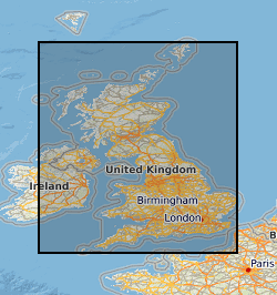
Spatial extent
N
S
E
W
Provided by

Associated resources
Not available