 NERC Data Catalogue Service
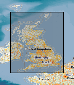
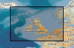
Gravity surveys
Type of resources
Available actions
Topics
Keywords
Contact for the resource
Provided by
Years
Formats
Representation types
Update frequencies
Scale
-

Field notebooks,maps, field sheets etc for Regional gravity observations on the UK mainland, Northern Ireland, offshore islands, tidal estuaries and seabed. Most of the surveys were carried out by the BGS but the database includes data originally acquired by other organisations and subsequently given to the BGS to be managed as part of the national archive. Complete coverage of the UK mainland with a station density of 1-2 stations per square kilometre.
-

Regional gravity observations on the UK mainland, Northern Ireland, offshore islands, tidal estuaries and seabed. Most of the surveys were carried out by the BGS but the database includes data originally acquired by other organisations and subsequently given to the BGS to be managed as part of the national archive. Complete coverage of the UK mainland with a station density of 1-2 stations per square kilometre.
-

GSNI GeoIndex Northern Ireland Combined Gravity Surveys This layer shows the station locations for various gravity surveys carried out for GSNI from 1959 to present day.
-
Indexes and data records for Regional gravity observations on the UK mainland, Northern Ireland, offshore islands, tidal estuaries and seabed. Records include station identities, position, gravity reading and reduced gravity values. Most of the surveys were carried out by the BGS but the database includes data originally acquired by other organisations and subsequently given to the BGS to be managed as part of the national archive. Complete coverage of the UK mainland with a station density of 1-2 stations per square kilometre.
-
Corrected and smoothed and network adjusted ship gravity, magnetics and bathymetry data acquired by BGS as part of its Offshore Reconnaissance Mapping Programme. This programme was commenced in 1967, funded mainly by the Department of Energy.
-

Corrected and smoothed ship gravity, magnetics and bathymetry data acquired by various commercial and academic bodies. Provided to BGS for various reasons. May be available for distribution.
-

Corrected and smoothed ship gravity, magnetics and bathymetry data acquired by MOD Hydrographic Office for which BGS acts as agent. May be available for distribution subject to Hydrographic Office approval.
-

A significant part of this data collection is geophysical survey data in digital form, being mainly instrumental recordings made during fieldwork. Derived data created during the subsequent processing and interpretation of the field data is described in 'Nirex Magnetic Tape Archives - Processed Data'. These data were originally stored on a variety of media. With the overall aim of delivering an efficient and effective archive service, the data have been consolidated onto DLT cartridges. Some related data, which were either analogue, on obscure media or in unknown formats have been retained in their original form. British Geological Survey maintains a full catalogue of the data, as an Access database.The data sets that comprise the magnetic archive are the following: Seismic surveys: marine, land and transition zone; field, navigation, statiatcs; Geophysical wireline logging of boreholes: routine wireline logging of investigation boreholes (gamma-ray, sonic, porosity, etc.); velocity surveys; dipmeter surveys;vertical seismic profiling; borehole televiewer (BHTV) surveys; formation microscanner (FMS) surveys; Ground surveys: magnetic; gravity; radiometric; thermal imaging; photographic imaging; in-flight videos. The ownership of NIREX (Nuclear Industry Radioactive Waste Executive) was transferred from the nuclear industry to the UK Government departments DEFRA and DTI in April 2005, and then to the UK's Nuclear Decommissioning Authority (NDA) in November 2006.
-
A significant part of this data collection is geophysical survey data in digital form being derived data created during the subsequent processing and interpretation of the field data described in 'Nirex Magnetic Tape Archives - Raw Data'. These data were originally stored on a variety of media. With the overall aim of delivering an efficient and effective archive service, the data have been consolidated onto DLT cartridges. Some related data, which were either analogue, on obscure media or in unknown formats have been retained in their original form. British Geological Survey maintains a full catalogue of the data, as an Access database. The data sets that comprise the magnetic archive are the following: Seismic surveys: demultiplexed and processed data; Geophysical wireline logging of boreholes: wireline derived data including synthetic seismograms; cross-hole tomography. The ownership of NIREX (Nuclear Industry Radioactive Waste Executive) was transferred from the nuclear industry to the UK Government departments DEFRA and DTI in April 2005, and then to the UK's Nuclear Decommissioning Authority (NDA) in November 2006.
-

Corrected and smoothed ship gravity, magnetics and bathymetry data acquired by BGS as part of its Offshore Reconnaissance Mapping Programme. This programme was commenced in 1967, funded mainly by the Department of Energy. Corrected and smoothed ship gravity and bathymetry data from various commercial and academic surveys between 1965 and 1994 Confidential MOD (Ministry of Defence) Hydrographic Office integrated ship gravity and magnetics surveys of North West Europe marine areas for which BGS acts as agent. Network adjusted gravity and magnetic compilations of data from BGS and non-BGS sources.