
Microsoft Access
Type of resources
Available actions
Topics
Keywords
Contact for the resource
Provided by
Years
Formats
Representation types
Update frequencies
Scale
-

Microsoft Access database, compiled from the flat-file geotechnical datasets generated during the applied geology mapping of Wrexham, Stoke-on-Trent, Southeast Leeds and Southwest Essex. For each of these projects, data were abstracted from the available site investigations within the mapping area. The structure of the database is limited, in that all geological and geotechnical data is attributed to 'samples' at discrete depths. The dataset includes the more common geotechnical parameters, although some are entered as only class intervals, rather than in detail.
-

**Now superceded by Geoscience Imagebase**Digital index to the British Association for the Advancement of Science (BAAS) Geological Photographs. This collection of around 8,000 photographs dating between 1861 and 1948 is held in the BGS Library on deposit from the BAAS. The Irish photographs are held in the Ulster Museum in Belfast.
-
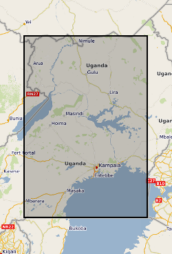
This dataset provides the field data collected in 2016 to assess the functionality and performance of 600 handpumped borehole supplies (HPBs) across the three countries, Ethiopia, Malawi and Uganda, and the capacity of the community water management arrangements. The individual HPBs surveyed in the dataset were selected by a two or three stage randomised sampling approach. The UPGro Hidden Crisis project (2015-20) was an international research project aimed at developing a robust evidence base and understanding of the complex and multi-faceted causes which underlie the current high failure rates of many new groundwater supplies in Africa. The project was jointly funded by: DFID, NERC and ESRC as part of the UPGro programme. The project carried out the research work in three countries - Ethiopia, Malawi and Uganda – to examine functionality and performance of groundwater supplies in a range of hydrogeological, climatic and social, institutional and governance environments in East Africa. The work focused specifically on examining the functionality of HPBs – these being the main form of improved community water supply across rural Africa. The Survey 1 dataset, is major dataset developed by the project.
-

PROJECT DETAILS ONLY - NO DATA. The most sustained steep increase in marine biodiversity took place during the Ordovician. The variety of biogeographical and palaeoecological settings in the British Isles, the historical type area for the Ordovician, makes this a crucial area for understanding the patterns and processes of biodiversity change. Databases on well-constrained spatial and temporal distributions of organisms will be compiled and analysed to answer a series of pertinent questions on the timing, patterns and controls of biodiversity increase and also its implications for the end-Ordovician extinction event. The understanding of these issues will contribute directly and significantly to the global analysis of Ordovician biodiversity change
-

**Nothing Known About This**Grain size analysis and statistics of Jurassic-Cretaceous and Tertiary sands from East Dorset, the Hampshire Basin and Shaftesbury area. Analysis taken from selected sites therefore not complete cover of the area.
-

This dataset provides a detailed physical science dataset to the groundwater resource and engineering properties of 150 handpumped borehole supplies (HPBs) across Ethiopia, Malawi and Uganda, surveyed in 2017. The dataset includes measurements of aquifer resource potential, groundwater quality, downhole construction and condition of handpump components, and borehole construction. Detailed social science data were also collected as part of the second survey phases of the Hidden Crisis project. However, these data are reported as a separate (associated) dataset to the physical science Survey 2 dataset – and are available from Economic and Social Research Council (ESRC) UK Data Service (UKDS). The Hidden Crisis project (2015-20) was an international research project aimed at developing a robust evidence base and understanding of the complex and multi-faceted causes which underlie the current high failure rates of many new groundwater supplies in Africa. The project was jointly funded by: DFID, NERC and ESRC as part of the UPGro programme. The project carried out the research work in three countries - Ethiopia, Malawi and Uganda – to examine functionality and performance of groundwater supplies in a range of hydrogeological, climatic and social, institutional and governance environments in East Africa. The work focused specifically on examining the functionality of HPBs – these being the main form of improved community water supply across rural Africa. The Survey 2 dataset, is major dataset developed by the project.
-
The WellMaster database holds hydrogeological information on water wells for wells and boreholes identified within the Single Onshore Borehole Index (SOBI) within England Wales and Scotland. The database contains index details supplementary to SOBI, including information on the availability of more detailed hydrogeological information. Four main categories of data are held within the database; lithostratigraphic details, well/borehole construction including casing and screens, water information including depths and pumping rates and water quality information.
-

Data relating to the investigation of landfill sites and associated pollution from sites in the UK, Southern Europe, South America, Africa and S.E.Asia. Data include borehole information, lithological information, geology, hydrochemistry, hydrology and analytical results of samples.
-

Data related to contaminated land projects completed under commercial contract for local authorities (ConSEPT). The data held and used in the project included published BGS data (borehole, BGS Geology 50k and 10k, water well information), as well as third party data held on behalf of local authorities (including current and historical land use polygons and landfill sites) for the purposes of building the ConSEPT GIS. Consequently some data and the projects are strictly commercial in confidence and should not be shared.
-
The database contains a range of geochemical data for metamorphosed limestones from the Dalradian of Scotland and Northern Ireland. The data include a) whole-rock geochemical analyses by XRF (X-Ray Fluorescence) for major oxides and a range of trace elements for several hundred samples, b) a number of whole-carbonate O (oxygen) and C (carbon) stable isotope and Sr (strontium) data, c) electron microprobe mineral data on carbonates and calc-silicate minerals and d) ion-probe O stable isotope and mineral trace element data for calcites in a small number of samples. The samples from which the data have been derived were collected from a wide range of outcrops within the Scottish and Irish Dalradian, mainly concentrated in the North East Grampian Highlands of Scotland. The data have been collected mainly to support the mapping and scientific work being undertaken in the Grampian Highlands by BGS since the early 1980s. The database includes some data from the literature. All samples are located by British National Grid coordinates to the nearest 10m or better. The isotope data were acquired as part of a PhD study by C W Thomas in the late 1990s. The database is not currently being added to, but is still being used in various studies. The combined data provide wide-ranging insights into marine chemistry contemporary with deposition of the limestones and the way in which this chemistry changed with time during the Neoproterozoic, and they elucidate subsequent effects of diagenesis and metamorphism and the outcrop and grain-scale. The data set is largely complete with regard to geochemical data, but still requires some editing to bring all fields up to date, particularly with regard to lithostratigraphical assignation. The data are currently held in MS Access tables and can conveniently be displayed via GIS or abstracted in tabular form and used in spreadsheets, statistical analysis and graphing software.