RiSCAN
Type of resources
Available actions
Topics
Keywords
Contact for the resource
Provided by
Years
Formats
Update frequencies
-

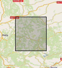
Terrestrial laser scanning datasets (including GPS data for georeferencing), and field photographs collected during the 2016 Central Italian Earthquake sequence. Data were collected from multiple localities to capture the co- seismic near-fault deformation along the earthquake surface ruptures from the 30th Oct Norcia Earthquake. See the scan_data.xlsx for individual details of each laser scan location, and readme.txt for a complete description. In each scan site folder you can find the unprocessed raw files and processed ascii files. Field photographs taken at the site and in the aftermath of the 2016 Norcia Earthquake (30th October 2016, Mw6.6) are provided. Relevant references are: Wilkinson, MW, KJW McCaffrey, RR Jones, GP Roberts, RE Holdsworth, LC Gregory, RJ Walters, LNJ Wedmore, H Goodall, F Iezzi (2017). Near-field fault slip of the 2016 Vettore Mw 6.6 earthquake (Central Italy) measured using low-cost GNSS. Scientific Reports 7: 4612. Walters, RJ, LC Gregory, LNJ Wedmore, TJ Craig, K McCaffrey, M Wilkinson, J Chen, Z Li, JR Elliott, H Goodall, F Iezzi, F Livio, AM Michetti, G Roberts, E Vittori (2018). Dual control of fault intersections on stop-start rupture in the 2016 Central Italy seismic sequence. Earth and Planetary Science Letters 500, 1-14. Wedmore, LNJ, LC Gregory, KJW McCaffrey, H Goodall, RJ Walters (in review). Partitioned off-fault deformation in the 2016 Norcia earthquake captured by differential terrestrial laser scanning. Submitted to Geophysical Research Letters (directly related to this dataset). The dataset will also be available on opentopography.com once the above paper is accepted.
 NERC Data Catalogue Service