 NERC Data Catalogue Service
Oil shale
Type of resources
Available actions
Topics
Keywords
Contact for the resource
Provided by
Years
Formats
Representation types
Update frequencies
Scale
-

[This metadata record has been superseded, see http://data.bgs.ac.uk/id/dataHolding/13606289] Scanned images of 78 maps covering 13 National Grid 1:10,560 map areas in the area of the Lothian oil-shale field. Each map shows the extent of a single oil shale seam. They were published between 1977 and 1982 by the Institute of Geological Sciences in Edinburgh. The original maps were scanned in 2014.
-
The collection includes colour microfilm aperture card copies of 7,170 plans of mine workings for coal and oil shale dating from 1872 onwards deposited on abandonment of a mine in compliance with the Coal Mines Regulation Act. An additional c.5,000 coal 'working' plans, mostly pre-dating 1872, formerly belonging to British Coal, have been added to the abandonment plan collection. The latter are held as black & white microfilm aperture cards. The collection includes plans of workings for other minerals, notably ironstone, where worked with coal. The microfilms are held on behalf of the Coal Authority who hold the original plans on behalf of the Health & Safety Executive (HSE). Original plans are held by the Coal Authority, Mansfield. No complete digital index held by BGS. An up to date finding aid is provided by the Coal Authority's paper 'Catalogue of Plans of Abandoned Mines'. The collection is believed to be fairly complete for mines abandoned since the 1872 Act. Plans were added from the British Coal plan collections to fill gaps in holdings, particularly for mines abandoned prior to 1872. Relates to coalfield areas of Central Scotland.
-

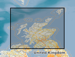
A collection of seventy-eight maps covering thirteen National Grid 1:10 560 map sheets in the area of the Lothian oil shale field published between 1977 and 1982. Each map shows the extent of a single oil shale seam. An oil shale seam refers to a layer or deposit of sedimentary rock rich in organic material known as kerogen, which has the potential to yield hydrocarbons such as oil and gas through a process called pyrolysis. Oil shale is different from conventional oil and gas reservoirs in that the hydrocarbons are not present in a liquid or gaseous form but are trapped within the solid structure of the shale rock. The maps were published by the Institute of the Geological Sciences in Edinburgh (previous name for the British Geological Survey). This entry relates to hardcopy maps stored in the National Geological Data Centre (NGDC) and digital files produced by scanning them, as well as any derivative files. These maps are hard-copy paper records stored in the National Geoscience Data Centre (NGDC).
-
Mining hazard (not including coal) summarises the location, extent and indicates the level of hazard associated with former and present underground mine workings. The dataset covers Great Britain and is published at 1: 50 000 scale. The content is derived from a range of data sources including, but not limited to the bedrock geology, extensive literature reviews of both published and unpublished documents, abandonment and mine plans, combined with a wealth of expert knowledge and experience. The release of version 8 builds on the content of previously published versions. The coverage has been expanded with the inclusion of newly identified areas and drawing on data from the BGS published Britpits (BGS database of British Pits -includes both surface and underground mineral workings) and other resources. For the first time, zones of influence have been integrated (for evaporites, oil shales and building stones) to indicate the areas surrounding mining sites which might be impacted. The data have been compiled and presented in an easy to use format to provide a national overview of the country's mining legacy. Given the long and complex mining history of Great Britain, this dataset represents the best information available at the present time (September 2020). Work continues to develop this product, which will result in the release of ad hoc updates in the future.