Agriculture
Type of resources
Available actions
Topics
Keywords
Contact for the resource
Provided by
Years
Representation types
Update frequencies
-

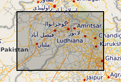
The groundwater systems of northwest India and central Pakistan are amongst the most heavily exploited in the world. Groundwater has been monitored in the region for more than a century resulting in a unique long-term record of groundwater level change. The BGS has compiled groundwater level data from northwest India (Haryana and Punjab) and Pakistan (Punjab) between 1884 and 2020. The dataset, presented here, was compiled from various sources between 2018 and 2020. The excel file consists of two tabs both containing groundwater level data (in metres below ground level) and location information. In the first tab (Full_dataset), which contains the full dataset, there are 68783 rows of observed groundwater level data from 4028 individual sites. In the second tab (LTS) there are 7547 rows of groundwater level observations from 130 individual sites, which have water level data available for a period of more than 40 years and from which at least two thirds of the annual observations are available.
 NERC Data Catalogue Service