 NERC Data Catalogue Service
Groundwater recharge in Africa from ground based measurements (NERC Grant NE/L002035/1)
Simple
- Date (Publication)
- 2020-11-19
0115 936 3276
0115 936 3276
- Maintenance and update frequency
- notApplicable notApplicable
- GEMET - INSPIRE themes, version 1.0
- BGS Thesaurus of Geosciences
-
- Ground water recharge
- Climatology
- Groundwater
- dataCentre
- Keywords
-
- NERC_DDC
- Access constraints
- otherRestrictions Other restrictions
- Other constraints
- licenceOGL
- Use constraints
- otherRestrictions Other restrictions
- Other constraints
- The copyright of materials derived from the British Geological Survey's work is vested in the Natural Environment Research Council [NERC]. No part of this work may be reproduced or transmitted in any form or by any means, or stored in a retrieval system of any nature, without the prior permission of the copyright holder, via the BGS Intellectual Property Rights Manager. Use by customers of information provided by the BGS, is at the customer's own risk. In view of the disparate sources of information at BGS's disposal, including such material donated to BGS, that BGS accepts in good faith as being accurate, the Natural Environment Research Council (NERC) gives no warranty, expressed or implied, as to the quality or accuracy of the information supplied, or to the information's suitability for any use. NERC/BGS accepts no liability whatever in respect of loss, damage, injury or other occurence however caused.
- Other constraints
- Available under the Open Government Licence subject to the following acknowledgement accompanying the reproduced NERC materials "Contains NERC materials ©NERC [year]"
- Spatial representation type
- textTable Text, table
- Metadata language
- EnglishEnglish
- Topic category
-
- Geoscientific information
- Geographic identifier
-
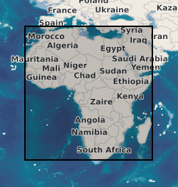
AFRICA [id=600000]
- Date (Creation)
- 1979
))
- Begin date
- 1970-01-01
- End date
- 2020-01-01
- Unique resource identifier
- WGS 84 (EPSG::4326)
- Distribution format
-
-
Microsoft Excel
(
witheld
)
-
GIS files (ESRI layer package; *.BIL; *.TIF)
()
-
Microsoft Excel
(
witheld
)
0115 936 3276
- OnLine resource
- Data ( WWW:DOWNLOAD-1.0-http--download )
- OnLine resource
-
Citation Information - Digital Object Identifier (DOI)
(
WWW:LINK-1.0-http--related
)
MacDonald, A.M., Lark, R.M., Taylor, R.G., Abiye, T., Fallas, H.C., Favreau, G., Goni, I.B., Kebede, S., Scanlon, B.R., Sorenson, J.P.R., Tijani, M., Upton, K.A., West, C. (2020). Groundwater recharge in Africa from ground based measurements. British Geological Survey. (Dataset). https://doi.org/10.5285/45d2b71c-d413-44d4-8b4b-6190527912ff
- Hierarchy level
- dataset Dataset
- Other
- dataset
Conformance result
- Date (Publication)
- 2011
- Explanation
- See the referenced specification
- Pass
- No
Conformance result
- Date (Publication)
- 2010-12-08
- Explanation
- See http://eur-lex.europa.eu/LexUriServ/LexUriServ.do?uri=OJ:L:2010:323:0011:0102:EN:PDF
- Pass
- No
- Statement
- The methodology for generating the dataset (both map and database) are recorded in MacDonald et al. 2020. Mapping groundwater recharge in Africa from ground observations and implications for water security. Environmental Research Letters
- File identifier
- b46455ac-04a1-4a76-e054-002128a47908 XML
- Metadata language
- EnglishEnglish
- Hierarchy level
- dataset Dataset
- Date stamp
- 2026-05-03
- Metadata standard name
- UK GEMINI
- Metadata standard version
- 2.3
- Dataset URI
- http://data.bgs.ac.uk/id/dataHolding/13607685
Overviews
Spatial extent
Provided by
