 NERC Data Catalogue Service
Permeability Dataset for Great Britain (Bedrock)
The data comprises a GIS layer representing the permeability of bedrock for Great Britain The permeability data has been derived from DiGMap-GB (Digital Geological Map Data of Great Britain), and therefore reflects the scale of DiGMap-GB. For the majority of the Great Britain, the scale is 1:50,000, however in areas where the geology is not mapped to this scale, 1:250,000 data are. The data is updated annually, or after a major new release of DiGMap-GB. The permeability data describes the fresh water flow through geological deposits and the ability of a lithostratigraphical unit to transmit water. Maximum and minimum permeability indices are given for each geological unit to indicate the range in permeability likely to be encountered and the predominant flow mechanism (fracture or intergranular). Neither of the assigned values takes into account the thickness of either the unsaturated or saturated part of the lithostratigraphical unit. The data can be used freely internally, but is licensed for commercial use. It is best displayed using a desktop GIS, and is available in vector format as ESRI shapefiles and MapInfo TAB files.
Simple
- Date (Creation)
- 2005-07-29
Distributor
British Geological Survey
-
Enquiries
01491 692345
Maclean Building, Crowmarsh Gifford
,
WALLINGFORD
,
OXON
,
OX10 8BB
,
United Kingdom
01491 838800
01491 692345
Point of contact
British Geological Survey
-
Enquiries
01491 692345
Maclean Building, Crowmarsh Gifford
,
WALLINGFORD
,
OXON
,
OX10 8BB
,
United Kingdom
01491 838800
01491 692345
Custodian
British Geological Survey
-
Enquiries
01491 692345
Maclean Building, Crowmarsh Gifford
,
WALLINGFORD
,
OXON
,
OX10 8BB
,
United Kingdom
01491 838800
01491 692345
- Maintenance and update frequency
- annually Annually
- GEMET - INSPIRE themes, version 1.0
- BGS Thesaurus of Geosciences
-
- Ground water movement
- Hydrogeology
- UK Location (INSPIRE)
- Permeability
- dataCentre
- Keywords
-
- NERC_DDC
- Access constraints
- otherRestrictions Other restrictions
- Other constraints
- license
- Other constraints
- Data can be used internally, but is licensed for commercial use.
- Use constraints
- otherRestrictions Other restrictions
- Other constraints
- The copyright of materials derived from the British Geological Survey's work is vested in the Natural Environment Research Council [NERC]. No part of this work may be reproduced or transmitted in any form or by any means, or stored in a retrieval system of any nature, without the prior permission of the copyright holder, via the BGS Intellectual Property Rights Manager. Use by customers of information provided by the BGS, is at the customer's own risk. In view of the disparate sources of information at BGS's disposal, including such material donated to BGS, that BGS accepts in good faith as being accurate, the Natural Environment Research Council (NERC) gives no warranty, expressed or implied, as to the quality or accuracy of the information supplied, or to the information's suitability for any use. NERC/BGS accepts no liability whatever in respect of loss, damage, injury or other occurence however caused.
- Other constraints
- The dataset is made available to external clients under BGS Digital Data Licence terms and conditions. Revert to the IPR Section (iprdigital@bgs.ac.uk ) if further advice is required with regard to permitted usage.
- Other constraints
- Either: (i) the dataset is made freely available, e.g. via the Internet, for a restricted category of use (e.g. educational use only); or (ii) the dataset has not been formally approved by BGS for access and use by external clients under licence, but its use may be permitted under alternative formal arrangements; or (iii) the dataset contains 3rd party data or information obtained by BGS under terms and conditions that must be consulted in order to determine the permitted usage of the dataset. Refer to the BGS staff member responsible for the creation of the dataset if further advice is required. He / she should be familiar with the composition of the dataset, particularly with regard to 3rd party IPR contained in it, and any resultant use restrictions. This staff member should revert to the IPR Section (ipr@bgs.ac.uk ) for advice, should the position not be clear.
- Spatial representation type
- vector Vector
- Denominator
- 50000
- Metadata language
- EnglishEnglish
- Topic category
-
- Geoscientific information
- Geographic identifier
-
GBN
- Date (Revision)
- 2009
- Geographic identifier
-
GREAT BRITAIN [id=139600]
- Date (Creation)
- 1979
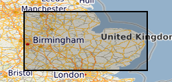
N
S
E
W
))
- Begin date
- 2005 Before
- Supplemental Information
- No new data captured but an interpretation of existing data, DiGMap-GB, that is under continuing revision.
- Unique resource identifier
- OSGB 1936 / British National Grid (EPSG::27700)
- Distribution format
-
-
ESRI Shapefile
(
1994
)
-
MapInfo (TAB)
()
-
ESRI Shapefile
(
1994
)
Distributor
British Geological Survey
-
Enquiries
01491 692345
Maclean Building, Crowmarsh Gifford
,
WALLINGFORD
,
OXON
,
OX10 8BB
,
United Kingdom
01491 838800
01491 692345
- OnLine resource
-
BGS Datasets - Permeability
(
WWW:LINK-1.0-http--link
)
Resource page for dataset with contact and licensing details
- Hierarchy level
- dataset Dataset
Conformance result
- Date (Publication)
- 2011
- Explanation
- See the referenced specification
- Pass
- No
Conformance result
- Date (Publication)
- 2010-12-08
- Explanation
- See http://eur-lex.europa.eu/LexUriServ/LexUriServ.do?uri=OJ:L:2010:323:0011:0102:EN:PDF
- Pass
- No
- Statement
- The data is derived from DiGMap-GB. DiGMap-50 was used where available, and in the areas where there was no 1:50,000 coverage, DiGMap-250 was used in its place. Each lithology that occurred in DiGMap-GB was reattributed with permeability data. The maximum and minimum permeability indices were given for each geological unit along with the predominant flow mechanism. Hydrogeologists from BGS Wallingford and Edinburgh completed the attribution in Microsoft Access. This data was then joined to the DiGMap-GB GIS data in ESRI's ArcGIS. The permeability data layers were split into ten geographical areas to make them easier to display and interrogate. These include England and Wales - South East, England and Wales - South West, England and Wales - East Midlands, England and Wales - West Midlands and Wales, England and Wales - North East, England and Wales - North West, Scotland - East, Scotland - West, Scotland - North East, and Scotland - North West.
- File identifier
- 9df8df52-d60f-37a8-e044-0003ba9b0d98 XML
- Metadata language
- EnglishEnglish
- Hierarchy level
- dataset Dataset
- Date stamp
- 2025-12-14
- Metadata standard name
- UK GEMINI
- Metadata standard version
- 2.3
Point of contact
British Geological Survey
Maclean Building, Crowmarsh Gifford
,
WALLINGFORD
,
OXON
,
OX10 8BB
,
United Kingdom
+44 115 936 3100
- Dataset URI
- http://data.bgs.ac.uk/id/dataHolding/13603036
Overviews
Spatial extent
N
S
E
W
Provided by

Associated resources
Not available