 NERC Data Catalogue Service
Ship data from Tasman and Coral Seas 2019 (NERC Grant NE/S01067X/1)
Simple
- Date (Creation)
- 2023-06-23
- Maintenance and update frequency
- notApplicable notApplicable
- GEMET - INSPIRE themes, version 1.0
- BGS Thesaurus of Geosciences
-
- Bathymetry
- Gravity
- Rock samples
- Magnetic data
- Geochemistry
- Seamounts
- X ray fluorescence spectroscopy
- dataCentre
- Keywords
-
- NERC_DDC
- Access constraints
- otherRestrictions Other restrictions
- Other constraints
- no limitations
- Other constraints
- The dataset is made freely available for access, e.g. via the Internet. Either no third party data / information is contained in the dataset or BGS has secured written permission from the owner(s) of any third party data / information contained in the dataset to make the dataset freely accessible.
- Use constraints
- otherRestrictions Other restrictions
- Other constraints
- The copyright of materials derived from the British Geological Survey's work is vested in the Natural Environment Research Council [NERC]. No part of this work may be reproduced or transmitted in any form or by any means, or stored in a retrieval system of any nature, without the prior permission of the copyright holder, via the BGS Intellectual Property Rights Manager. Use by customers of information provided by the BGS, is at the customer's own risk. In view of the disparate sources of information at BGS's disposal, including such material donated to BGS, that BGS accepts in good faith as being accurate, the Natural Environment Research Council (NERC) gives no warranty, expressed or implied, as to the quality or accuracy of the information supplied, or to the information's suitability for any use. NERC/BGS accepts no liability whatever in respect of loss, damage, injury or other occurence however caused.
- Other constraints
- There are no restrictions on the use that may be made of the dataset, although an appropriate copyright acknowledgement must be made when any part of the dataset is reproduced. Either no third party data / information is contained in the dataset or BGS has secured written permission from the owner of any third party data / information contained in the dataset to make the dataset freely available without any use constraints - inclusion of any third party data / information will affect the copyright acknowledgement that needs to be made.
- Spatial representation type
- vector Vector
- Metadata language
- EnglishEnglish
- Topic category
-
- Geoscientific information
- Geographic identifier
-
CORAL SEA [id=2001359]
- Date (Revision)
- 2010
- Geographic identifier
-
TASMAN SEA [id=2001476]
- Date (Revision)
- 2010
))
- Begin date
- 2019-08-07
- End date
- 2022-06-15
- Unique resource identifier
- WGS 84 (EPSG::4326)
- Distribution format
-
-
Image (JPEG)
()
-
WCD
(
witheld
)
-
ALL
(
witheld
)
-
ABS
(
witheld
)
-
DAT
(
witheld
)
-
ENV
(
witheld
)
-
Text file (TXT)
(
witheld
)
-
Microsoft Excel
(
witheld
)
-
SEG-Y
(
witheld
)
-
RAW
(
witheld
)
-
PDF
(
witheld
)
-
Image (JPEG)
()
- OnLine resource
- Data ( WWW:DOWNLOAD-1.0-http--download )
- Hierarchy level
- dataset Dataset
- Other
- dataset
Conformance result
- Date (Publication)
- 2011
- Explanation
- See the referenced specification
- Pass
- No
Conformance result
- Date (Publication)
- 2010-12-08
- Explanation
- See http://eur-lex.europa.eu/LexUriServ/LexUriServ.do?uri=OJ:L:2010:323:0011:0102:EN:PDF
- Pass
- No
- Statement
- Primary ship data collected include multibeam echosounder bathymetry data, dredge samples, magnetic data, gravity data, and sub-bottom profiler data, together with a suite of underway measurements. Additional routine measurements not directly relevant to the NERC-funded project associated with this voyage (e.g., current data, sea surface temperature data, radon data) as well as data from piggyback projects (e.g., seabird data) are not included here, but may be available from CSIRO.
- File identifier
- 00d7f66c-6296-23b0-e063-0937940aa575 XML
- Metadata language
- EnglishEnglish
- Hierarchy level
- dataset Dataset
- Date stamp
- 2026-05-03
- Metadata standard name
- UK GEMINI
- Metadata standard version
- 2.3
- Dataset URI
- http://data.bgs.ac.uk/id/dataHolding/13608090
Overviews
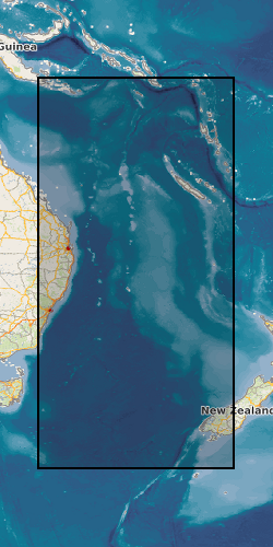
Spatial extent
Provided by
