NERC Data Catalogue Service
BGS Offshore Bedrock 250k version 3.0
Default
Identification info
- Alternative title
- DiGRock250k
- Metadata Language
- English (en)
- Dataset Reference Date ()
- 2013
0115 936 3276
0115 936 3276
- Maintenance and update frequency
- asNeeded
- GEMET - INSPIRE themes, version 1.0
- BGS Thesaurus of Geosciences
-
- Continental shelf
- Geology
- Digital maps
- Marine geology
- GIS
- Maps
- Data
- MEDIN
- Bed rock
- UK Location (INSPIRE)
- Keywords ()
- Keywords
-
- NERC_DDC
- Limitations on Public Access
- otherRestrictions
- Other constraints
- license
- Use constraints
- otherRestrictions
- Other constraints
- The copyright of materials derived from the British Geological Survey's work is vested in the Natural Environment Research Council [NERC]. No part of this work may be reproduced or transmitted in any form or by any means, or stored in a retrieval system of any nature, without the prior permission of the copyright holder, via the BGS Intellectual Property Rights Manager. Use by customers of information provided by the BGS, is at the customer's own risk. In view of the disparate sources of information at BGS's disposal, including such material donated to BGS, that BGS accepts in good faith as being accurate, the Natural Environment Research Council (NERC) gives no warranty, expressed or implied, as to the quality or accuracy of the information supplied, or to the information's suitability for any use. NERC/BGS accepts no liability whatever in respect of loss, damage, injury or other occurence however caused.
- Other constraints
- The dataset is made available to external clients under BGS Digital Data Licence terms and conditions. Revert to the IPR Section (iprdigital@bgs.ac.uk ) if further advice is required with regard to permitted usage.
- Spatial representation type
- vector
- Denominator
- 250000
- Topic category
-
- Geoscientific information
- Extent
-
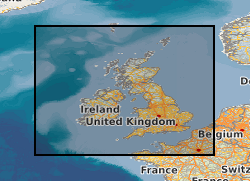
UK CONTINENTAL SHELF [id=121701]
- Dataset Reference Date ()
- 1979
))
- Begin date
- 2013-10
- End date
- 2013-10
- Code
- WGS 84 (EPSG::4326)
Distribution Information
- Data format
-
-
MapInfo - .tab
(
Current BGS version
)
-
ArcGIS - shapefiles
(
Current BGS version
)
-
Other formats available on request
()
-
MapInfo - .tab
(
Current BGS version
)
- Resource Locator
-
BGS Datasets - Offshore bedrock 250k Homepage
This page provides further information about the BGS Offshore Bedrock 250k dataset including a user guide, details about licensing and sample data.
- Resource Locator
- Digital Object Identifier (DOI)
- Resource Locator
-
BGS Datasets - Offshore bedrock 250k Homepage
This page provides further information about the BGS Offshore Bedrock 250k dataset including a user guide, details about licensing and sample data.
- Resource Locator
- Digital Object Identifier (DOI)
- Quality Scope
- dataset
- Other
- dataset
Report
- Dataset Reference Date ()
- 2011
- Explanation
- See the referenced specification
- Degree
Report
- Dataset Reference Date ()
- 2010-12-08
- Explanation
- See http://eur-lex.europa.eu/LexUriServ/LexUriServ.do?uri=OJ:L:2010:323:0011:0102:EN:PDF
- Degree
- Statement
- The offshore bedrock geology was mapped using a range of remotely sensed (e.g. seismic, side scan sonar) and physical ground truthing data (e.g. boreholes, cores). This mapping was first published in printed form on the bedrock offshore 1:250 000 map series (known as Solid Geology). Using Universal Transverse Mercator projection, each sheet covers an area of 1 degree of latitude by 2 degrees of longitude. The printed maps are still available via the BGS Bookshop. The geological linework used to create the paper maps was used as the basis for the first version of this dataset (then call DiGRock250k). The second version of this dataset was released in 2007 (known as DiGRock250k v.2). The principle objective of this revision and geological checking was to remove, as much as possible, join-up issues between the various ‘sheet’ areas, inherited from the sequentially published paper maps. In 2013, the dataset was put through a further comprehensive geological and GIS checking process to create the third and current version (then named DiGRock250k v.3).
Metadata
- File identifier
- e605cf9b-7fb3-0431-e044-0003ba9b0d98 XML
- Metadata Language
- English (en)
- Resource type
- dataset
- Metadata Date
- 2024-04-24
- Metadata standard name
- UK GEMINI
- Metadata standard version
- 2.3