 NERC Data Catalogue Service
UK continental shelf seabed sediments (1:1 million scale)
UK continental shelf seabed sediment data at 1:1 million scale. This data layer is the BGS contribution to the OneGeology project, providing UK onshore geological data at 1:625 000 scale and UK continental shelf seabed sediment data at 1:1 million scale.
INSPIRE
Identification
- File identifier
- 9df8df52-d786-37a8-e044-0003ba9b0d98 XML
- Resource type
- dataset
Online resource
Resource identifier
- Metadata Language
- English (en)
- Spatial representation type
- vector
Encoding
- Format
- ESRI Shapefile
Projection
Classification of data and services
- Topic category
-
- Geoscientific information
Classification of data and services
Coupled resource
Coupled resource
Classification of data and services
Coupled resource
Coupled resource
Keywords
- GEMET - INSPIRE themes, version 1.0
- BGS Thesaurus of Geosciences
-
- Maps
- Scottish SDI
- Geology
- Data
- Geological age
- UK Location (INSPIRE)
- GIS
- Digital maps
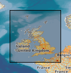
Geographic coverage
N
S
E
W
))
N
S
E
W
))
N
S
E
W
))
Temporal reference
Temporal extent
Temporal extent
- Dataset Reference Date ()
- 1995
Quality and validity
- Lineage
- The data shows polygonal and selected linear geological information, sourced from published BGS 1:625 000 scale maps.
- Denominator
- 1000000
Conformity
Conformity
Conformity
Conformity
Conformity
Conformity
- Explanation
- See the referenced specification
Restrictions on access and use
- Access constraints
- licenceOGL
- Access constraints
- Available under the Open Government Licence subject to the following acknowledgement accompanying the reproduced NERC materials "Contains NERC materials ©NERC [year]"
- Access constraints
- The copyright of materials derived from the British Geological Survey's work is vested in the Natural Environment Research Council [NERC]. No part of this work may be reproduced or transmitted in any form or by any means, or stored in a retrieval system of any nature, without the prior permission of the copyright holder, via the BGS Intellectual Property Rights Manager. Use by customers of information provided by the BGS, is at the customer's own risk. In view of the disparate sources of information at BGS's disposal, including such material donated to BGS, that BGS accepts in good faith as being accurate, the Natural Environment Research Council (NERC) gives no warranty, expressed or implied, as to the quality or accuracy of the information supplied, or to the information's suitability for any use. NERC/BGS accepts no liability whatever in respect of loss, damage, injury or other occurence however caused.
- Access constraints
- Available under the Open Government Licence subject to the following acknowledgement accompanying the reproduced NERC materials "Contains NERC materials ©NERC [year]"
Responsible organization (s)
Contact for the resource
- Organisation name
- British Geological Survey
- not available
- Organisation name
- British Geological Survey
- not available
Responsible organization (s)
Contact for the resource
- Organisation name
- British Geological Survey
- not available
- Organisation name
- British Geological Survey
- not available
Metadata information
Contact for the metadata
- Organisation name
- British Geological Survey
- enquiries@bgs.ac.uk
- Metadata Date
- 2024-04-24
- Metadata Language
- English (en)
SDS
Conformance class 1: invocable
Access Point URL
Endpoint URL
Technical specification
Conformance class 2: interoperable
Access constraints
Limitation
Use constraints
Limitation
Responsible custodian
Contact for the resource
Overviews
N
S
E
W
N
S
E
W
N
S
E
W
Publishing Body

Associated resources (if any)
Not available