NERC Data Catalogue Service
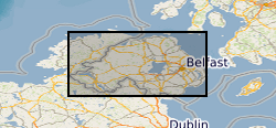
Public Health England(PHE) - Geological Survey of Northern Ireland(GSNI) - British Geological Survey(BGS) Joint Indicative Atlas of Radon in Northern Ireland
The joint PHE-GSNI-BGS digital Indicative Atlas of Radon in Northern Ireland presents an overview of the results of detailed mapping of radon potential, defined as the estimated percentage of homes in an area above the radon Action Level. The Indicative Atlas of Radon in Northern Ireland presents a simplified version of the Radon Potential Dataset for Northern Ireland, with each 1-km grid square being classed according to the highest radon potential found within it, so is indicative rather than definitive. The Radon Potential Dataset for Northern Ireland provides the current definitive map of radon Affected Areas in Northern Ireland. The Indicative Atlas of Radon in Northern Ireland is published in Z Daraktchieva, J D Appleton, D M Rees, K A M Adlam, A H Myers, S A Hodgson, N P McColl, G R Wasson and L J Peake, 2015. Indicative Atlas of Radon in Northern Ireland. PHE-CRCE-017, 22 pp. Radon is a natural radioactive gas, which enters buildings from the ground. Exposure to high concentrations increases the risk of lung cancer. Public Health England (PHE) recommends that radon levels should be reduced in homes where the annual average exceed 200 becquerels per cubic metre (200 Bq m-3), the radon Action Level. Public Health England defines radon Affected Areas as those with 1% chance or more of a house having a radon concentration exceeding the Action Level.
Default
Identification info
- Alternative title
- Radon NI V1 indicative atlas
- Metadata Language
- English (en)
- Dataset Reference Date ()
- 2015-07-27
British Geological Survey
-
Enquiries
0115 936 3276
Environmental Science Centre, Nicker Hill, Keyworth
,
NOTTINGHAM
,
NOTTINGHAMSHIRE
,
NG12 5GG
,
United Kingdom
0115 936 3143
0115 936 3276
British Geological Survey
-
Enquiries
0115 936 3276
Environmental Science Centre, Nicker Hill, Keyworth
,
NOTTINGHAM
,
NOTTINGHAMSHIRE
,
NG12 5GG
,
United Kingdom
0115 936 3143
0115 936 3276
British Geological Survey
-
Enquiries
0115 936 3276
Environmental Science Centre, Nicker Hill, Keyworth
,
NOTTINGHAM
,
NOTTINGHAMSHIRE
,
NG12 5GG
,
United Kingdom
0115 936 3143
0115 936 3276
British Geological Survey
-
Enquiries
0115 936 3276
Environmental Science Centre, Nicker Hill, Keyworth
,
NOTTINGHAM
,
NOTTINGHAMSHIRE
,
NG12 5GG
,
United Kingdom
0115 936 3143
0115 936 3276
British Geological Survey
-
Enquiries
0115 936 3276
Environmental Science Centre, Nicker Hill, Keyworth
,
NOTTINGHAM
,
NOTTINGHAMSHIRE
,
NG12 5GG
,
United Kingdom
0115 936 3143
0115 936 3276
- Maintenance and update frequency
- asNeeded
- GEMET - INSPIRE themes, version 1.0
- BGS Thesaurus of Geosciences
-
- UK Location (INSPIRE)
- Natural hazards
- Keywords ()
- Keywords
-
- NERC_DDC
- Limitations on Public Access
- otherRestrictions
- Other constraints
- restricted
- Use constraints
- otherRestrictions
- Other constraints
- The copyright of materials derived from the British Geological Survey's work is vested in the Natural Environment Research Council [NERC]. No part of this work may be reproduced or transmitted in any form or by any means, or stored in a retrieval system of any nature, without the prior permission of the copyright holder, via the BGS Intellectual Property Rights Manager. Use by customers of information provided by the BGS, is at the customer's own risk. In view of the disparate sources of information at BGS's disposal, including such material donated to BGS, that BGS accepts in good faith as being accurate, the Natural Environment Research Council (NERC) gives no warranty, expressed or implied, as to the quality or accuracy of the information supplied, or to the information's suitability for any use. NERC/BGS accepts no liability whatever in respect of loss, damage, injury or other occurence however caused.
- Other constraints
- The dataset is made available to external clients under BGS Digital Data Licence terms and conditions. Revert to the IPR Section (iprdigital@bgs.ac.uk ) if further advice is required with regard to permitted usage.
- Denominator
- 10000
- Topic category
-
- Geoscientific information
- Extent
-
NIR
- Dataset Reference Date ()
- 2009
- Extent
-
NORTHERN IRELAND [id=181000]
- Dataset Reference Date ()
- 1979
N
S
E
W
))
- Begin date
- 1990
- End date
- 2015-07
- Additional information
- The method by which the PHE-GSNI-BGS joint Indicative Atlas of Radon in Northern Ireland was produced is published in: MILES, J.C.H, and APPLETON J.D., 2005. Mapping variation in radon potential both between and within geological units. Journal of Radiological Protection 25, 257-276.
Distribution Information
- Data format
-
- Resource Locator
-
BGS Homepage
(
HTTP
)
The BGS Homepage is an entry point to the BGS data services.
- Resource Locator
-
BGS Homepage
(
HTTP
)
The BGS Homepage is an entry point to the BGS data services.
- Quality Scope
- dataset
- Other
- dataset
Report
- Dataset Reference Date ()
- 2011
- Explanation
- See the referenced specification
- Degree
Report
- Dataset Reference Date ()
- 2010-12-08
- Explanation
- See http://eur-lex.europa.eu/LexUriServ/LexUriServ.do?uri=OJ:L:2010:323:0011:0102:EN:PDF
- Degree
- Statement
- Derivation of radon potential data for Northern Ireland was carried out by the BGS, working in collaboration with the GSNI and the PHE. Finalisation of the data set by BGS was carried out using funding from the BGS Derived Products programme of the Information Products science area and Geochemical Hazards under Hazard Products programme of the Environmental Modelling science area.
Metadata
- File identifier
- 1c78a576-7df3-078d-e054-002128a47908 XML
- Metadata Language
- English (en)
- Resource type
- dataset
- Metadata Date
- 2024-04-24
- Metadata standard name
- UK GEMINI
- Metadata standard version
- 2.3
British Geological Survey
Environmental Science Centre, Keyworth
,
NOTTINGHAM
,
NOTTINGHAMSHIRE
,
NG12 5GG
,
United Kingdom
+44 115 936 3100