 NERC Data Catalogue Service
Water quality
Type of resources
Available actions
Topics
Keywords
Contact for the resource
Provided by
Years
Formats
Representation types
Update frequencies
Scale
-

Measured concentrations of 52 different modern pesticides in both waters and sediments. Collected during routine sampling as part of the PhD project "Assessing the Impacts of Organic and Inorganic Contaminants on British Rivers: from Sediments to Fish". Samples were collected in 2021 and 2022, and pesticides were measured using UPLC-MS/MS at the British Geological Survey. Site coordinates are included in a separate tab. Full detail on sample collection, analytical methodology and data summaries, including interpretations, can be found in the accompanying thesis.
-

The file contain groundwater level/depth (WL), Groundwater and Surface Water Quality data (EC (micro-siemens per centimetre or µS/cm), Temperature (°C) and pH) for 49 points under fortnightly monitoring relevant to Gro for GooD research project in Kwale County, Kenya. Blank - Data not available. Gro for GooD: Groundwater Risk Management for Growth and Development
-
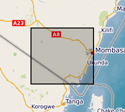
The dataset contains hourly river water level data for 3 monitoring sites; Mukurumudzi River (3KD06 Shimba Hills & KISCOL Weir) Ramisi River (Eshu Bridge) in Kwale County, Kenya
-
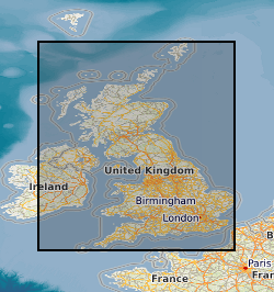
This layer of the map based index (GeoIndex) shows the location of available Hydrogeological Maps which have been published at various scales, covering areas ranging in size from the whole of England and Wales, Northern Ireland and to Jersey. They display information on surface water features, the three dimensional geometry of aquifers, groundwater levels, abstractions and quality including saline intrusion in varying amounts of detail.