Water chemistry
Type of resources
Available actions
Topics
Keywords
Contact for the resource
Provided by
Years
Formats
Representation types
Update frequencies
Service types
Scale
-
This layer of the map based index (GeoIndex) is a map based index of the National Well Record Archive. This index shows the location of water wells along with basic information such as well name, depth and date of drilling. The index is based on the collection of over 105,000 paper records of water wells, springs and water boreholes. Geological information, construction details, water quality data and hydrogeological data may also be available for some water wells. The amount of detail held on individual sites varies widely and certain fields will have an 'unknown' value where the paper records have yet to be checked for their content. The zero values for the depth represent those for which the depth has yet to be entered into the database from the paper records.
-

This data pack contains processed data from straddle packer pump testing of TH0424 ground investigation borehole at the UK Geonergy Observatory at Thornton Science Park, Cheshire during October 2022. TH0424 (BGS borehole reference NG47NW249) is located at NGR Easting: 344965 Northing: 375857 and drilled to a depth of 101.14 mbgl. Full meta data for the test borehole is included in the borehole information pack (https://doi.org/10.5285/badff3b9-8bc8-4897-b324-7f4653fdd214). This dataset is accompanied by BGS open report OR/23/037 (https://nora.nerc.ac.uk/id/eprint/536445/) which provides context, description, and analysis of the data. Data sets included in this data pack: 1) Groundwater level data as measured by downhole transducers in the isolated packer intervals and outside packer intervals for 20 pump tests at various target depths/zones. Level data includes raw level readings as well as barometric pressure readings at surface and barometrically compensated level data. 2) Pump flow rate data during pump tests 3) Event logs including timestamped events such as packer inflation, pump deployment etc. 4) Hydrochemical data from on-site parameter measurements and analysed groundwater samples collected during constant rate pump tests. 5) Coring/drilling log of TH0410 with timestamped coring progress during the pump testing period. This dataset is included as activities at TH0410 during testing are thought to have significantly impacted data quality. 6) Logged abstraction events from the Thornton Science Park abstraction borehole (Borehole reference SJ47NW25, NGR 344950 375500, ~350m south of TH0424) by means of a pressure transducer attached to the borehole headworks. This dataset is included as abstraction of the TSP borehole is known to drawdown groundwater levels in TH0424.
-

Geochemical data, cations, anions and stable and radiogenic strontium isotope data of Nepali rivers collected in 2002 as part of a study now accepted for publication as Stevenson et al. in American Journal of Science. The data set also includes supplementary information with the analytical solutions to the reactive transport equations describing dissolution-reprecipitation reactions in a carbonate matrix, definition of symbols and references that accompany the paper. The paper is authored by Emily Stevenson, Kevin Burton, Ian Parkinson, Rachael James, Basak Kisakürek, Ed Tipper and Mike Bickle.
-

The data release includes surface and groundwater chemistry data from 86 samples (20 surface water, 60 ground water, and 6 ground water duplicates) collected during the baseline water monitoring at the UK Geoenergy Observatories (UKGEOS) Glasgow facility. This release from the British Geological Survey (BGS) covers surface and groundwater samples collected between 14 September 2020 and 20 May 2021 from 6 surface water sites, 5 mine water boreholes, and 5 environmental monitoring boreholes. The samples were then analysed for the concentrations of selected parameters at BGS and other laboratories. It contains a report and 2 data sheets GroundWaterChemData1 and SurfaceWaterChemData2. Version 2 06/09/2023 - Edits made to create consistency with subsequent data release, field included erroneously, removed.
-
Results of two sampling campaigns conducted in Kwale County Kenya in March and June 2016 by GHS/UPC as part of the Gro for GooD project. Water samples from over 79 groundwater and 6 surface water (SW) locations were analysed for major ions, stable isotopes, selected trace constituents, electrical conductivity, nitrates, ammonia, pH, DO (Dissolved Oxygen), Eh (oxidation / reduction potential), Temperature, TOC (Total Organic Carbon) and field alkalinity. Most locations were sampled in both March (dry season) and June (wet season). Geology at each location recorded as follows: P - Pliocene Sands, Pls - Pleistocene Sands, Plc - Pleistocene corals. Reference: First step to understand the importance of new deep aquifer pumping regime in groundwater system in a developing country, Kwale, Kenya; Ferrer et al, Geophysical Research Abstracts, Vol. 18, EGU2016-16969, 2016; http://meetingorganizer.copernicus.org/EGU2016/EGU2016-16969.pdf; https://upgro.files.wordpress.com/2015/09/egu16_groforgood_v1.pdf UPC - The Departement of Civil Enginyering de la Universitat Politecnica de Catalunya GHS - Grupo de Hidrologia Subterranea
-
Cation, anion and Sr isotope data from Nepalese river water. Suspended sediment concentration, suspended sediment chemistry presented as wt% oxides from Nepalese rivers. Both the waters and sediments were collected following the 2015 earthquakes.
-
100,000 paper records of water wells, including details of lithologies, well construction, water levels and yields and water chemistry. Details lodged by drillers under statute. Includes approximately 90% of water boreholes in England & Wales, less in Scotland. There is a high density of information over major aquifers and urban areas with new data added as it is received from drillers and other outside organisations. The level of detail within individual records varies, reflecting historical changes in reporting practices.
-
Data from the British Geological Survey's GeoIndex Geochemistry theme are made available for viewing here. GeoIndex is a website that allows users to search for information about BGS data collections covering the UK and other areas world wide. Access is free, the interface is easy to use, and it has been developed to enable users to check coverage of different types of data and find out some background information about the data. More detailed information can be obtained by further enquiry via the web site: www.bgs.ac.uk/geoindex.
-

The data release includes surface and groundwater chemistry data from 86 samples (20 surface water, 60 ground water, and 6 ground water duplicates) collected during the baseline water monitoring at the UK Geoenergy Observatories (UKGEOS) Glasgow facility. This release from the British Geological Survey (BGS) covers surface and groundwater samples collected between 14 September 2020 and 20 May 2021 from 6 surface water sites, 5 mine water boreholes, and 5 environmental monitoring boreholes. The samples were then analysed for the concentrations of selected parameters at BGS and other laboratories. It contains a report and 2 data sheets GroundWaterChemData1 and SurfaceWaterChemData2. Further details can be found in the accompanying report https://nora.nerc.ac.uk/id/eprint/532731/ . Detailed methodologies are reported in Fordyce (2021, http://nora.nerc.ac.uk/id/eprint/529818/ and Palumbo-Roe (2021, http://nora.nerc.ac.uk/id/eprint/531098/ ).
-
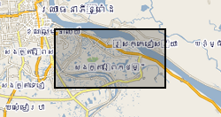
The dataset comprise hydrogeochemical, isotopic and environmental geophysics data from surface waters and groundwater and sediments from scientific boreholes drilled into arsenic-prone aquifers in the Mekong River Basin. The data is divided into 5 categories: Geophysical data Hydrogeochemical data Isotopic data Sedimentary data Outreach and Dissemination Publications to date - open access linkages The data pertain to samples obtained from northern Kandal province just south of Phnom Penh in Cambodia. The data were collected over the period 2013-2016. The hydrogeochemical data were obtained by one of more of (i) in situ analytical techniques; or (ii) instrumental geochemical techniques, notably IC, ICP-AES, ICP-MS and GC-MS in the Manchester Analytical Geochemistry Unit, University of Manchester following methods as described in Richards et al. (2015, 2017). The geophysical data were obtained as described in Uhlemann et al. (2017). The data were obtained as part of a project funded by NERC Standard Research Grant NE/J023833/1 the major purpose of which was to determine the extent to which surface derived organics may be driving arsenic mobilisation in shallow circum-Himalayan aquifers, an exemplar of which is norther Kandal Province's largely Holocene aquifers to which these data refer. The data were obtained and interpreted by the University of Manchester except as follows: environmental geophysics data were obtained and interpreted by Oliver Kuras and Sebastian Uhlemann of the British Geological Survey GTOM team; tritium data were generated by Jurgen Sultenfuss of the University of Bremen; oxygen and hydrogen isotope data by SUERC, East Kilbride and carbon-14 data by the NERC Radiocarbon Laboratory at East Kilbride.
 NERC Data Catalogue Service