 NERC Data Catalogue Service
Top soil
Type of resources
Available actions
Topics
Keywords
Contact for the resource
Provided by
Years
Formats
Representation types
Update frequencies
Scale
-

The UK Compiled Topsoil Dataset (UKTS) is the most extensive topsoil geochemistry dataset for the UK available at the time of release (August 2024). The dataset consists of 82 georeferenced TIFF raster images (GeoTIFF format) with a cell size of 500 x 500 m, displaying the predicted concentrations for 41 chemical elements in UK topsoil and their respective standard error. The dataset is based on the geochemical analyses of 57,966 topsoil samples collected between 1978 and 2014 and analysed by X-Ray Fluorescence spectrometry (XRF). The UKTS was brought together by combining data from the following sources: i. the British Geological Survey’s (BGS) Geochemical Baseline Survey of the Environment (G-BASE) rural and urban topsoil dataset (which accounts for 76.4% of the topsoil samples included in the UKTS) ii. the Geological Survey of Northern Ireland (GSNI) TellusNI rural and urban topsoil geochemical survey dataset (13.8% of the UKTS samples) iii. the BGS-Rothamsted Research X-ray Fluorescence Spectrometry (XRF) rural soil dataset (RR-BGS XRF), based on sub-samples held at Rothamsted Research from the National Soil Inventory (NSI) of England and Wales sample archive, National Soil Resources Institute, Cranfield University (9.8% of the UKTS samples). An atlas of the compiled topsoil concentrations for the UK is available to download (https://nora.nerc.ac.uk/id/eprint/535963) and all maps are available to view within the UK Soil Observatory website (https://www.ukso.org). The dataset covers England, Wales and Northern Ireland, and the Clyde Basin in Scotland. The GeoTIFF raster image maps were produced from the interpolation by ordinary kriging of the concentration values in the source data points, using the geostatistical wizard in the geostatistical analyst toolbox of ESRI ArcGIS 10.8.
-
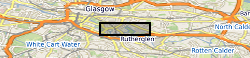
The UK Geoenergy Observatories (UKGEOS) Glasgow facility, baseline soil geochemistry dataset released from the BGS comprises an excel file with two spreadsheets. The first spreadsheet contains information on the chemical composition of 90 topsoil (0 - 20 cm) samples collected from seven initially proposed borehole sites for the UKGEOS Glasgow facility, and from two control sites, in February-March 2018 (03-18). Ten samples were collected from each site prior to installation of the UKGEOS Glasgow facility, and underwent laboratory analysis. Chemical data for pH and the total concentrations of 54 inorganic and 75 organic substances in the soil samples are presented. In addition, the dataset contains locational and descriptive information about the samples noted during sampling. The analyte name, element chemical symbols, analytical method, units of measurement and limits of quantification are recorded in header rows at the top of the spreadsheet. The dataset includes qualifiers, highlighting any quality control issues reported with the data. The data qualifiers are explained in the second spreadsheet released with the data. Further details about the dataset can be found in the accompanying report http://nora.nerc.ac.uk/id/eprint/527798/.
-
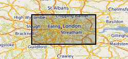
The London Earth data are part of the Geochemical Baseline Survey of the Environment (G-BASE) dataset, a nation-wide project to determine the distribution of chemical elements in the surface environment. London Earth focuses on the soil of the capital city, the limits of the survey being defined by the Greater London Authority (GLA) administrative boundary. Chemical elements have been determined by X-ray fluorescence spectrometry (XRFS) at the laboratories of the British Geological Survey (BGS) in Keyworth, Nottingham. These results are presented as a Microsoft Excel file.