Soil water
Type of resources
Topics
Keywords
Contact for the resource
Provided by
Years
Formats
Representation types
Update frequencies
Scale
-

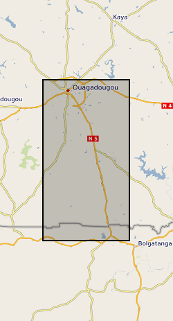
The datasets consist of soil moisture (hourly-weekly), river stage (1 min), and groundwater level (hourly) collected as part of the BRAVE project (NE/M008827/1 and NE/M008983/1) to understand the resilience of boreholes in low-yielding aquifers in the River Volta Basin to climate. The data were collected from physical observatories in Sanon (Burkina Faso) and Aniabisi (Ghana). Soil moisture data were logged hourly beneath contrasting land uses and roaming soil moisture surveys were also undertaken across a wider access tube array. River stage was monitored at the catchment outlet in Sanon and groundwater levels were measured in both catchments.
-

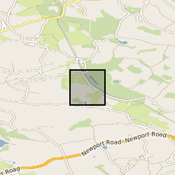
The data comprise of temperatures (degC) from a fibre optic distributed temperature sensor and soil moisture in the form of volumetric water content (VWC), expressed in m3/m3. The measurements were performed in a vegetated hillslope in Staffordshire, UK, in the context of the NERC funded project DiHPS: A Distributed Heat Pulse Sensor Network for subsurface heat and water fluxes. The site was equipped with: 15xVWC point probes (5TM, Decagon Devices) installed at 5 locations along the hillslope. At each location, 3x5TM probes were inserted in the soil at depths of 0.10m, 0.25m, 0.40m from the soil surface 1,512m of fibre optic cable for Active DTS measurements. The fibre was buried in the soil in three overlapped loops of 504m each at 0.10m, 0.25m, 0.40m. The measurements from the 5TM were used to infer a site specific empirical relation to obtain soil moisture from Active-DTS measurements, following the approach from Sayde et al., WRR, 2010 (https://www.researchgate.net/publication/241060722_Feasibility_of_soil_moisture_monitoring_with_heated_fiber_optics)
-

This dataset provides an assessment of the potential for a geological deposit to shrink and swell. Many soils contain clay minerals that absorb water when wet (making them swell), and lose water as they dry (making them shrink). This shrink-swell behaviour is controlled by the type and amount of clay in the soil, and by seasonal changes in the soil moisture content (related to rainfall and local drainage). The rock formations most susceptible to shrink-swell behaviour are found mainly in the south-east of Britain. Clay rocks elsewhere in the country are older and have been hardened by burial deep in the earth and are less able to absorb water. The BGS has carried out detailed geotechnical and mineralogical investigations into rock types known to shrink, and are modelling their properties across the near surface. This research underpins guidance contained in the national GeoSure dataset, and is the basis for our responses to local authorities, companies and members of the public who require specific information on the hazard in their areas. The BGS is undertaking a wide-ranging research programme to investigate this phenomenon by identifying those areas most at risk and developing sustainable management solutions. Complete Great Britain national coverage is available. The storage formats of the data are ESRI Shapefiles and MapInfo but other formats can be supplied. The GeoSure data sets and reports from the British Geological Survey provide information about potential ground movement or subsidence in a helpful and user-friendly format. The reports can help inform planning decisions and indicate causes of subsidence. The methodology is based on BGS DiGMap (Digital Map) and expert knowledge of the behaviour of the formations so defined.
-

In August 2020, two natural slopes just outside Kuala Lumpur, Malaysia, were instrumented with sensors to measure soil suction and volumetric water content (VWC), and rainfall. At present, data has been collected at the two sites for approximately one year, although measurements are expected to continue for the foreseeable future. The measurements taken are aimed at providing guidance on the stability of soil slopes in response to changing climatic conditions. Data is currently being analysed by researchers at Durham University and the National University of Malaysia (UKM).
-

The dataset ‘Future projections of the hydrology of the Philippines’ provides climate change scenarios from 1980-2089 using UKCP18 scenarios RCP 2.6 and RCP 8.5 run through the Philippine National Hydrological model. Each relative concentration pathway (RCP) scenario contains 15 ensemble members, and we present a total of 30 model runs from 1980-2089. The model simulates evapotranspiration, runoff, infiltration, soil moisture, river baseflow and groundwater levels. Aggregated variables at a monthly time interval are provided in this dataset in NetCDF format for each RCP and scenario or aggregated to provincial level in csv format. The provincial levels are based on the first level subdivisions from GADM (https://gadm.org/maps/PHL_1.html).
 NERC Data Catalogue Service