 NERC Data Catalogue Service
Soil analysis
Type of resources
Available actions
Topics
Keywords
Contact for the resource
Provided by
Years
Formats
Representation types
Update frequencies
Service types
Scale
-

Laboratory results for the analysis of soil samples collected from urban areas during the baseline geochemical mapping programme of Britain. Sample sites are described on field slips. Chemical results are subjected to high level of quality control in the laboratory. Results are the raw data processed (standardisation and normalisation) to give seamless geochemical images and the value added G-BASE (Geochemical Baseline Survey of the Environment) data in the BGS geochemistry database.
-

As an integral part of the investigations carried out at Sellafield, and to a lesser extent for the Dounreay boreholes, the cores from the boreholes were systematically examined by geologists and samples selected for detailed petrographic analysis. Thin sections were prepared from many of these samples. Some of the samples were then prepared for analysis using X-ray fluorescence, X-ray diffraction or scanning electron microscopy. Samples containing fluid inclusions were prepared as doubly polished fluid inclusion wafers. Thin sections were prepared from soil materials obtained from the investigations of the Quaternary deposits. Particular attention was given to samples of the mineralisation that was identified in the formations at Sellafield. In addition to the samples from the boreholes, there are also some samples obtained from surface exposures that were examined during the regional surveys. The samples and sections have been catalogued and incorporated into the national collection by the British Geological Survey. The ownership of NIREX (Nuclear Industry Radioactive Waste Executive) was transferred from the nuclear industry to the UK Government departments DEFRA and DTI in April 2005, and then to the UK's Nuclear Decommissioning Authority (NDA) in November 2006.
-
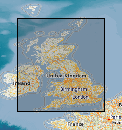
The BGS Geochemical Baseline Survey of the Environment (G-BASE) was the national strategic geochemical mapping programme in Great Britain. The project set out to establish the chemistry of the surface environment by the collection and analysis of stream sediment, stream water and soil samples. Beginning in the late 1960s in northern Scotland and moving southwards across the country, the primary focus was mineral exploration, however, the project quickly developed to address important environmental concerns. The final G-BASE samples were collected in southern England in 2014. The outputs from the G-BASE project provide an invaluable, systematic baseline of geochemical information for Great Britain, serving as a marker of the state of the environment against which to measure future change. Deep soil samples (also known as profile soil samples) were taken from depths of between 35 cm and 50 cm at densities of 1 sample per two square kilometres (rural / regional areas) and 4 samples per square kilometre (urban areas). The G-BASE profile soils were generally sieved to 150 microns before analysis and determined by XRF for some or all of: Ag, As, Ba, Bi, Br, Ca, Cd, Ce, Co, Cr, Cs, Cu, Fe, Ga, Ge, Hf, I, K, La, Mg, Mn, Mo, Nb, Ni, P, Pb, Rb, Sb, Sc, Se, Se, Sn, Sr, Ta, Te, Th, Ti, Tl, U, V, W, Y, Zn and Zr. Since 2003, for both regional and urban sampling, deep soil samples and shallow soil samples were routinely collected from the same sites, but only the shallow soil samples were submitted for chemical analysis. The deep soil samples were archived in the National Geoscience Data Centre. For more information about accessing these samples and their analytical results, contact BGS Enquiries (enquries@bgs.ac.uk).
-

The BGS Geochemical Baseline Survey of the Environment (G-BASE) was the national strategic geochemical mapping programme in Great Britain. The project set out to establish the chemistry of the surface environment by the collection and analysis of stream sediment, stream water and soil samples. Beginning in the late 1960s in northern Scotland and moving southwards across the country, the primary focus was mineral exploration, however, the project quickly developed to address important environmental concerns. The final G-BASE samples were collected in southern England in 2014. The outputs from the G-BASE project provide an invaluable, systematic baseline of geochemical information for Great Britain, serving as a marker of the state of the environment against which to measure future change. The routine collection of regional soil samples was introduced in 1986 in areas of poor drainage density, with an average sample density of one site per 2 square kilometres. Urban soil sampling commenced in 1991, with an average density of four samples per square kilometres, for the urban areas of Belfast, Cardiff, Corby, Coventry, Derby, Doncaster, Glasgow, Hull, Ipswich, Leicester, Lincoln, Manchester, Mansfield, Northampton, Nottingham, Peterborough, Scunthorpe, Sheffield, Swansea, Stoke, Telford, Wolverhampton and York. Topsoil samples were collected between depths of 5 cm and 20 cm, and were sieved through a 2 mm mesh and milled to less than 150 microns. The data include XRF and direct-reading optical emission spectrometry (DR-OES) analyses for some or all of the following elements: Ag, As, Ba, Bi, Br, Ca, Cd, Ce, Co, Cr, Cs, Cu, Fe, Ga, Ge, Hf, I, K, La, Mg, Mn, Mo, Nb, Ni, P, Pb, Rb, Sb, Sc, Se, Se, Sn, Sr, Ta, Te, Th, Ti, Tl, U, V, W, Y, Zn and Zr. Loss on Ignition (LOI) and pH (in a slurry of 0.01 M CaCl2) were also routinely determined on 50% of regional and all urban samples. For more information about accessing these samples and their analytical results, contact BGS Enquiries (enquries@bgs.ac.uk).
-

This Web service provides layers which show metadata relating to geochemical samples held by the British Geological Survey (BGS). The layers are point layers which indicate the spatial locations samples were taken from. Geochemical samples have been collected, analysed and stored in the BGS Geochemistry Database from different projects. The two most significant contributors to the database are the Geochemical Baseline Survey of the Environment (G-BASE) project and the Mineral Reconnaissance Programme (MRP). Each project took a variety of different sample types, including stream water, stream sediment, shallow soil and deep soil, and one layer is provided for each type of sample. The sample metadata provided include: sample name; sample type; the Regional Geochemical Atlas area (for G-BASE samples only) and a comma-separated list of available analytes. In many cases, samples are retained in the National Geoscience Data Centre (NGDC) at BGS Keyworth. For more information about obtaining samples or the results of their geochemical analyses, contact BGS Enquiries (enquiries@bgs.ac.uk).
-
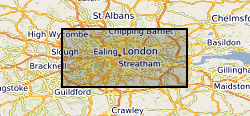
The London Earth data are part of the Geochemical Baseline Survey of the Environment (G-BASE) dataset, a nation-wide project to determine the distribution of chemical elements in the surface environment. London Earth focuses on the soil of the capital city, the limits of the survey being defined by the Greater London Authority (GLA) administrative boundary. Chemical elements have been determined by X-ray fluorescence spectrometry (XRFS) at the laboratories of the British Geological Survey (BGS) in Keyworth, Nottingham. These results are presented as a Microsoft Excel file.