Scottish SDI
Type of resources
Available actions
Topics
Keywords
Contact for the resource
Provided by
Years
Formats
Representation types
Update frequencies
Service types
Scale
-
This layer of the map based index (GeoIndex) is a map based index of the National Well Record Archive. This index shows the location of water wells along with basic information such as well name, depth and date of drilling. The index is based on the collection of over 105,000 paper records of water wells, springs and water boreholes. Geological information, construction details, water quality data and hydrogeological data may also be available for some water wells. The amount of detail held on individual sites varies widely and certain fields will have an 'unknown' value where the paper records have yet to be checked for their content. The zero values for the depth represent those for which the depth has yet to be entered into the database from the paper records.
-
[This metadata record has been superseded, see http://data.bgs.ac.uk/id/dataHolding/13608329]. This layer of the map based index (GeoIndex) providex an index to 17,500 borehole rock samples (drillcore) from the Mineral Reconnaissance Programme (MRP) and related studies. The UK Government's Department of Trade and Industry (DTI) funded BGS to provide baseline information on areas prospective for the occurrence of metallic minerals in Great Britain. This programme, known as the MRP, ran continuously from 1973 to 1997 and covered particular locations across Great Britain. It was designed to stimulate private sector exploration and to encourage the development of Britain's indigenous mineral resources. Under the programme a number of boreholes were drilled to gather information.
-
This layer displays the urban areas for which there is an "urban geochemical mapping" report. An integral part of the G-BASE (Geochemical Baseline Survey of the Environment) mapping programme is to map and establish the soil geochemical baselines of urban areas. These data provide unique soil chemical information for the urban environment and are used to; assess the condition of soils within populated areas, identify and quantify human impact on soils in urban areas through comparison with the rural, natural soil geochemical background and Indicate elevated concentrations of potential harmful elements. 27 urban areas which have been sampled by the project to date.These include Glasgow, Nottingham, Ipswich and Cardiff.
-
An index to over 600 ground geophysical surveys carried out in the UK for a variety of projects. A large number of these surveys were done in conjunction with the DTI Mineral Reconnaissance Programme in the 1970's and 80's, and many others were carried out at the request of BGS field mapping groups. Information held describes the survey objective, location of measurements, geophysical methods and equipment used, reports and publications, storage locations of data and results (for analogue and digital data), dates and personnel. There are two datasets; one shows the outline of the survey areas, and the other shows the actual survey lines within each area.
-
The GeoSure data sets and reports from the British Geological Survey provide information about potential ground movement or subsidence in a helpful and user-friendly format. The reports can help inform planning decisions and indicate causes of subsidence. The methodology is based on BGS DiGMap (Digital Map) and expert knowledge of the behaviour of the formations so defined. This dataset provides an assessment of the potential for a geological deposit to compress under an applied load, a characteristic usually of superficial deposits such as peat or alluvium. Some types of ground may contain layers of very soft materials like clay or peat. These may compress if loaded by overlying structures, or if the groundwater level changes, potentially resulting in depression of the ground and disturbance of foundations. Complete Great Britain national coverage is available. The storage formats of the data are ESRI and MapInfo but other formats can be supplied.
-
This layer of the GeoIndex shows the availability of 1:25000 scale Classical Areas Geological Maps. The maps themselves show the occurrence, nature and stratigraphic age of rocks. They are available for selected areas of outstanding geological interest in the United Kingdom, and in a number of versions (Solid, or Solid and Drift combined, Bedrock or Superficial). Maps are normally available in both flat and folded format. 1:25000 scale maps are also available for the Channel Islands. To order maps, take note of the map name and use the BGS Internet Shop.
-
This low-resolution image has been produced from BGS land and marine gravity data. The colour was generated using the BGS COLMAP software package. Colour levels are defined by histogram equalisation. Combining this image with the grey shaded relief image produces a similar image to the colour shaded relief image. The measured gravity values have been corrected in order to show the anomalies attributable to variations in crustal density. In broad terms the blues are attributable to large volumes of low density rocks, the reds to high density rocks. Significant lows occur, for instance, over areas of thick, low density sedimentary rocks(e.g. Cheshire Basin, Wessex Basin), or large granites (eg Cornwall). For marine data, free-air anomalies have been calculated from observed gravity values along marine survey lines. Line intersection errors between crossing lines and overlapping surveys have been used using network adjustment techniques. Free air anomalies have been calculated for sea-bottom stations. For land data, bouguer anomalies have been calculated from gravity observations at points of known height. In order to minimise the effect of topography, Bouguer corrections for the British Mainland have been applied using a density estimated for each station. Elsewhere a correction density of 2.67 Mg/m3 has been used. Corrections for the gravitational effect of terrain have been made where significant, and in a general extent to a radius of 48.6km. The data have been interpolated onto a 1km x 1km grid using a variable tension technique, and smoothed.
-
The UK Onshore Geophysical Library was established in 1994 in conjunction with the Department of Trade and Industry (DTI) and the UK Onshore Operators Group (UKOOG). The Library manages the archive and official release of seismic data recorded over landward areas of the UK. By agreement with the DTI and HMSO, the Library operates as a registered charity, funded by revenues raised from data sales and donations, with the long term objective of bringing all available UK onshore digital seismic data into secure archival storage, whilst providing efficient access to all interested parties. BGS has access to the data at cost of copying only for science budget work. Data index on the BGS Geoscience Data Index.
-
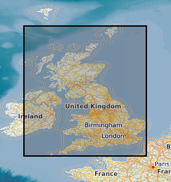
The map shows the localities of significant fossil samples, either collected by BGS Staff, or donated by individuals and institutions. The BGS fossil collections contain over 2 million specimens, including a sizeable quantity of type, figured and cited material. Since a small number of fossil locations are confidential, you are unable to view this dataset at large scales. However, if you send a data enquiry, such information may be made available. Enquiries are normally free, but a charge may be levied depending upon the time taken; users will be notified in advance. Material is available for inspection on application by e-mail. Specimens are sometimes available for loan to bona fide academics.
-

This INSPIRE network service provides an Atom feed of predefined datasets that are available for download.
 NERC Data Catalogue Service