 NERC Data Catalogue Service
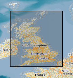
Radon potential
Type of resources
Available actions
Topics
Keywords
Contact for the resource
Provided by
Years
Formats
Representation types
Update frequencies
Service types
Scale
Resolution
-
Radon is a natural radioactive gas, which enters buildings from the ground. The joint UK Health Security Agency (UKHSA) - British Geological Survey (BGS) Radon Potential for Great Britain digital dataset provides the current definitive map of Radon Affected Areas in Great Britain. Exposure to high concentrations of radon increases the risk of lung cancer. The UK Health Security Agency (formerly Public Health England, PHE) recommends that radon levels should be reduced in homes where the annual average is at or above 200 becquerels per cubic metre (200 Bq m-3). This is termed the Action Level. The UKHSA defines Radon Affected Areas as those with 1% chance or more of a house having a radon concentration at or above the Action Level of 200 Bq m-3. This dataset allows an estimate to be made of the probability that an individual property is at or above the Action Level for radon. This information provides an answer to one of the standard legal enquiries on house purchase in England and Wales, known as CON29 standard Enquiry of Local Authority; 3.13 Radon Gas: Location of the Property in a Radon Affected Area. Radon Potential for Great Britain also provides information on the level of protection required for new buildings, as described in the latest Building Research Establishment guidance on radon protective measures for new buildings (Radon: guidance on protective measures for new dwellings; BR 211, 2015 in Scotland, England, Wales and Northern Ireland). This radon potential hazard information for Great Britain is based on UKHSA indoor radon measurements and BGS digital geology information. This product was derived from BGS Geology 50k (formerly known as DiGMapGB-50k) version 8 and UKHSA in-house radon measurement data. The indoor radon data are used with the agreement of the UKHSA. Confidentiality of measurement locations is maintained through data management practices. The data may be accessed under licence.
-

OneGeology is an international collaborative project in the field of geology supported by 113 countries, UNESCO and major global geoscience bodies. It aims to enable online access to dynamic digital geological map of the world for everyone. An EU Joint Research Centre project is using OneGeology geological data as a framework for the production of a Geogenic Radon Map of Europe. The BGS-HPA UK Onegeology Radon Potential dataset provides, within a 1:625,000 scale geological framework, a general indication of how the estimated arithmetic mean ground-floor radon concentration varies within the United Kingdom. The indoor radon data is used with the agreement of the Health Protection Agency (HPA). Mapping of radon-prone areas at the OneGeology 1:625 000 scale can be used to inform European policy makers, politicians and the general public about the general variation of radon potential within the United Kingdom at the European scale. The dataset should not be used at scales larger than 1:250,000 or for regulatory (i.e. Building Control or Radon Affected Area) purposes in the UK.
-

Radon is a natural radioactive gas which enters buildings from the ground. The joint UK Health Security Agency (UKHSA) - British Geological Survey (BGS) Digital Indicative Atlas of Radon in Great Britain presents an overview of the results of detailed mapping of radon potential, defined as the estimated percentage of homes in an area above the Radon Action Level. Exposure to high concentrations increases the risk of lung cancer. UKHSA (formerly Public Health England) recommends that radon levels should be reduced in homes where the annual average is at or above 200 becquerels per cubic metre (200 Bq m-3). This is termed the Action Level. The UK Health Security Agency defines radon affected areas as those with 1% chance or more of a house having a radon concentration at or above the action level of 200 Bq m-3. The Indicative Atlas of Radon in Great Britain presents a simplified version of the radon potential for Great Britain, in which each 1 km grid square is classed according to the highest radon potential found within it, so the dataset is indicative rather than definitive. The joint UKHSA-BGS Digital Radon Potential for Great Britain dataset provides the current definitive map of Radon Affected Areas in Great Britain.
-

This Web service provides the Indicative Atlas of Radon Potential for Great Britain dataset. Every building contains radon (Rn) but the levels are usually low. The chances of a higher level depend on the type of ground. The UK Health Security Agency (UKHSA) and the BGS have published a map showing where high levels are more likely. The darker the colour, the greater the chance of a higher level of radon. The chance is less than one home in a hundred in the white areas and greater than one in three in the darkest areas.