Palaeozoic
Type of resources
Topics
Keywords
Contact for the resource
Provided by
Years
Formats
Update frequencies
Scale
-
The register lists Lower Palaeozoic microfaunas (including "small shelly" faunas), but occasionally mentions small trilobites and various fragments. SAQ1-259 are used, although several numbers have no details assigned to them. Sample number, sheet number, NGR, fossil identification, borehole names & depths are given.
-

This dataset contains geochemical measurements which quantify the major and trace element concentrations of Precambrian (Proterozoic) and Paleozoic (541–251 Mya) mudstones. Sampled mudstones are listed under their formation name, with information on the locations of each outcrop belt and further details on lithological characteristics, including environment of formation, freely available on the British Geological Survey Lexicon of named rock units (https://www.bgs.ac.uk/technologies/the-bgs-lexicon-of-named-rock-units/) and Government of Canada weblex (https://weblex.canada.ca/weblexnet4/weblex_e.aspx), for UK and Canadian samples, respectively. Stratigraphic age is given in accordance to the GSA geological timescale v.5.0. Following sampling, specific methodologies for preparation for major and trace element analysis, conducted on an Agilent 5100, are provided in the Methodology. The data was collected to understand changes in weathering intensity coeval with the Paleozoic expansion of land plants. The major element data was needed to: 1) determine how much sample was required for subsequent Lithium isotope analyses (data from which are separately uploaded to the repository); and 2) to ensure similarity of source between samples compared across our study. The tabulated major element analyses were compared at different temporal stages of plant evolution through the Paleozoic. Samples were collected by the University of Cambridge. Major element data was obtained by William McMahon, and supervised by Edward Tipper and Mohd Tarique and Emily Stevenson.
-
Reports, images, GIS and gridded products describing the Palaeozoic geology and conventional petroleum systems of parts of the UK offshore. Devonian and Carboniferous rocks are the focus in and around the Mid North Sea High, Central North Sea, the Moray Firth and Orcadian Basin. In the greater Irish Sea area, Carboniferous rocks are described. The peer-reviewed products were produced for the 21CXRM Palaeozoic Project by BGS for DECC/OGA, Oil and Gas UK and oil company sponsors between November 2014 and May 2016, to improve regional digital datasets and knowledge of the underexplored Palaeozoic petroleum systems, and to stimulate exploration. The petroleum systems analysis was based on new interpretations of extensive well, seismic, gravity-magnetic and source rock datasets, integrated with petrophysical studies, basin modelling and UK onshore knowledge. Released data were collated and interpreted, and interpretations of unreleased data were included with agreement of the data owners. Unreleased raw data is excluded, as is the UK Government Seismic data released in 2016. The datasets are applicable for use at scales between 1: 750,000 to 1: 3,000,000.
-
This is a geochemical dataset accompanying Emmings, J., Poulton, S., Vane, C., Davies, S., Jenkin, G., Stephenson, M., Leng, M., Lamb, A., Moss-Hayes, V. A Mississippian Black Shale Record of Redox Oscillation. Palaeogeography, Palaeoclimatology, Palaeoecology [submitted July 2019]. This dataset includes RockEval pyrolysis, major and trace element (XRF), Fe speciation, C, N and S isotopes and S species analyses through the Upper Bowland Shale in the Craven Basin (Lancashire, UK). This research was conducted by Joe Emmings, PhD researcher at the University of Leicester and British Geological Survey (BGS) between 2014-2018, and as a post-doctoral research associate (PDRA) at the British Geological Survey (2018-2021). The PhD research was funded by the Natural Environment Research Council (NERC), as part of the Central England Training Alliance (CENTA) [grant no. NE/L002493/1] and received CASE funding from the BGS. PDRA research was funded by the British Geological Survey. Reproduction or manipulation of these data in future analyses should cite one or more of the following related publications (as necessary): Emmings, J., 2018. Controls on UK Lower Namurian Shale Gas Prospectivity: Understanding the Spatial and Temporal Distribution of Organic Matter in Siliciclastic Mudstones. PhD Thesis, University of Leicester. Emmings J. et al. 2017. Stream and slope weathering effects on organic-rich mudstone geochemistry and implications for hydrocarbon source rock assessment: a Bowland Shale case study. Chemical Geology. 471. 74-91. Emmings, J. et al., 2019a. From Marine Bands to Hybrid Flows: Sedimentology of a Mississippian Black Shale. Sedimentology, [Accepted ms.]. Emmings, J.F. et al., 2019b. Controls on amorphous organic matter type and sulphurization in a Mississippian black shale. Review of Palaeobotany and Palynology, 268: 1-18. Emmings, J.F. et al. A Mississippian black shale record of redox oscillation. Palaeogeography, Palaeoclimatology, Palaeoecology [submitted July 2019] Co-workers: Sarah Davies (University of Leicester) - Primary PhD supervisor, sedimentology Chris Vane (BGS) - PhD supervisor, RockEval pyrolysis Mel Leng (BGS & University of Nottingham) - PhD supervisor, C & S isotopes Mike Stephenson (BGS) - PhD supervisor Simon Poulton (University of Leeds) - Fe speciation Gawen Jenkin (University of Leicester) - PhD supervisor Vicky Moss-Hayes (BGS) - RockEval pyrolysis Angela Lamb (BGS) - S isotopes
-
Reports, images, GIS and gridded products describing the Palaeozoic geology and conventional petroleum systems of parts of the UK offshore from the Orcadian Basin, Moray Firth to northern Forth Approaches (Quadrants 6-21). Devonian and Carboniferous rocks are the focus. The peer-reviewed products were produced for the 21CXRM Palaeozoic Project by BGS for DECC/OGA, Oil and Gas UK and oil company sponsors between November 2014 and May 2016, to improve regional digital datasets and knowledge of the underexplored Palaeozoic petroleum systems, and to stimulate exploration. The petroleum systems analysis was based on new interpretations of extensive well, seismic, gravity-magnetic and source rock datasets, integrated with petrophysical studies, basin modelling and UK onshore knowledge. Released data were collated and interpreted, and interpretations of unreleased data were included with agreement of the data owners. Unreleased raw data is excluded, as is the UK Government Seismic data released in 2016. The datasets are applicable for use at scales between 1:750,000 to 1: 3,000,000
-
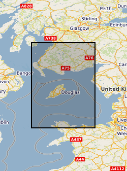
Reports, images, GIS and gridded products describing the Palaeozoic geology and conventional petroleum systems of parts of the UK offshore from the greater Irish Sea area. Carboniferous rocks were the focus in areas from the Firth of Clyde, Solway Basin, Manx-Peel Basin to the East Irish Sea Basin and surrounding areas (Quadrants 110-126). The peer-reviewed products were produced for the 21CXRM Palaeozoic Project by BGS for DECC/OGA, Oil and Gas UK and oil company sponsors between November 2014 and May 2016, to improve regional digital datasets and knowledge of the underexplored Palaeozoic petroleum systems, and to stimulate exploration. The petroleum systems analysis was based on new interpretations of well, seismic, gravity-magnetic and source rock datasets, integrated with petrophysical studies, basin modelling and UK onshore knowledge. Released data were collated and interpreted, and interpretations of unreleased data were included with agreement of the data owners. Unreleased raw data is excluded. The datasets are applicable for use at scales between 1: 750,000 to 1: 3,000,000.
-
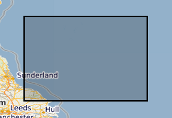
Reports, images, GIS and gridded products describing the Palaeozoic geology and conventional petroleum in and around the Mid North Sea High (Quadrants 25-44). Covering a large area of the Central North Sea from the Forth Approaches to the northern side of the Southern North Sea, the focus is on Devonian and Carboniferous rocks. The peer-reviewed products were produced for the 21CXRM Palaeozoic Project by BGS for DECC/OGA, Oil and Gas UK and oil company sponsors between November 2014 and May 2016, to improve regional digital datasets and knowledge of the underexplored Palaeozoic petroleum systems, and to stimulate exploration. The petroleum systems analysis was based on new interpretations of extensive well, seismic, gravity-magnetic and source rock datasets, integrated with petrophysical studies, basin modelling and UK onshore knowledge. Released data were collated and interpreted, and interpretations of unreleased data were included with agreement of the data owners. Unreleased raw data is excluded, as is the UK Government Seismic data released in 2016. The datasets are applicable for use at scales between 1:750,000 to 1: 3,000,000.
-
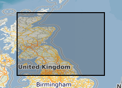
GIS versions of a regional structural summary and palaeogeographic reconstructions describing the Palaeozoic geology of parts of the UK offshore and onshore, plus a set of summary posters and a summary presentation capturing the conventional petroleum systems. Devonian and Carboniferous rocks are the focus in and around the Mid North Sea High, Central North Sea, the Moray Firth and Orcadian Basin. In the greater Irish Sea area, Carboniferous rocks are described. The peer-reviewed products were produced for the 21CXRM Palaeozoic Project by BGS for DECC/OGA, Oil and Gas UK and oil company sponsors between November 2014 and May 2016, to improve regional digital datasets and knowledge of the underexplored Palaeozoic petroleum systems, and to stimulate exploration. The petroleum systems analysis was based on new interpretations of extensive well, seismic, gravity-magnetic and source rock datasets, integrated with petrophysical studies, basin modelling and UK onshore knowledge. Released data were collated and interpreted, and interpretations of unreleased data were included with agreement of the data owners. Unreleased raw data is excluded, as is the UK Government Seismic data released in 2016. The GIS layers were digitised from figures prepared for project reports and are applicable for use at scales between 1:1,000,000 and 1:3,000,000.
 NERC Data Catalogue Service