 NERC Data Catalogue Service
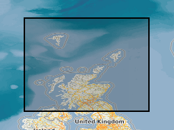
Marine geotechnical assessment
Type of resources
Available actions
Topics
Keywords
Contact for the resource
Provided by
Years
Formats
Representation types
Update frequencies
Service types
Scale
-

Pan-European water depth suitability map, derived from EMODnet (European Marine Observation and Data Network) Bathymetry data, showing the relative suitability for offshore wind pile foundations. The relative scoring system is from 0 (null) and 1 to 5 (i.e., high to low suitability, respectively), resulting in regional water depth suitability map for pile foundations. Null values represent hexagons that extended too far inland (e.g. estuaries) and thus don’t overlay the bathymetry map, however are kept in for information. A score of 5 (low suitability) is given to values >=0 and over 80 m. A score of 3 is given to 60-80 m. A score of 2 (higher suitability) is given to 10-50 m. The scoring system is a relative suitability scale, defined by BGS (2014), a commercial project undertaken with The Crown Estate. The original water depth (EMODnet Bathymetry) data has been translated into Hex maps due to the various data resolutions of the bathymetry datasets. Hex maps permit spatial screening of suitable license areas over vast areas and provides the end-user with an understanding to the level of uncertainty regarding the final maps. This pan-European digital GIS product is produced by the British Geological Survey (BGS) and forms part of a series of maps that define domain parameters related to marine geotechnical conditions, focusing on water depth and suitability for foundation installation. Water depth is a critical parameter influencing the selection and design of foundation systems for offshore infrastructure. Water Depth is a domain-type to support early-stage site assessment, engineering design constraints and risk evaluation processes in offshore development projects. The data is useful for marine spatial planners, wind farm developers, and research institutions who would like to understand the suitability of different foundation types for various water depths at a regional scale.
-
Results of geotechnical testing carried out, at various depth intervals, on shallow cores or boreholes collected by BGS from the UK Continental Shelf (UKCS). The bulk of the data north of 56N are in digital form and result from testing carried out onboard survey vessels using hand-held test equipment (penetrometers and shear vanes). These values are averaged for each test interval, and are expressed in kilopascals (kPa). There are approximately 6,000 test results in the dataset. Some more detailed test information, in non-digital and report form, is held for selected sites. For most sites where digital data are not available, geological descriptions of core material contain semi-quantitative information on the stiffness of the material. Geotechnical knowledge is required to understand and interpret the results if they are to be used as a basis for engineering studies. Core material is managed as part of the BGS materials collection and is available for examination, testing or subsampling. The data are stored as part of the National Geoscience Data Centre (NGDC) and the Marine Environmental Data and Information Network (MEDIN) Data Archive Centre (DAC) for geology and geophysics. Data are delivered via the 'Offshore samples: geotechnical data' layer on the BGS GeoIndex. Reference: Fannin, NGT. (1989) Offshore Investigations 1966-87. British Geological Survey Technical Report WB/89/2, British Geological Survey.
-

This Web service provides layers which show data relating to offshore survey activities undertaken by the British Geological Survey (BGS) and its predecessors. The layers are polygon, line and point layers which indicate the spatial areas of survey activities. The survey overview layer shows the location and basic information for coastal and marine surveys. It includes information about the survey, including the types of equipment deployed during the survey. For some surveys, a zip file of additional data can be downloaded using the URL link provided where available. The geophysical surveys layers show survey lines and shot points along those lines, where applicable. Geophysical surveys include shallow seismic reflection (e.g. airgun, boomer, pinger, sparker and water gun) and sonar (e.g. echo sounder, sidescan sonar and transit sonar). There may be several types of equipment deployed on a single survey line. Survey lines are uniquely named with a survey and line identifier (name or number). For example, 1985/6#16 is line 16 of survey 1985/6. The lines layer includes seismic reflection (sub seabed imaging which provides information about structures below the seabed) and sonar (seabed imaging which provides information about the roughness of the seabed or simple bathymetric data). Links to scanned images of geophysical records are provided (where available) for openly available survey lines where terms of use are known. The backscatter layer shows the location and basic information for bathymetric surveys containing backscatter data. A zip file of the backscatter image files for the survey can be downloaded using the URL link provided. Note that there can be more than one polygon per survey and these will link to the same zip file for the entire survey. The majority of the data were collected and processed for the Maritime and Coastguard Agency (MCA) under the Civil Hydrography Programme. To download the related bathymetry data go to the Admiralty Marine Data Portal (https://datahub.admiralty.co.uk/portal/apps/sites/#/marine-data-portal). The oil and gas industry site surveys layer shows the geographic location of oil and gas industry site surveys. The metadata for these surveys were collated via the BGS MEDIN Data Archive Centre (DAC). BGS do not hold the data. For further information contact the custodian of the data. For more information, contact BGS Marine Enquiries (offshoredata@bgs.ac.uk).