 NERC Data Catalogue Service
Hydrogeological maps
Type of resources
Available actions
Topics
Keywords
Contact for the resource
Provided by
Years
Formats
Representation types
Update frequencies
Scale
-

The BGS database of geological maps is an index into BGS holdings of modern and historical published geological maps, geological standards and field slips, and also contains a range of other map series, including geophysical maps, geochemical maps, hydrogeological maps, thematic maps and other small-scale miscellaneous non-series maps. Historical vertical and horizontal sections, as well as indices to colours, are also included. The database comprises map metadata, including the title, theme, survey and revision years, publication years, mapped geological theme, base material, map function, colouration, approval status and the spatial extent of each map sheet. An accompanying file store contains high-resolution JPEG2000 scans for delivery, as well as various digital master and delivery formats. For a small number of maps, no scan exists. In total, the database contains over 240,000 scans of over 130,000 maps and field slips. The majority of the maps in the database cover Great Britain, but other regions are also represented, including a historical series of 1-inch maps of Ireland, 6-inch maps of the Isle of Man, 1:25 000 scale maps of the Channel Islands, and various overseas maps. The database contains a record of all geological maps produced by the British Geological Survey and its predecessors since the commencement of systematic geological mapping in the 1830s. The BGS Maps Database is mostly an archive of previous BGS maps, and is not the same as the latest BGS digital mapping. The maps within the database may differ significantly from BGS digital vector mapping. Further information about BGS digital vector mapping is available on the BGS website, under 'BGS Datasets'. The database has evolved over time, originally being a series of discrete databases. These databases have now been aggregated into a single dataset. BGS published maps, as well as 1:10 560 and 1:10 000 large-scale geological maps of England and Wales, and Scotland, are available through the BGS Maps Portal. Field slips and some thematic maps are not included on the BGS Maps Portal. The information about a map is normally a transcription from the map itself. Sometimes key information such as the title may not be actually printed on the map. Where this is the case the information is supplied in square brackets, e.g. [Kirk Maiden]. Information in square brackets means the information is supplied by the cataloguer and is not transcribed from the item.
-

A collection of hydrogeological maps created by the British Geological Survey between 1967 and 1994. The maps in the collection cover aspects of groundwater availability, exploitation and quality, and were published at various scales from 1:25 000 to 1:625 000. A hydrogeological map is a specialized type of map that illustrates the distribution and characteristics of hydrogeological features in a particular area. Hydrogeological maps of the UK provide information on major aquifers, including geological and lithological information, surface drainage systems and water quality issues. The 23 maps show information on surface water features, the three dimensional geometry of aquifers, groundwater levels, abstractions and quality including saline intrusion in varying amounts of detail. They range in scale from 1:625 000, for the national map of the hydrogeology of England and Wales, down to 1:25 000 for some of the smaller regional maps. These maps are important tools for understanding and managing groundwater resources, as well as for addressing water-related environmental issues. These maps are hard-copy paper records stored in the National Geoscience Data Centre (NGDC), and are delivered as digital scans through the BGS website.
-
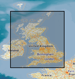
This layer of the map based index (GeoIndex) shows the location of available Hydrogeological Maps which have been published at various scales, covering areas ranging in size from the whole of England and Wales, Northern Ireland and to Jersey. They display information on surface water features, the three dimensional geometry of aquifers, groundwater levels, abstractions and quality including saline intrusion in varying amounts of detail.