 NERC Data Catalogue Service
Geothermal heat flow
Type of resources
Available actions
Topics
Keywords
Contact for the resource
Provided by
Years
Formats
Representation types
Update frequencies
-

The data is a first digital release of the UK legacy geothermal catalogue of temperature measurements, thermal conductivity measurements and heat flow calculations. The geothermal catalogue comprises data contained in numerous historic technical reports from the 1977-1991 Geothermal Energy Programme, delivered by BGS and funded by the then UK Department of Energy and the European Commission. This release contains 11,821 data points derived from 743 sites. This first digital release contains data that has been: spatially located, an identified data source, intellectual property rights (IPR) checked and assessed for release under version 3 of the Open Government Licence (OGL). There are known limitations on the dataset, including that the data is provided as it was listed in the UK legacy geothermal catalogue. Validation of the IPR and copyright status of some of the incorporated datasets was challenging and a take down policy is in operation. Further details can be found in the accompanying report https://nora.nerc.ac.uk/id/eprint/537202
-
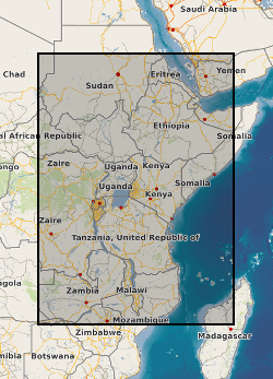
A geographic information system (GIS) heat flow and temperature model of East Africa created by extracting data from open sources into a series of shapefiles and rasters containing information on geothermal sites, hot spring locations, digital elevation model, surface temperature, geothermal gradients, thermal conductivities and heat flow data, major faults, surface geology, crustal basement, electrification grid system and population density across East Africa. This data is stored in the World Geodetic System (WGS) 1984 Geographic Projection System.
-

The dataset portrays heat flow as a continuous modelled surface, interpolated between observation points. Onshore coverage is provided for England, Wales, Scotland and Northern Ireland. The British Geological Survey (BGS) Heat flow dataset version 1 (United Kingdom) is derived from a catalogue of legacy heat flow observations and ground-heat modelling. Heat flow data is typically used to determine temperatures beneath the ground surface, and model how much thermal energy may be stored in or recovered from the ground. The dataset is presented as a raster model, but is also available as cellular, vector grids. The raster and square-cellular grid defines each cell by an area of c. 4km2 (2km per side). The hexagonal-cellular defines each cell by an area of c. 2.56km2 (1km per side). Heat flow values are milli-Watts per square metre (mWm-2). The data are available under BGS data licence.
-
The OSCAR (Oceanographic and Seismic Characterisation of heat dissipation and alteration by hydrothermal fluids at an Axial Ridge) data set is an interdisciplinary collection of physical oceanography and geophysics measurements. Data collection took place in the Panama Basin, bounded in the north-west by the Cocos Ridge, by the Carnegie Ridge in the south and by South and Central America in the east and north, respectively. Measurements were collected during RRS James Cook cruises JC112 and JC113 (05/12/2014 to 16/01/2015), RRS James Cook cruise JC114 (22/01/2015 to 08/03/2015) and RV Sonne cruise SO328 (06/02/2015 to 06/03/2015). The project investigated the effect of the cooling of young oceanic crust close to a mid-ocean ridge. It is here that rapid cooling is dominated by hydrothermal circulation of seawater through the crust, which is then discharged into the ocean along the ridge. Once in the ocean, released heated seawater mixes with the ambient cold water to form a plume, which provides a mechanism to lift the densest waters away from the bottom boundary layer. Data were collected using Bottom Pressure Recorder, Acoustic Doppler Current Profiler (ADCP), Magnetotelluric Lander, CTD, Vertical Microstructure Profiler, Synthetic Aperture Radar, Ocean-bottom seismograph and Multibeam echosounder. Measurement of salinity, oxygen and helium were also made and zooplankton samples collected with vertical net casts. This multidisciplinary, collaborative research project was led by Professor Richard Hobbs at the Department of Earth Science, University of Durham, UK and funded by Natural Environment Research Council (NERC) grant NE/I027010/1.