 NERC Data Catalogue Service
Engineering geology
Type of resources
Available actions
Topics
Keywords
Contact for the resource
Provided by
Years
Formats
Representation types
Update frequencies
Service types
Scale
Resolution
-

A list of the laboratory reports produced from testing in the engineering geology laboratory. It includes report number, title and author's name(s). The reports themselves contain data on a wide range of geotechnical and geophysical laboratory tests, from standard and index tests to complex research. Test materials are highly varied, soils and rock, from the UK or overseas.
-

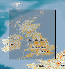
This Web service provides a spatial index into the ground investigation (also known as site investigation) reports collection held by the British Geological Survey (BGS) in the National Geoscience Data Centre (NGDC). Because of the long history and composite nature of this collection, and the different methodologies which have been used to locate and spatially reference the reports, the accuracy of report areas varies within the collection. Some reports have been scanned, and where available, a download link to the scan is provided.
-

Reports of ground investigations (also known as site investigations) produced by external organisations carried out for all forms of site investigation. The reports date back to the 1950s and may contain information on boreholes, trial pits, laboratory tests and chemical analyses etc. The collection covers the whole of Great Britain with concentrations around urban areas and transportation routes. The interpretive parts of the reports are not available to public. Reports from onshore Great Britain (or near shore) site investigations are held in the National Geoscience Data Centre in paper, microfilm or digital format. The entire collections at BGS Edinburgh has been scanned, but in BGS Keyworth currently only reports received since 2002 have been scanned. Scanning started in 2002 and is ongoing with new records being scanned and added to the collection. Images are stored in TIFF format and are indexed in the Site Investigation Database and Detailed Accessions Database. The boreholes within the report, and any associated images, are linked to the Single Onshore Borehole Index.
-
New acquisitions of all forms of geological data received from external organisations are recorded in the accessions database and the digital or analogue data itself is then available to users. Data is in the form of reports, plans and digital information. This information comes from a wide variety of sources, including public bodies and agencies and commercial organisations. The data itself will be incorporated into existing corporate collections or may form a new collection in its own right. The rate of transfer will depend on priorities and requirements of both internal and external users. Data is continuously removed from the collection, all except recently received material will have been processed.
-
The Quaternary deposits summary lithologies dataset is a digital geological map across the bulk of the UK Continental Shelf (UKCS), for areas up to a water depth of 200 m, which groups the deposits into classes based on similar engineering geology characteristics. The map is derived from (unpublished) BGS 1:1,000,000 scale Quaternary digital geological mapping, so is effective at that scale. The map was produced in 2014 in collaboration with, and co-funded by, The Crown Estate as part of a wider commissioned project to assess seabed geological constraints on engineering infrastructure across the UKCS. The divisions on the map combine the Quaternary deposits into 7 categories of similar strength and lithological variability, each with a ‘Category’ title that summarises their main lithological character: diamict; firm to hard interbedded (layered); firm to hard mud; sand and gravel; soft interbedded; soft mud; undifferentiated. These categories can be used as a basis for assessing, in conjunction with a range of other geological factors, the geological constraints on engineering structures at or close to the seabed. The data are held by the BGS as an ESRI ArcGIS Shapefile.
-
This dataset is a characterisation of discontinuity types found within rocks and soils in Great Britain. Discontinuities are breaks, fractures or planes of weakness in the rock mass. The dataset includes type, frequency and orientation of discontinuities within rock and soil materials at formation (local to regional) scale. The discontinuities are classified in 3 categories: stratification (bedding planes), foliation (mineral banding) and rock mass description. The dataset aims to facilitate the preliminary research for planning and design of buildings, infrastructure and resource extraction. It forms part of the DiGMap Plus dataset series of GIS layers which describes the engineering properties of materials from the base of pedological soil down to c. 3m depth (ie the uppermost c.2m of geology). These deposits display a variable degree of weathering, but still exhibit core engineering characteristics relating to their lithologies.
-
This dataset contains scans of Applied Geology Maps (AGMs) and sections, which are also known as thematic maps, Environmental Geology Maps (EGMs) or Planning for Development Maps (PfD). They were produced as part of 'Geological Background for Planning and Development' and preliminary sand and gravel projects carried out by the British Geological Survey for the Department of the Environment, Transport and the Regions (DETR), the Scottish Development Department and Scottish Office from 1975 to 1996. The maps and sections cover a number of themes (up to 22) for specific areas relating to the project area within the United Kingdom (which are mostly urban areas). Themes include simplified bedrock and superficial maps, drift thickness, drift lithology, rockhead contours and a range of mining-related themes. Each area had its own custom set of maps and were issued with an accompanying BGS Technical Report. The maps and report were sometimes issued as a pack, but for some areas they were made available separately. The geological linework and the methods used to produce the maps are those current at the time of production. Map scales are predominantly 1:10 000 or 1:25 000, with a few 1:50 000 maps. The maps have Ordnance Survey map bases and are bounded by the project area. The maps could be used for geological, engineering geological, environmental and resources research, as an information and reference resource and for inclusion in reports and papers. These maps are hard-copy paper records and digital scans, stored in the National Geoscience Data Centre (NGDC).
-

Pan-European water depth suitability map, derived from EMODnet (European Marine Observation and Data Network) Bathymetry data, showing the relative suitability for offshore wind pile foundations. The relative scoring system is from 0 (null) and 1 to 5 (i.e., high to low suitability, respectively), resulting in regional water depth suitability map for pile foundations. Null values represent hexagons that extended too far inland (e.g. estuaries) and thus don’t overlay the bathymetry map, however are kept in for information. A score of 5 (low suitability) is given to values >=0 and over 80 m. A score of 3 is given to 60-80 m. A score of 2 (higher suitability) is given to 10-50 m. The scoring system is a relative suitability scale, defined by BGS (2014), a commercial project undertaken with The Crown Estate. The original water depth (EMODnet Bathymetry) data has been translated into Hex maps due to the various data resolutions of the bathymetry datasets. Hex maps permit spatial screening of suitable license areas over vast areas and provides the end-user with an understanding to the level of uncertainty regarding the final maps. This pan-European digital GIS product is produced by the British Geological Survey (BGS) and forms part of a series of maps that define domain parameters related to marine geotechnical conditions, focusing on water depth and suitability for foundation installation. Water depth is a critical parameter influencing the selection and design of foundation systems for offshore infrastructure. Water Depth is a domain-type to support early-stage site assessment, engineering design constraints and risk evaluation processes in offshore development projects. The data is useful for marine spatial planners, wind farm developers, and research institutions who would like to understand the suitability of different foundation types for various water depths at a regional scale.
-

Data identifying the current national understanding of the locations (shown as polygons) of buried valleys from BGS maps, memoirs and current borehole data. The scale of the data is 1:250 000 scale. Onshore coverage is provided for England, Wales and Scotland. It is formed of two parts: 1) a compilation of the positions of buried valleys data derived from historical publications and academic literature; 2) an expert controlled semi-automated 3D modelling methodology to create our best current assessment of where these features might occur. It is meant to complement the National Superficial Deposit Thickness Model.
-
Index to acquisitions and donations of all types of geological record data. This information has been received from a variety of external organisations including public bodies and commercial concerns. The Oracle index was set up in 1988 and holds basic index information about the donor and the donation. The index has been expanded in 2009 to include other sections of BGS and covers all their donations. The majority are from Great Britain.